Thawing Trend Kicks In For Green Country
Green Country will get a chance to thaw out over the next few days! Some areas of very patchy freezing fog will be possible to start our Thursday morning, mostly near lakes and rivers. Most of us won't encounter it, but if you run into some patchy fog on the morning drive, be aware a few slick spots could develop on bridges and overpasses.Thursday, December 17th 2020, 5:43 am
Green Country will get a chance to thaw out over the next few days!
Some areas of very patchy freezing fog will be possible to start our Thursday morning, mostly near lakes and rivers. Most of us won't encounter it, but if you run into some patchy fog on the morning drive, be aware a few slick spots could develop on bridges and overpasses.

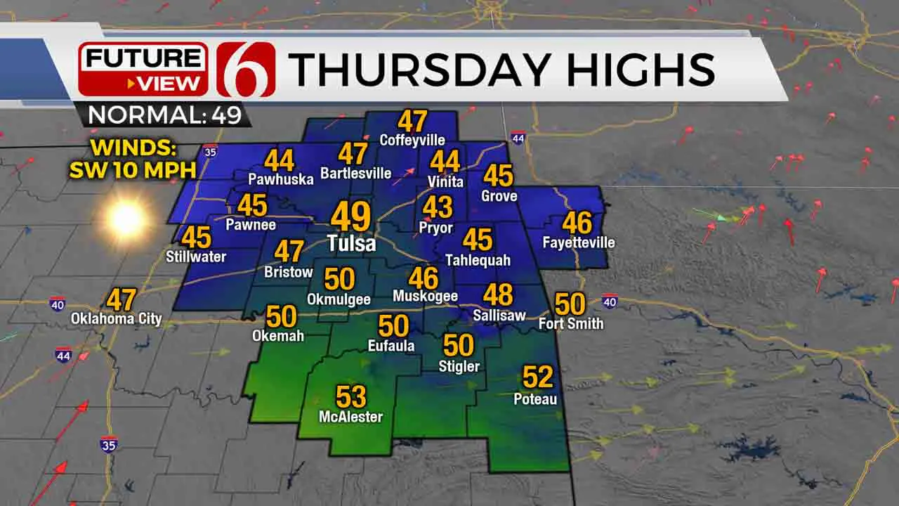
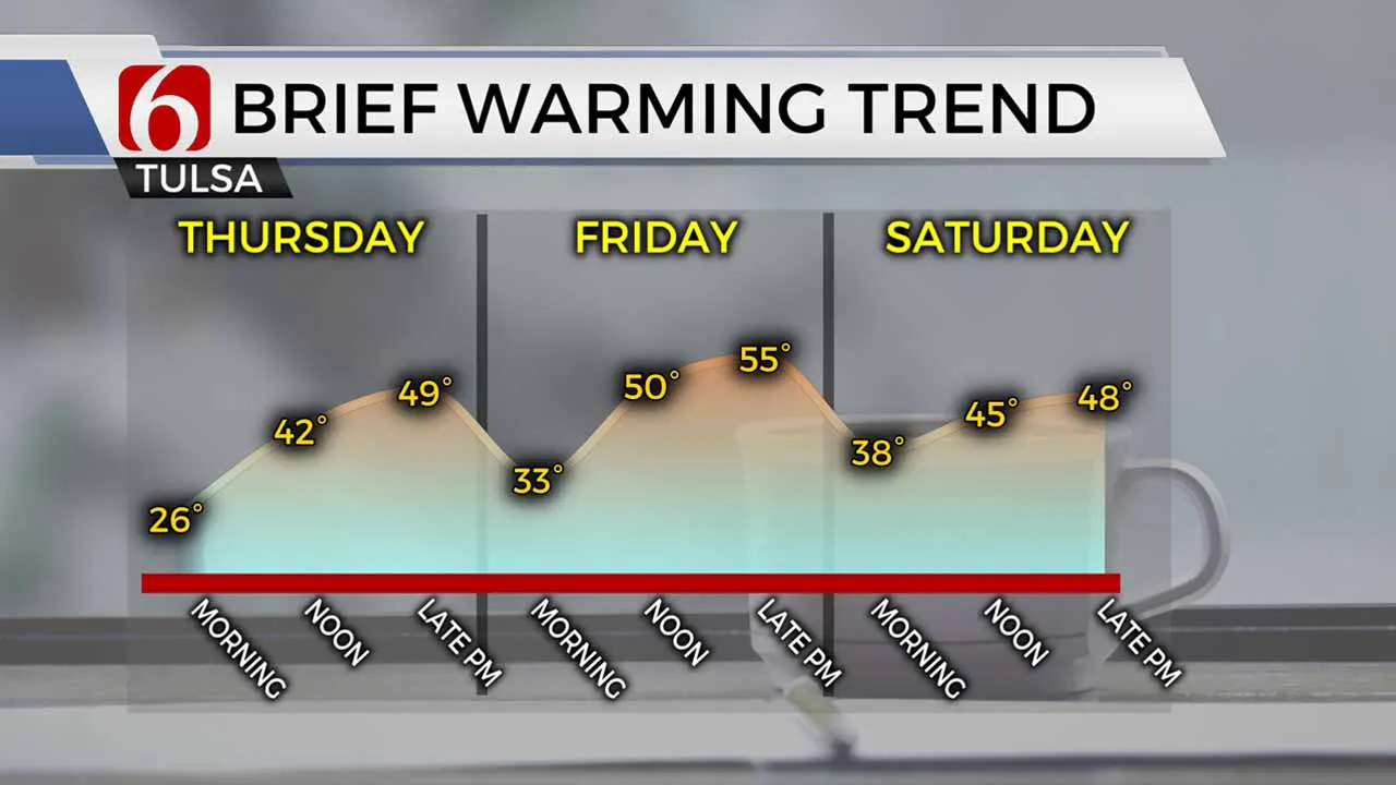
Otherwise, we’re expecting a good amount of afternoon sunshine to finally thaw us out! It’ll still be a cool day overall, but the warmest day we’ve had since last weekend’s snowstorm with highs in the upper 40s to around 50 degrees.
South winds will increase quite a bit on Friday, bringing clouds back to the area. Despite the increase in clouds, we’ll keep the warming trend going with highs in the mid-50s Friday afternoon. Those gusty south winds come out ahead of our next cold front, which moves into Green Country Saturday morning.
Scattered showers and perhaps a couple storms will be possible ahead of that front Saturday morning, mostly east of Tulsa. Those chances will end by mid-day Saturday. Behind the front, we’ll pick up gusty north winds once again, with highs Saturday in the upper 40s.

Despite Saturday’s cold front, temperatures look to quickly rebound back above normal by the end of the weekend and into next week. Highs back in the 60s are possible next Monday and Tuesday, just a few days before Christmas! But we are keeping an eye on a potential shot of some pretty cold air just in time for Christmas. Of course, we’ll keep you updated!
More Like This
December 17th, 2020
February 14th, 2022
January 26th, 2022
January 25th, 2022
Top Headlines
December 14th, 2024
December 14th, 2024
December 14th, 2024


