Falling Temperatures As Cold Front Begins To Move Across The State
A strong upper-level system will eject into the northern intermountain Rockies this morning and into the plains this evening. This will shove a strong cold front across the state later tonight into Wednesday morning bringing blustery weather across Oklahoma with a slight mention for a few showers early Wednesday, especially across southeastern and far eastern Oklahoma.Tuesday, December 22nd 2020, 5:19 am
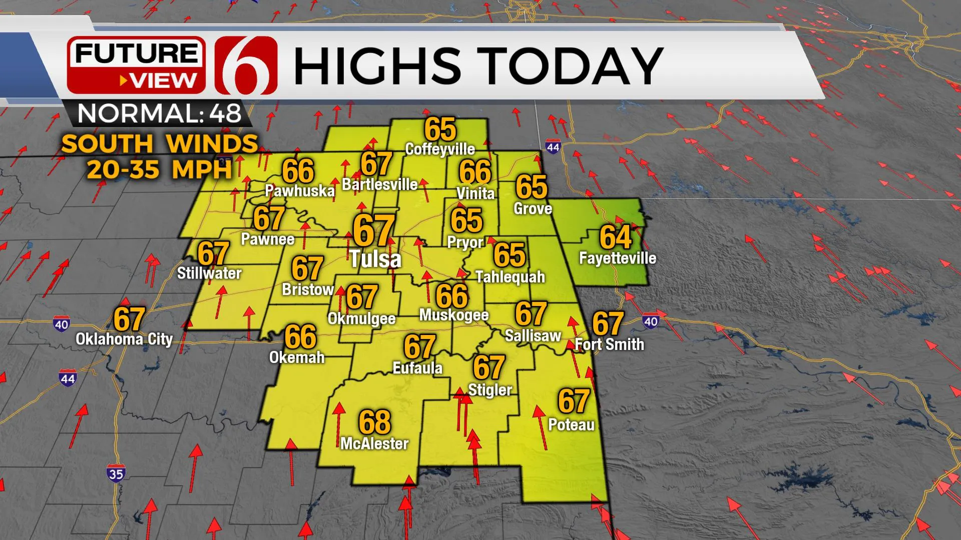
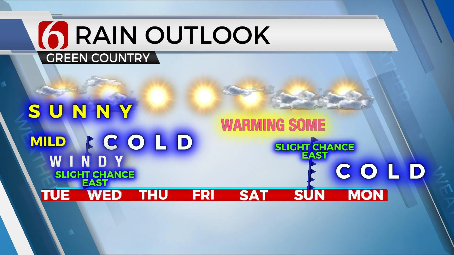
A strong upper-level system will eject into the northern intermountain Rockies this morning and into the plains this evening. This will shove a strong cold front across the state later tonight into Wednesday morning bringing blustery weather across Oklahoma with a slight mention for a few showers early Wednesday, especially across southeastern and far eastern Oklahoma. Temps Wednesday will start pre-dawn in the 50s but quickly drop into the mid-40s and remain so for the rest of the day along with northwest winds from 20 to 35 mph creating low wind chill values midday to afternoon. This brings cold weather across northeastern OK Christmas Eve with morning lows in the 20s and highs in the upper 30s to lower 40s. Christmas Day features the beginning of a mini-warming trend after a very cold start in the teens and 20s. Daytime highs will be reaching the lower 50s Friday and near 60 Saturday before another fast-moving system brushes the state with a slight chance of showers. But the strongest system may arrive right before the new year next week with cold weather and some precipitation chances. Highs today will reach the mid-60s along with sunshine and high clouds, but the strong winds from the south will require most folks to keep the jackets and coats around for the day.

The progressive upper air pattern remains for at least the next few days, including a fast-moving system nearing our area later tonight into Wednesday morning. Moisture is expected to remain very limited and thin in the atmosphere. Even though there will be a few showers ahead of the front pre-dawn Wednesday, I’ll keep only low mentions due to the low impact and short window for this system. The main impact will be the blustery weather, colder temps and dropping wind chills. If this system had a big wrap-around feature, the air would be cold enough for snow behind the system Wednesday night into Thursday morning, but as of this morning, we don’t see any precipitation chances as the system exits the area. Those hoping for a White Christmas should fly to the upper Midwest or into the northeastern U.S., where some snow will develop Thursday and exit early Friday morning. Some snow will also be possible across the interior mountains of the Pacific Northwest on Christmas Day.

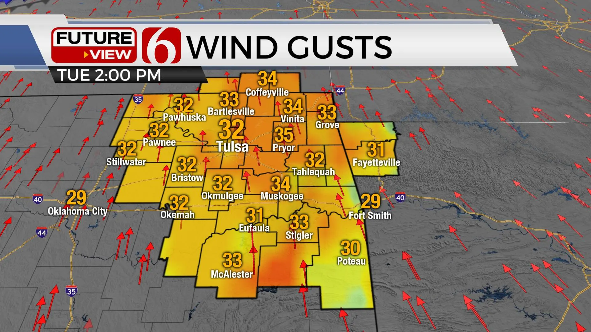
Gusty south winds will be developing later today with highs reaching the mid to upper 60s. Drying soil content and dormant vegetation will lead to increasing fire danger spread rates today as the winds increase. Use caution. And gusty winds are likely to continue Wednesday and part of Thursday.

Thanks for reading the Tuesday morning weather discussion and blog.
Have a super great day!
Alan Crone
KOTV
If you listen to podcasts, you can now get my morning update on most podcast providers. Search for NewsOn6 and ‘Weather Out The Door‘ including here on Spotify.
More Like This
December 22nd, 2020
February 14th, 2022
January 26th, 2022
January 25th, 2022
Top Headlines
December 14th, 2024
December 14th, 2024
December 14th, 2024
December 14th, 2024


