Foggy, Cold Monday Morning With Mostly Sunny, Pleasant Afternoon
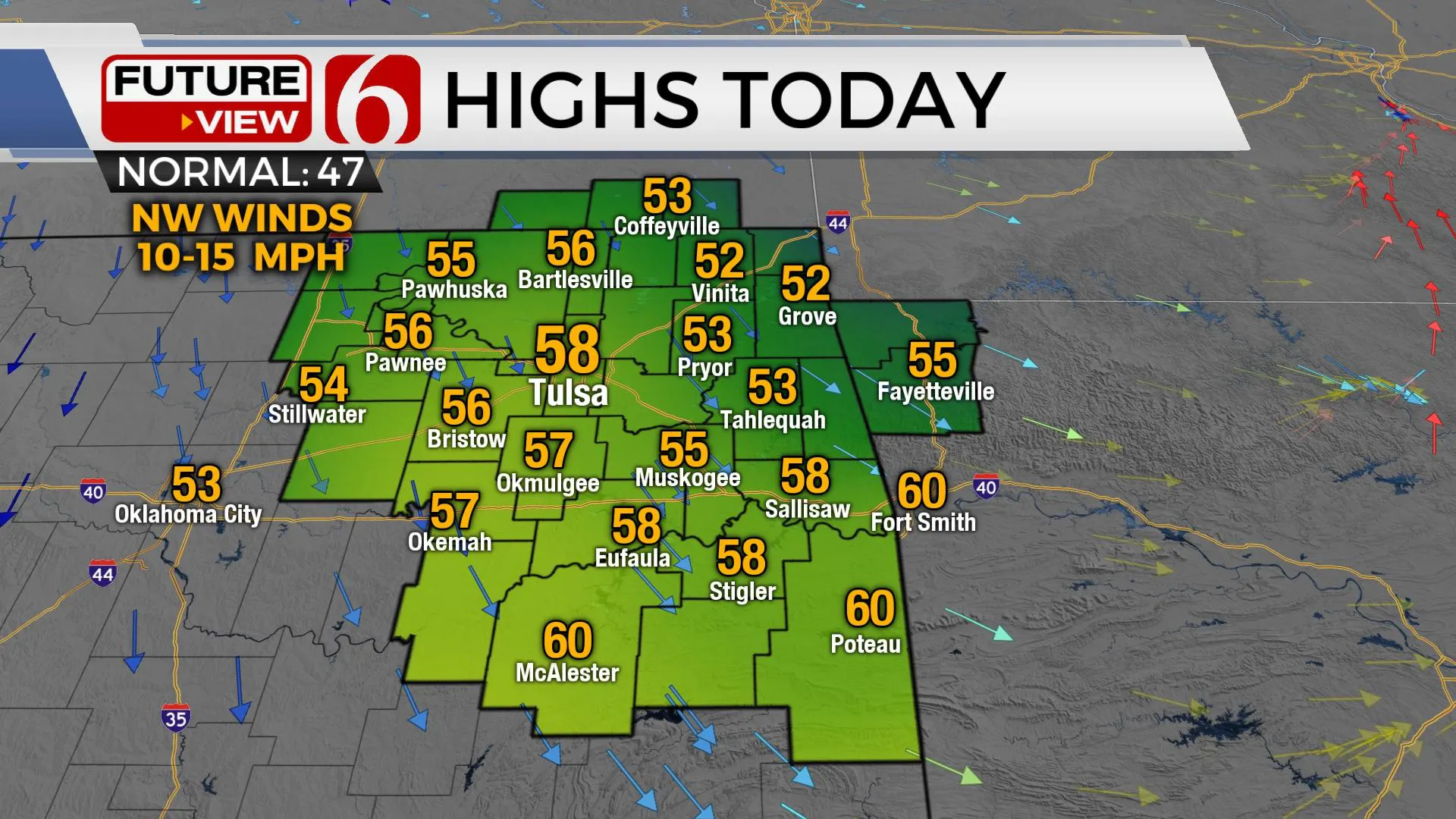
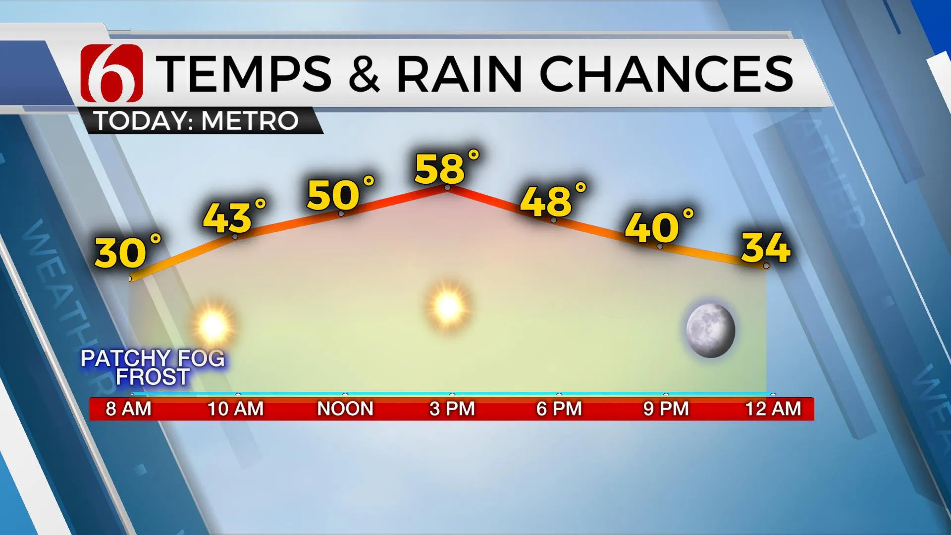
Some patchy fog and frost is possible again this morning across part of northeastern OK and southern Kansas where temps will be below freezing for a few hours this morning. This may result in a few elevated slick spots, but the threat remains very low. Otherwise, highs today will reach the mid to upper 50s along with south winds quickly backing from the northwest as a weak system moves across the state this morning. After a few morning clouds, we should experience a mostly sunny day with pleasanMonday, January 4th 2021, 5:05 am
Some patchy fog and frost is possible again this morning across part of northeastern OK and southern Kansas where temps will be below freezing for a few hours this morning. This may result in a few elevated slick spots, but the threat remains very low. Otherwise, highs today will reach the mid to upper 50s along with south winds quickly backing from the northwest as a weak system moves across the state this morning. After a few morning clouds, we should experience a mostly sunny day with pleasant weather for most locations.

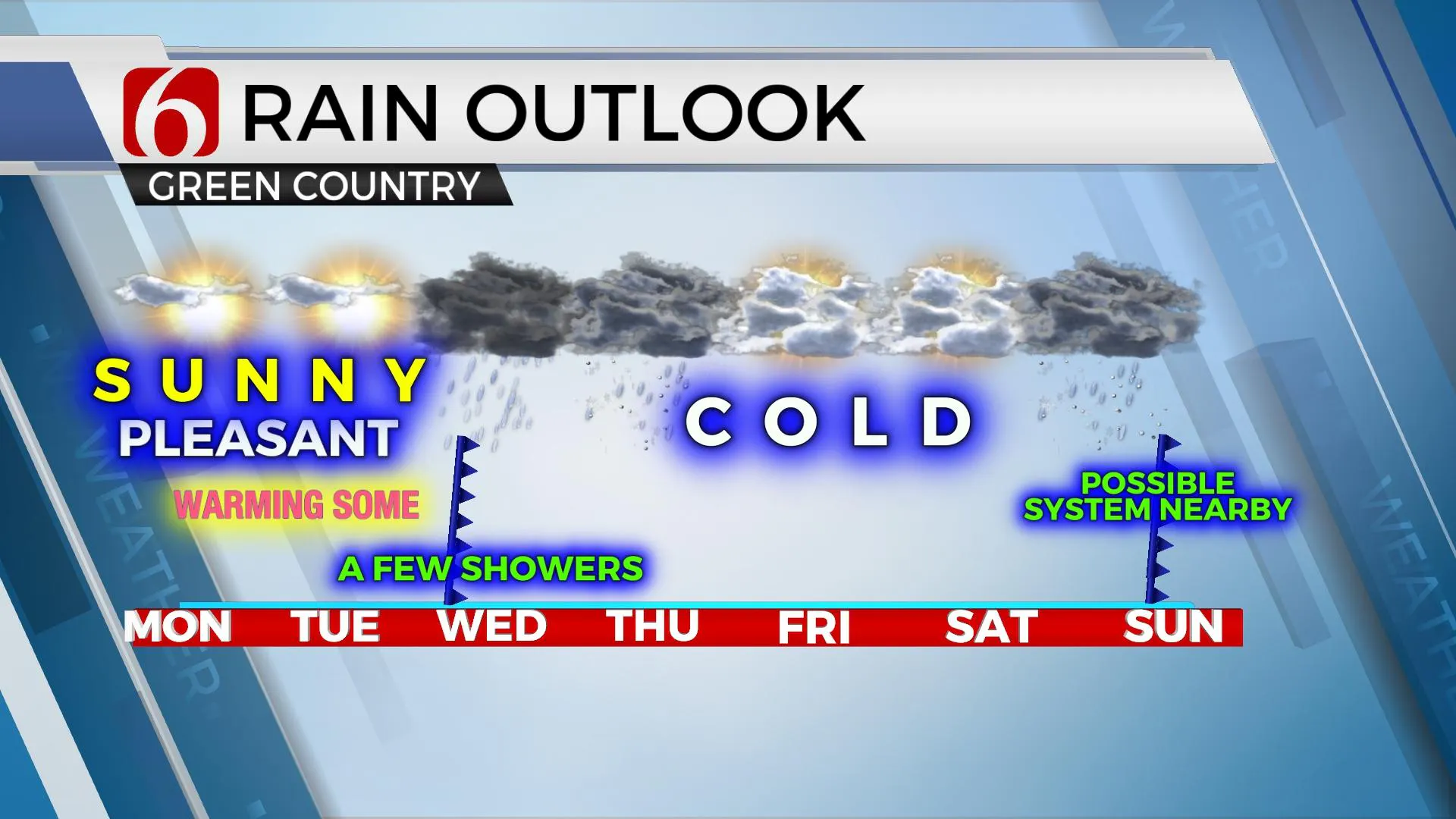
The progressive upper air pattern will bring another system across the state Tuesday night into Wednesday as it slows down and deepens across northeastern OK and northwestern Arkansas Wednesday evening and early Thursday. Another system quickly follows this weekend, mostly Sunday but the data remains inconsistent. Before the first system arrives midweek, we're looking at a mini-warming trend with highs reaching the upper 50s or lower 60s on Tuesday before dropping into the lower 40s for the remainder of the week regarding daytime highs. Morning lows will be in the upper 20s and lower 30s. Precipitation chances will remain for both of these upper-level systems.

The initial timing for the first system should be confined to Wednesday morning through midday as the initial cold front swings across Eastern OK. But additional low chances will remain late Wednesday night into Thursday morning as the upper air trough begins a process of closing and getting stronger. The positioning of this system may be slightly removed to our east, but I'll need to keep some chance for some light rain and snow mix under the cold core system as it slowly moves eastward out the area during this period. The 2nd system currently appears to take more of a southern route in the EURO for Saturday evening into Sunday and would already have some colder air at the surface as the upper-level cold core nears the southern plains. The GFS is more north and would bring a decent chance of rain and snow across part of northeastern OK Sunday. It's too early to know with any certainty at this point, and our mentions for the Sunday system will remain rather low at this point in the forecast process.

Thanks for reading the Monday morning weather discussion and blog.
Have a super great day!
Alan Crone
KOTV
Check out my daily weather update. Search for NewsOn6 and 'Weather Out The Door' on most podcast providers, such as here on Spotify.
More Like This
January 4th, 2021
February 14th, 2022
January 26th, 2022
January 25th, 2022
Top Headlines
December 11th, 2024
December 11th, 2024
December 11th, 2024
December 11th, 2024


