Morning Rain Chances, Colder Afternoon Temperatures
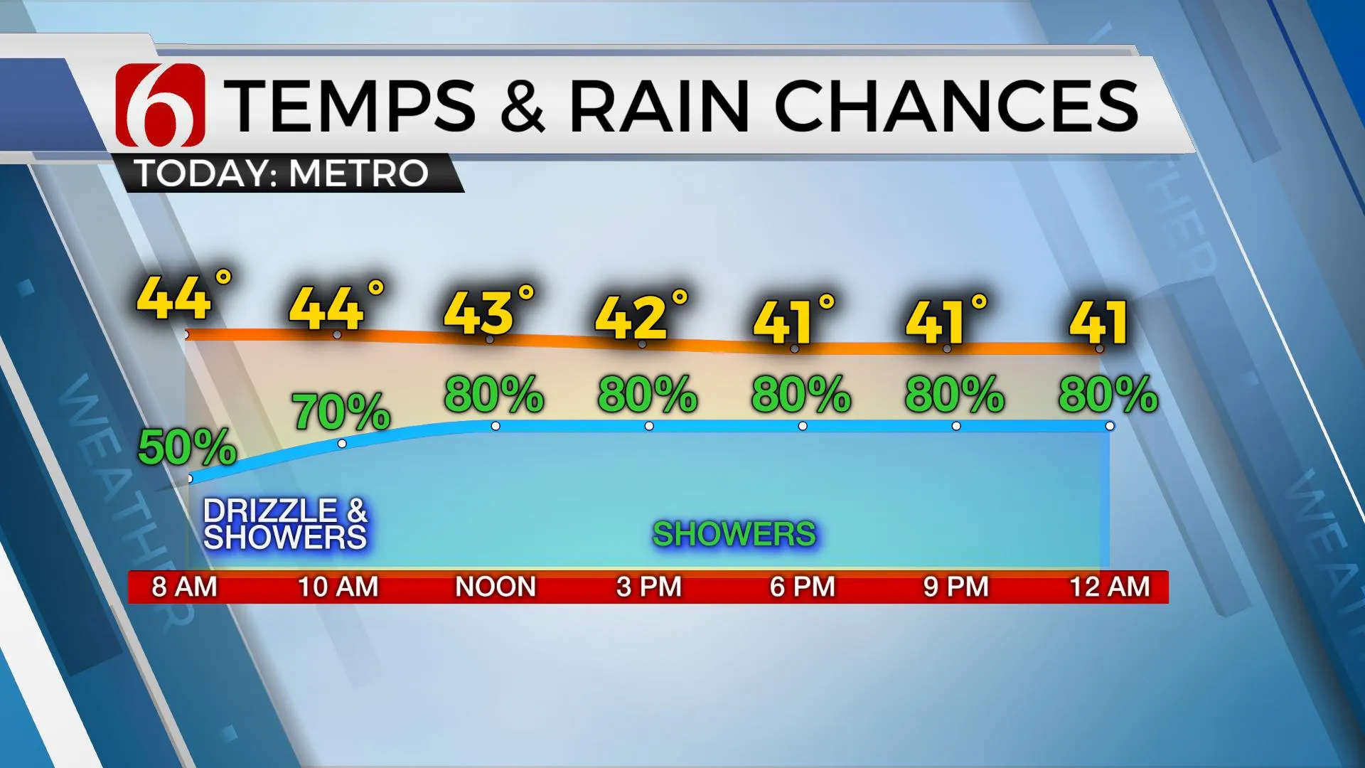
Colder afternoon temps will arrive today along with some chances for rain across part of the area from this morning through tonight. Highs will be reached early this morning in some locations with temps staying in the lower 40s this afternoon along with north winds and mostly cloudy sky. Cold weather will last through the weekend as we track another system mostly to the southwest of our immediate area.Wednesday, January 6th 2021, 5:50 am
Colder afternoon temps will arrive today along with some chances for rain across part of the area from this morning through tonight. Highs will be reached early this morning in some locations with temps staying in the lower 40s this afternoon along with north winds and mostly cloudy sky. Cold weather will last through the weekend as we track another system mostly to the southwest of our immediate area.

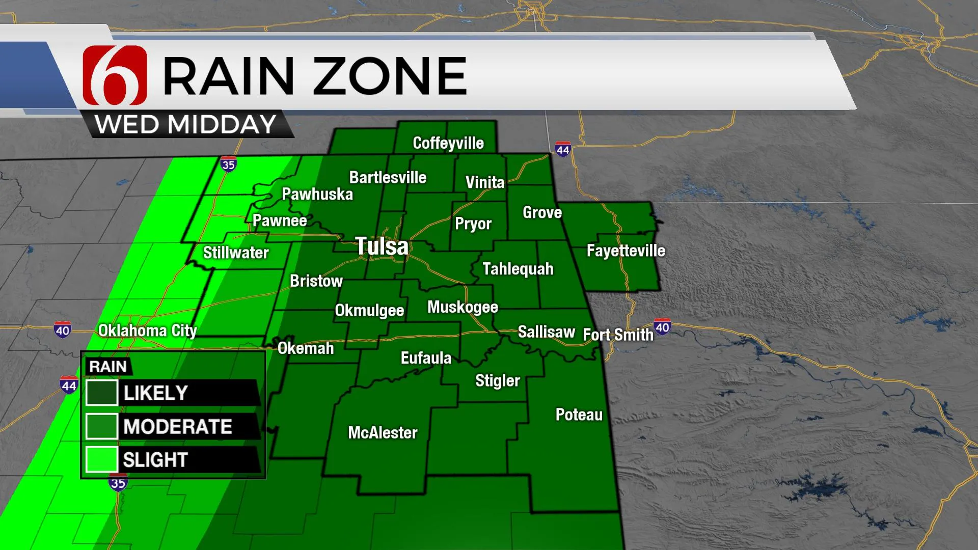
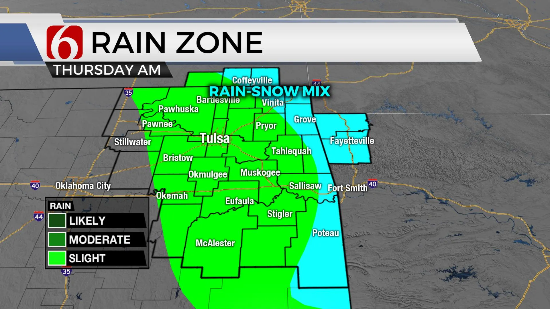
The front is expected to move across the area later this morning bringing a chance for some drizzle this morning along with some spotty showers through midday and more rain early evening. As the boundary progresses across far southeastern OK, the main upper-level system will be nearing the Red River and attempt to deepen or grow slightly stronger. As the main upper-level trough pivots across this region, colder air aloft will provide a small window for a rain to snow mix for any precipitation leftover across the area overnight. While this could be anywhere across northeastern OK overnight into Thursday morning for a few showers mixing with flurries, the higher chances will remain across extreme northeastern OK, southeastern Kansas and northwestern Arkansas where a dusting to near 1 inch may occur on grassy areas. Winter weather advisories and winter storm warnings are posted for part of northwestern Arkansas where some impactful snowfall from 1 to 5 inches will be likely. Another area for some light snow may also be across extreme southeastern OK, near Leflore to McCurtain Counties. This window will be limited and mostly from overnight through early Thursday morning and I am anticipating this to remain east of the metro. The colder weather will stick around through the weekend.

This weekend continues presenting another strong upper-level system nearing the state Saturday. This system appears stronger and should have more moisture but the trajectory remains unsettled in the data. A track along the Red River Valley would bring better chances for snow across part of the state. A track to the south, across west Texas, would keep the weekend dry yet cold. Data seems to be converging on a track well southwest of our region. A weak upper vort could bring a few flurries early Saturday nearby but the weekend forecast currently will remain cold yet dry.

Thanks for reading the Wednesday morning weather discussion and blog.
Have a super great day!
Alan Crone
KOTV
Check out my daily weather update and mini-podcast. Search for NewsOn6 and ‘Weather Out The Door’ on most podcast providers, including here on Spotify.
More Like This
January 6th, 2021
February 14th, 2022
January 26th, 2022
January 25th, 2022
Top Headlines
December 13th, 2024
December 13th, 2024
December 13th, 2024


