Spotty Morning Showers, Cold Air Sticks Around Into The Weekend
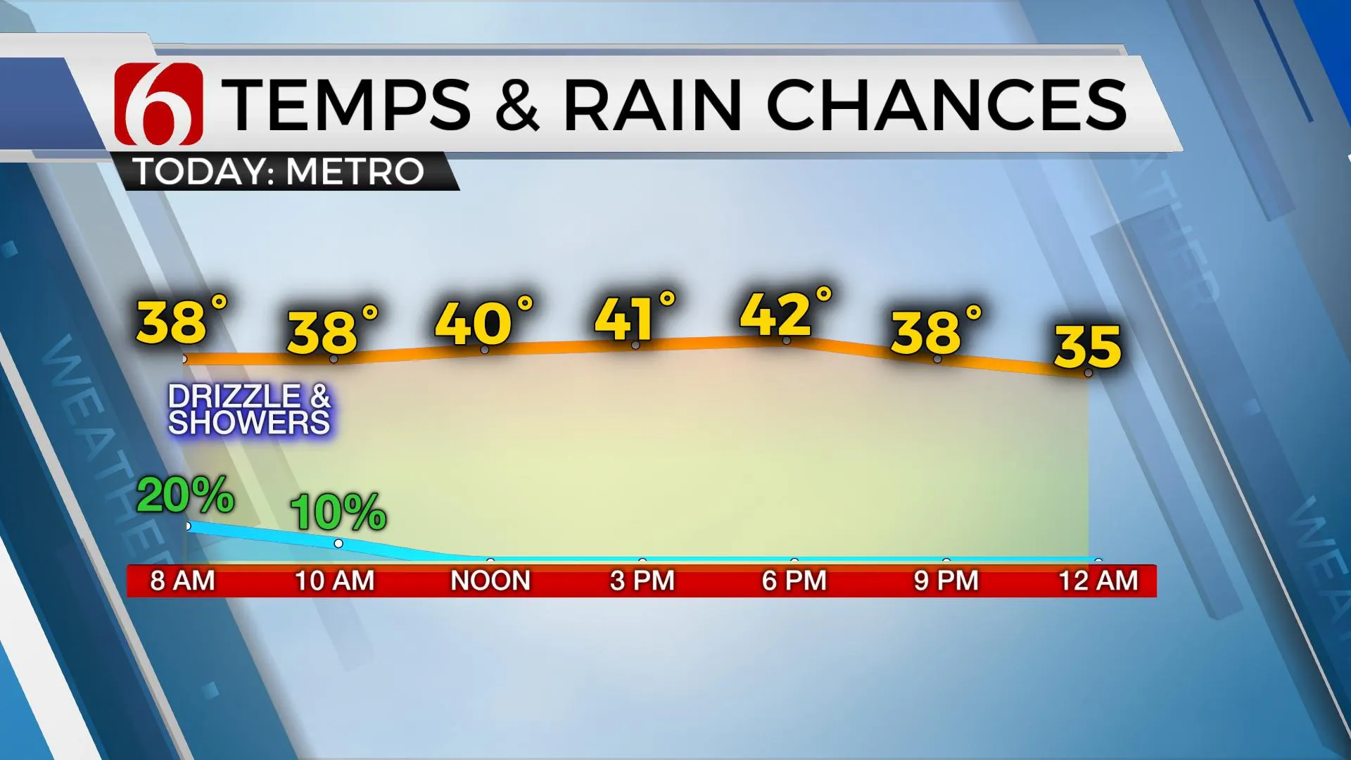
Spotty showers will exit the area early this morning, but the cold air will remain today and into the weekend. We’ll track several upper waves over the next few days, but no major impacts will be expected.Thursday, January 7th 2021, 6:26 am
Spotty showers will exit the area early this morning, but the cold air will remain today and into the weekend. We’ll track several upper waves over the next few days, but no major impacts will be expected.

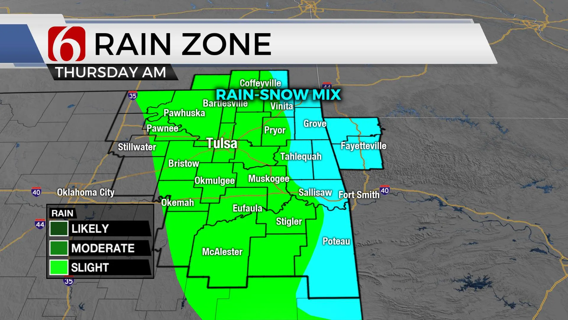
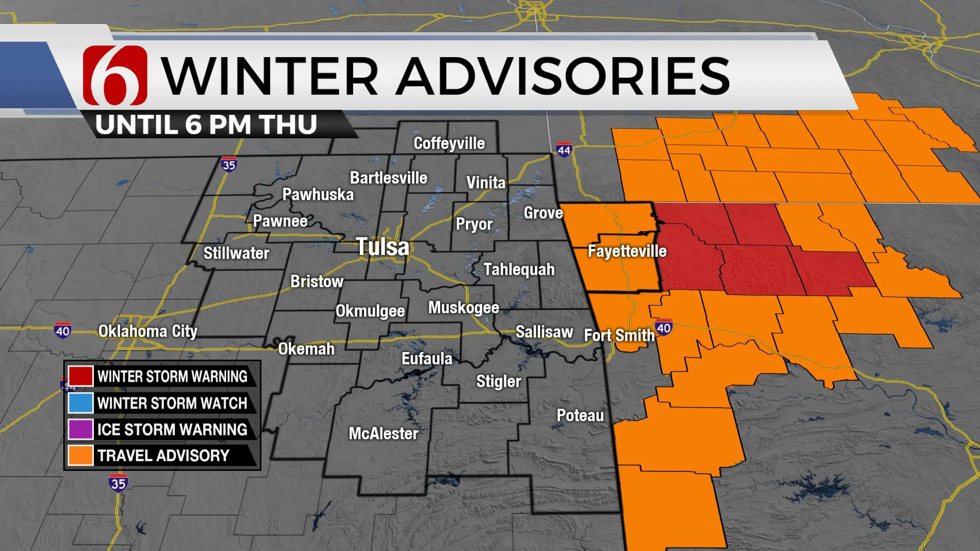
The cold-core low is located southeast of the metro this morning across the ArkLaTex and will exit our area soon. Locations to the north of this feature, including far eastern OK into western Arkansas may continue seeing some rain changing to snow with no impact across the eastern Oklahoma region. The area near and east of Fayetteville remains in a more favorable position for impactful snowfall with one to five inches possible, with higher amounts on mountain tops above 2000 ft. Snowfall from four to six inches will remain likely for areas currently included in a winter storm warning through 6 p.m. We currently do not have any Eastern OK counties included in any advisory, but some rain to snow can’t be ruled out as the system quickly exits this morning. Some snow may also occur as far south as Le Flore and McCurtain Counties where local elevation levels are highest.

The colder weather should stick around for the next several days with at least two more distinct waves nearing the state. The first is a weak upper-level disturbance arriving late Friday night into Saturday morning that may provide a few surprise snow flurries for a few locations, but the chance remains very low and I’ll not include any pop for the big seven-day planner.
The second wave is stronger and will have more moisture but currently appears to track too far south of our immediate area for any impacts of precipitation for northeastern sections of the state. Our friends and neighbors across southwestern OK into the western areas of north TX will see some wintry weather Saturday night but the higher impacts will occur southward across the Permian Basin before the low takes a turn across central Texas. As this low moves east across central Texas, some locations along the Red River Valley could see some snow Sunday evening into early Monday morning. This also remains a low chance for most of our southern OK counties with higher chances across the north Texas county region.

We may have a brief moderation of temps slightly above normal early next week before another cold snap moves down the central plains for the 2nd half of next week.
Thanks for reading the Thursday morning weather discussion and blog.
Have a super great day!
Alan Crone
KOTV
Check out my daily weather update and mini-podcast. Search for NewsOn6 and ‘Weather Out The Door’ on most podcast providers, including here on Spotify.
More Like This
January 7th, 2021
February 14th, 2022
January 26th, 2022
January 25th, 2022
Top Headlines
December 12th, 2024
December 12th, 2024
December 12th, 2024
December 12th, 2024


