Sunshine With Cool Afternoon Highs
The upper level low responsible for snow across the Lone Star State yesterday is exiting the ArkLaTex region this morning but will bring a few snow flurries across far southeastern OK for the next few hours. As the low accelerates east, clouds will clear from the west to east later today bringing sunshine but keeping the cool weather for afternoon highs. The pattern will change quickly for the next few days bringing another rollercoaster, mini-warm-up into the area before our next cold front snaMonday, January 11th 2021, 7:22 am
The upper level low responsible for snow across the Lone Star State yesterday is exiting the ArkLaTex region this morning but will bring a few snow flurries across far southeastern OK for the next few hours. As the low accelerates east, clouds will clear from the west to east later today bringing sunshine but keeping the cool weather for afternoon highs. The pattern will change quickly for the next few days bringing another rollercoaster, mini-warm-up into the area before our next cold front snaps across the area Thursday followed by more chilly air into the weekend. A decent looking upper-level low passes our area Wednesday to the south with no impact on sensible weather but another system may also arrive this weekend that could bring some active weather to western or southwestern OK. Our forecast currently remains dry for the weekend.

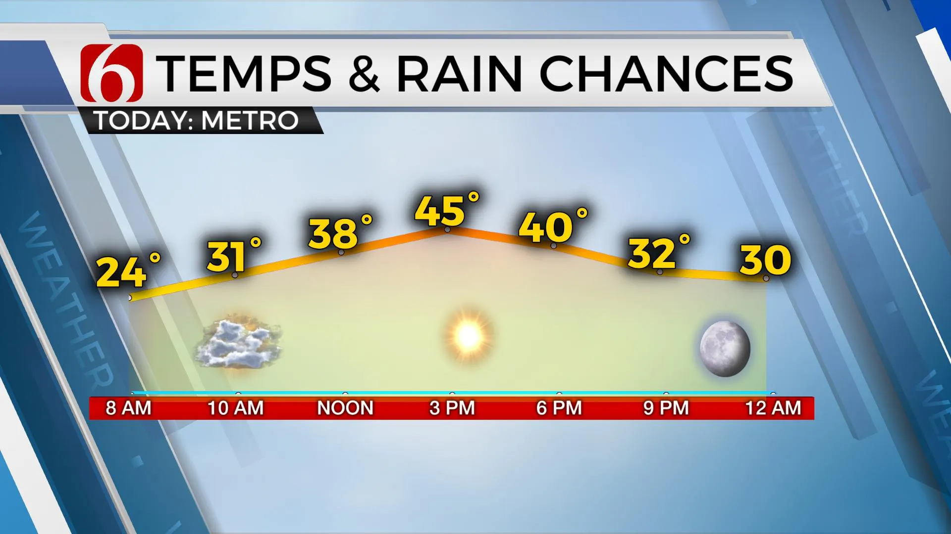
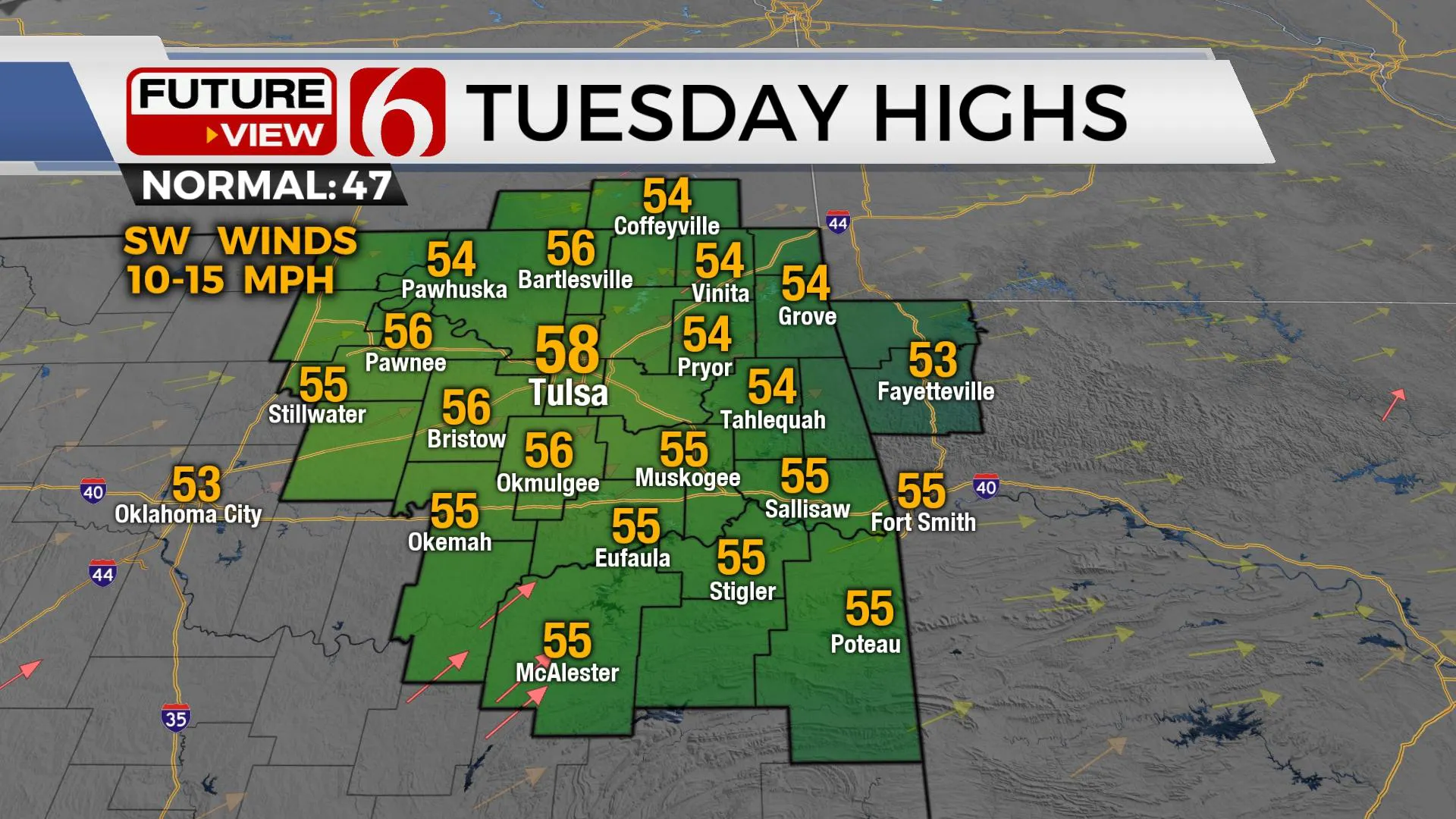
Temperatures this morning start in the mid-20s with north winds and reach the lower to mid-40s this afternoon along with the return of sunshine and light south winds by the afternoon. The thermal profile supports the gradual warm-up with highs reaching the upper 50s and lower 60s Tuesday and Wednesday, and possibly Thursday before the cold front moves across the state bringing temps down Friday into the weekend. Weekend lows will be in the upper 20s and lower 30s with highs in the upper 40s.

Thanks for reading the Monday morning weather discussion and blog.
Have a super great day!
Alan Crone
KOTV
Be sure and check out my daily weather update, podcast. Search for NewsOn6 and 'Weather Out The Door' on most podcast providers, including here on Spotify.
More Like This
January 11th, 2021
February 14th, 2022
January 26th, 2022
January 25th, 2022
Top Headlines
December 13th, 2024
December 13th, 2024
December 13th, 2024
December 13th, 2024


