Gusty Northwest Winds With Highs In The Mid-50s
The wind machine will crank up across a large portion of the nation today and tomorrow including much of our immediate area. Wind advisories are likely both today and tomorrow as a powerful upper level low deepens across the Midwest. A surface cold front is entering the area early this morning and will bring a very small chance for a sprinkle or brief shower, yet most locations will not experience this activity. Gusty northwest winds will pick-up soon and continue increasing speeds through the mThursday, January 14th 2021, 5:16 am
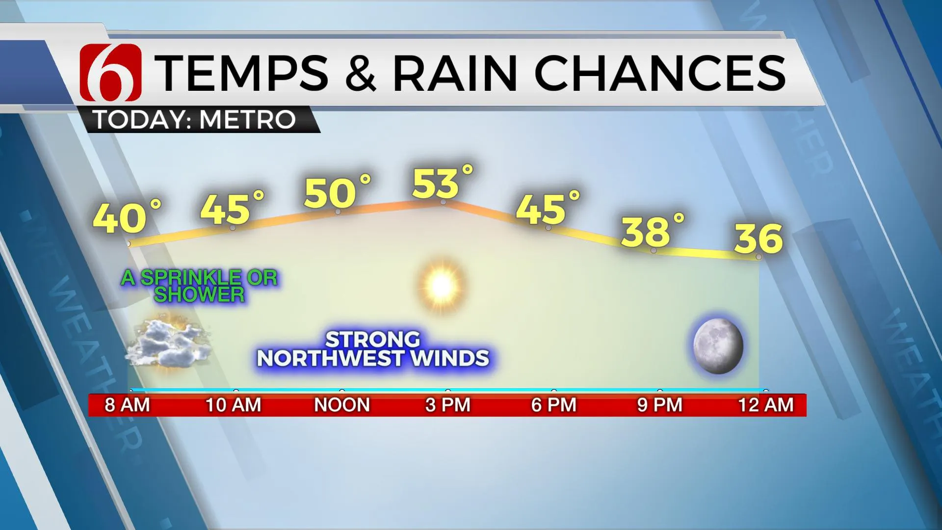
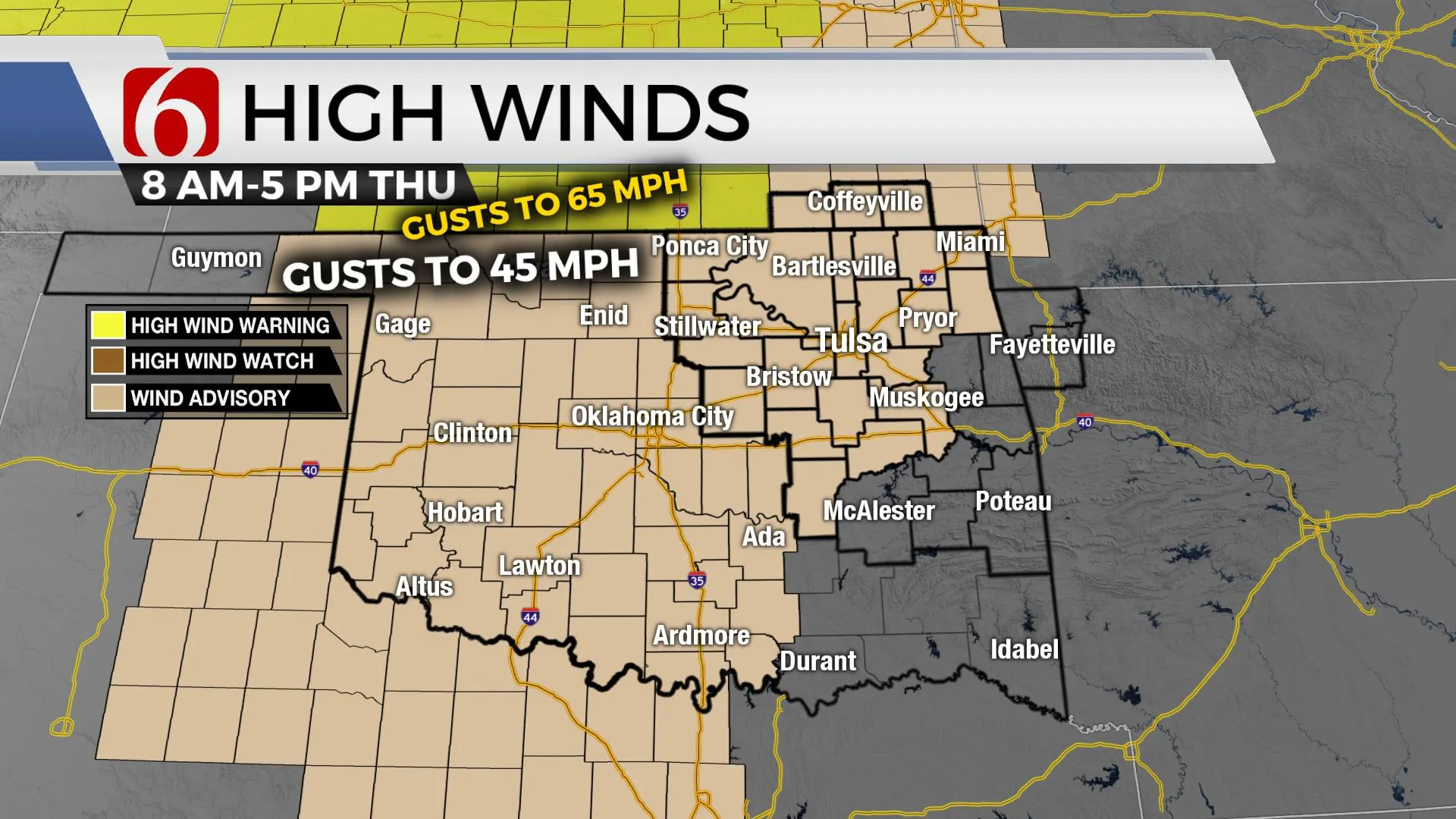
The wind machine will crank up across a large portion of the nation today and tomorrow including much of our immediate area. Wind advisories are likely both today and tomorrow as a powerful upper level low deepens across the Midwest. A surface cold front is entering the area early this morning and will bring a very small chance for a sprinkle or brief shower, yet most locations will not experience this activity. Gusty northwest winds will pick-up soon and continue increasing speeds through the midday and afternoon hours with morning clouds thinning by midday to afternoon. Highs today will still reach the lower and mid-50s, but the addition of the strong northwest winds will create wind chills in the 40s. The fire spread rate will increase both today and tomorrow leading to increasing fire danger issues across northeastern Oklahoma. Outdoor burning is highly discouraged due to the expectation of strong winds. Another surge of colder air arrives later tonight into Friday as the cold-core upper-level trough deepens across the upper Missouri Valley. This will bring temps down Friday into the upper 30s and lower 40s for afternoon highs with wind chill values staying in the 30s for most of the day. Northwest winds Friday may continue in the 20 to 45 mph range with more wind advisories likely for part of the area. Humidity values will be lowest Thursday compared to Friday, but the fire spread will continue to be an issue Friday, even with the colder conditions. As another spoke of energy rotates around the main cold-core low Friday, snow showers are likely to move across part of far eastern Kansas into southern Missouri and far northwestern Arkansas. A few flurries will be possible across extreme northeastern OK Friday with no major impacts.

This weekend another weak wave may brush the region with little impact. The deeper and colder air remains northeast of the state, but we’ll continue with a cold forecast Saturday with morning lows in the upper 20s and highs in the mid-40s. Wind speeds will be much lighter Saturday, but still from the north at 10 to 15 mph. Sunday features a return to southerly winds by afternoon with highs reaching the lower 50s and back into the mid-50s Monday before, yet another system nears the area Tuesday into Wednesday.

The system for the middle of next week also looks strong but moisture may continue to be the limiting factor for precipitation chances for much of our area. I’ll have a chance for a few showers Monday night into Tuesday with higher chances to our south Wednesday.
Thanks for reading the Thursday morning weather discussion and blog.
Have a super great day!
Alan Crone
KOTV
If you listen to podcasts, search for NewsOn6 and "Weather Out The Door." You’ll find it on most podcast providers, including here on Spotify.
More Like This
January 14th, 2021
February 14th, 2022
January 26th, 2022
January 25th, 2022
Top Headlines
December 14th, 2024
December 14th, 2024
December 14th, 2024


