Afternoon Highs In The Lower To Mid-50s, Gusty Southwest Winds
We’re tracking several systems for the next few days, but the main impacts will remain slightly south of the metro before a stronger wave nears for part of the weekend. Once again we’re on the roller-coaster ride of weather for northeastern Oklahoma. We’re starting this morning with some clear sky and cold weather. Some patchy frost is likely in the valleys with lows in the 20s. But high and mid-level clouds will quickly approach again from the southwest byWednesday, January 20th 2021, 6:06 am
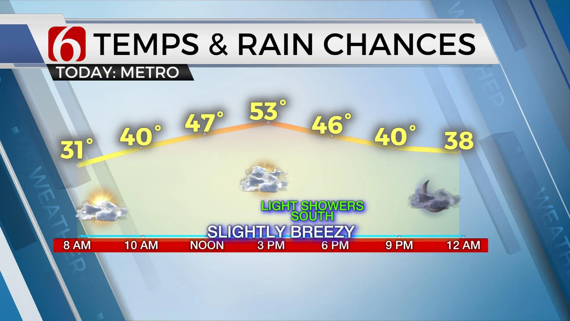
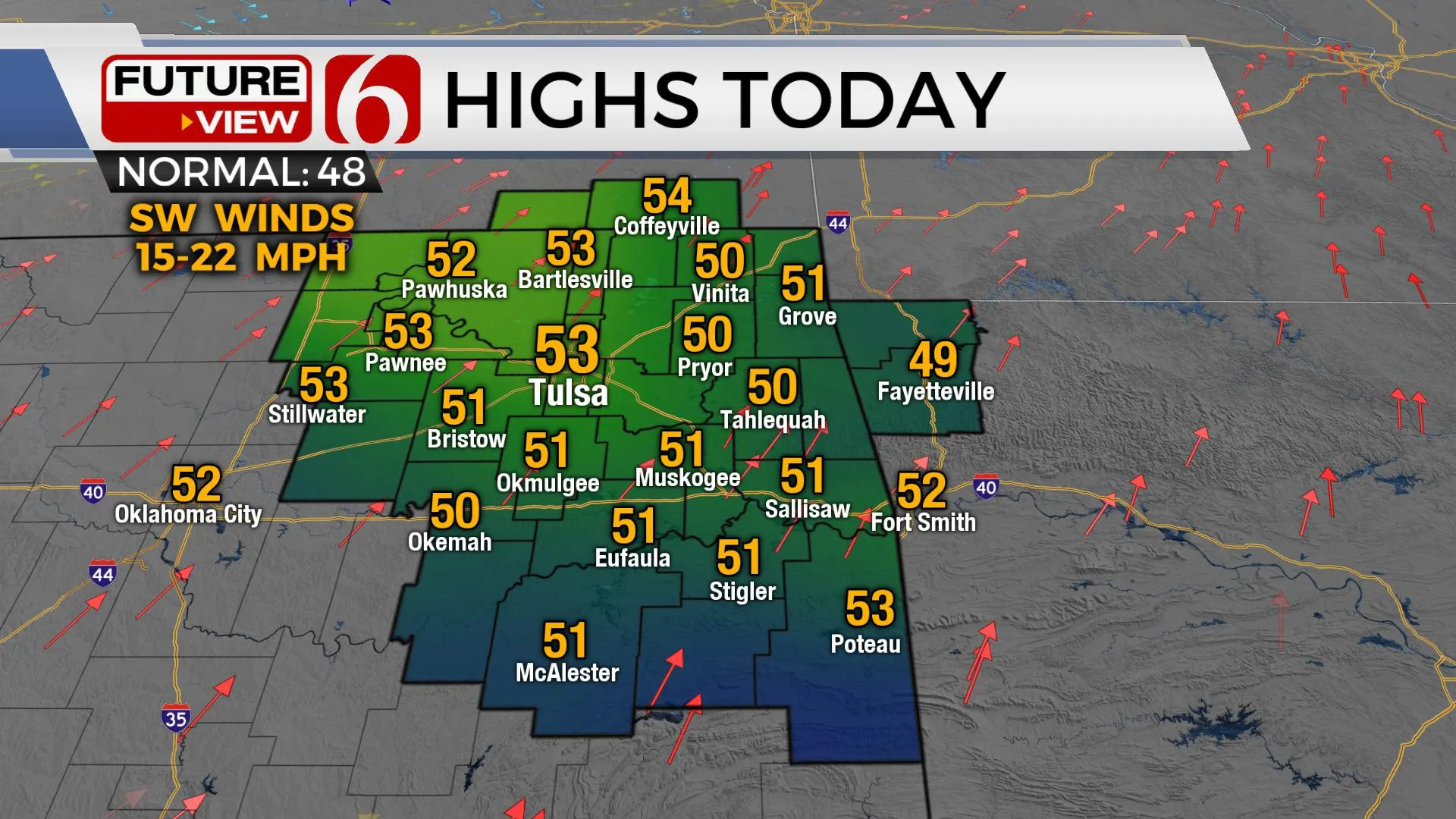
We’re tracking several systems for the next few days, but the main impacts will remain slightly south of the metro before a stronger wave nears for part of the weekend. Once again we’re on the roller-coaster ride of weather for northeastern Oklahoma. We’re starting this morning with some clear sky and cold weather. Some patchy frost is likely in the valleys with lows in the 20s. But high and mid-level clouds will quickly approach again from the southwest by midday to afternoon with a gusty southwest wind from 15 to 25 mph. Afternoon highs will reach the lower or mid-50s northern sections with increasing fire spread rates for most of the northern sections. Meanwhile, southern OK will see a high in the upper 40s near 50 along with a few showers this afternoon and evening as a lead wave ejects across the plains. This precipitation should remain south of the Tulsa metro.

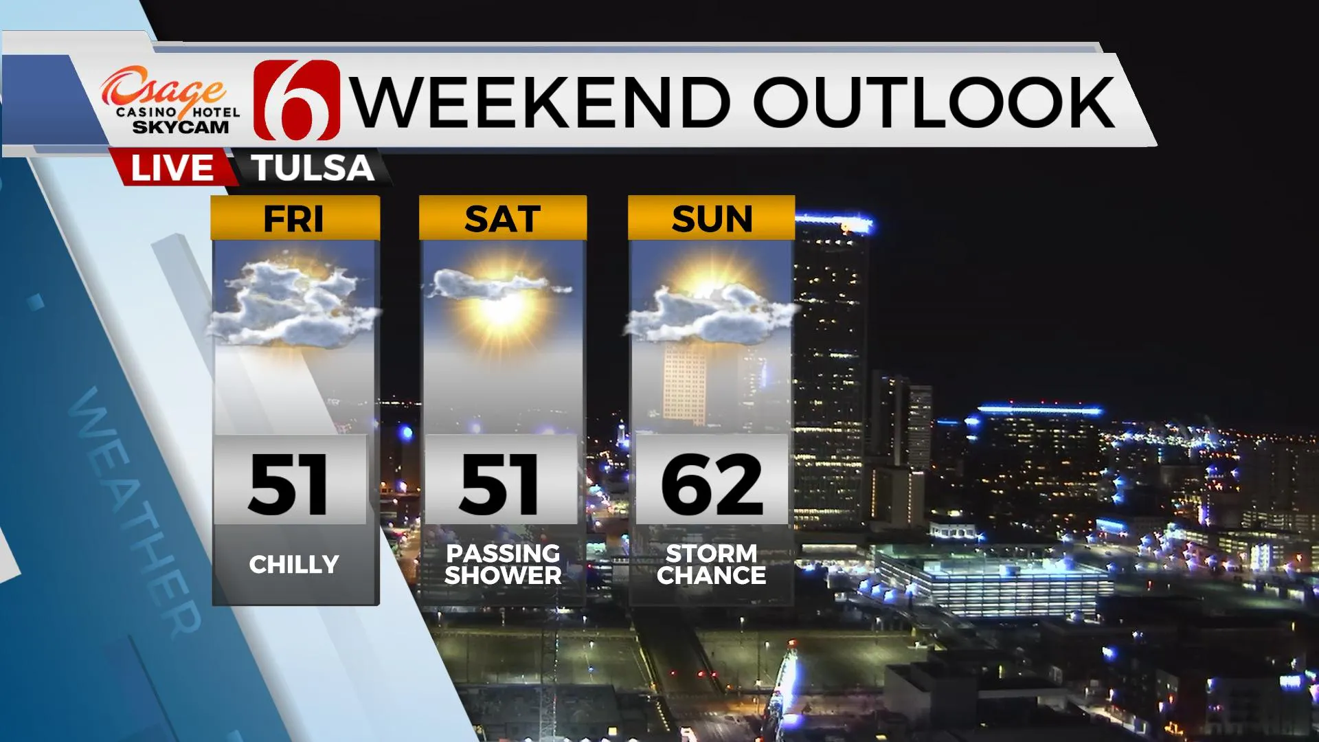
The main upper-level storm system responsible for damaging winds and wildfire issues in southern California and big snow across New Mexico will arrive near Oklahoma Thursday night into Friday. But this system will be shearing or weakening quickly. By the time it arrives, it will only provide a few spotty showers near or south of Tulsa and I continue with a 20% chance for Tulsa with higher chances across the southeastern and east-central portions of the state Thursday evening into pre-dawn Friday. This wave should exit the area rapidly, leaving the area dry for Friday.
Another separate system nears the area this weekend with increasing wind Saturday and increasing thunderstorm chances Sunday.

This weekend another trough develops across the western U.S. and brings a system near the area for Sunday evening into Monday morning. A surface area of low pressure develops Sunday across southwestern Kansas and ejects northeast while dragging a cold front across Eastern OK Sunday evening. Low-level moisture will return this weekend and should allow scattered showers and storms developing Sunday afternoon as the main upper-level energy nears the state. Based on the projected timing and instability in most data, the threat for any strong to severe storms will more than likely remain across extreme southeastern OK and northeast Texas for Sunday evening. There remain some big differences in the timing of the Sunday system and this could have impacts on Monday’s weather. I’ll not make any big adjustments to my previous forecast for Monday but will increase the pops some for Monday and lower temps slightly.

As we’ve been discussing for the past three weeks, the potential for some colder air continues to look good for the far northern third of the nation early next week. But the southern extent is still questionable.
Have a super great day!
Alan Crone
KOTV
Be sure and check out my daily weather update. Search for NewsOn6 and ‘Weather Out The Door’ on most podcast providers, including here on Spotify.
More Like This
January 20th, 2021
February 14th, 2022
January 26th, 2022
January 25th, 2022
Top Headlines
April 16th, 2024
April 16th, 2024


