Several Storm Systems Near The State
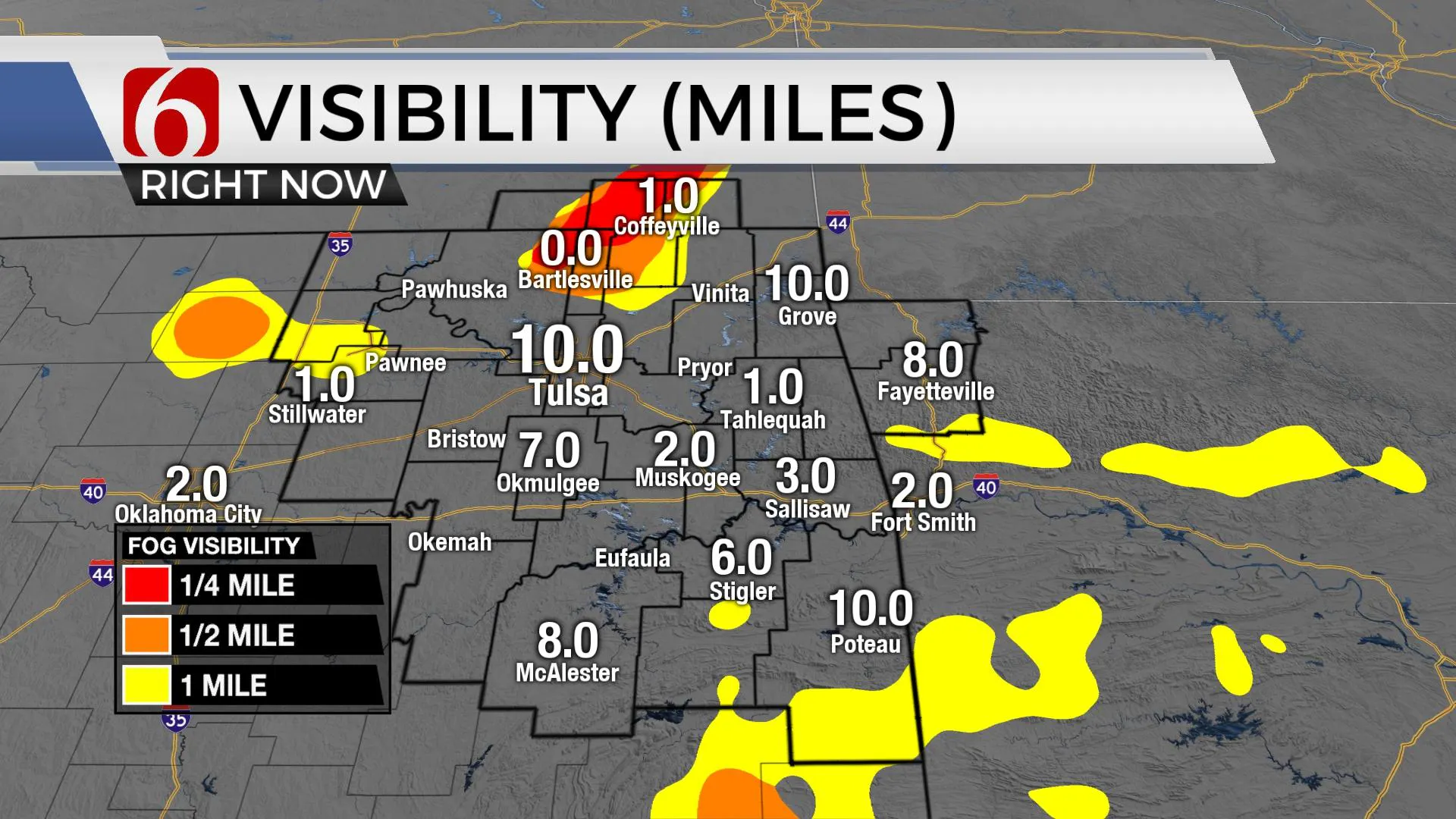
We may experience some patchy fog in a few spots this morning with stubborn clouds lingering for most of the day. Our weather pattern will remain active with several storm systems nearing the state for the next few days.Thursday, January 21st 2021, 5:53 am
We may experience some patchy fog in a few spots this morning with stubborn clouds lingering for most of the day. Our weather pattern will remain active with several storm systems nearing the state for the next few days.
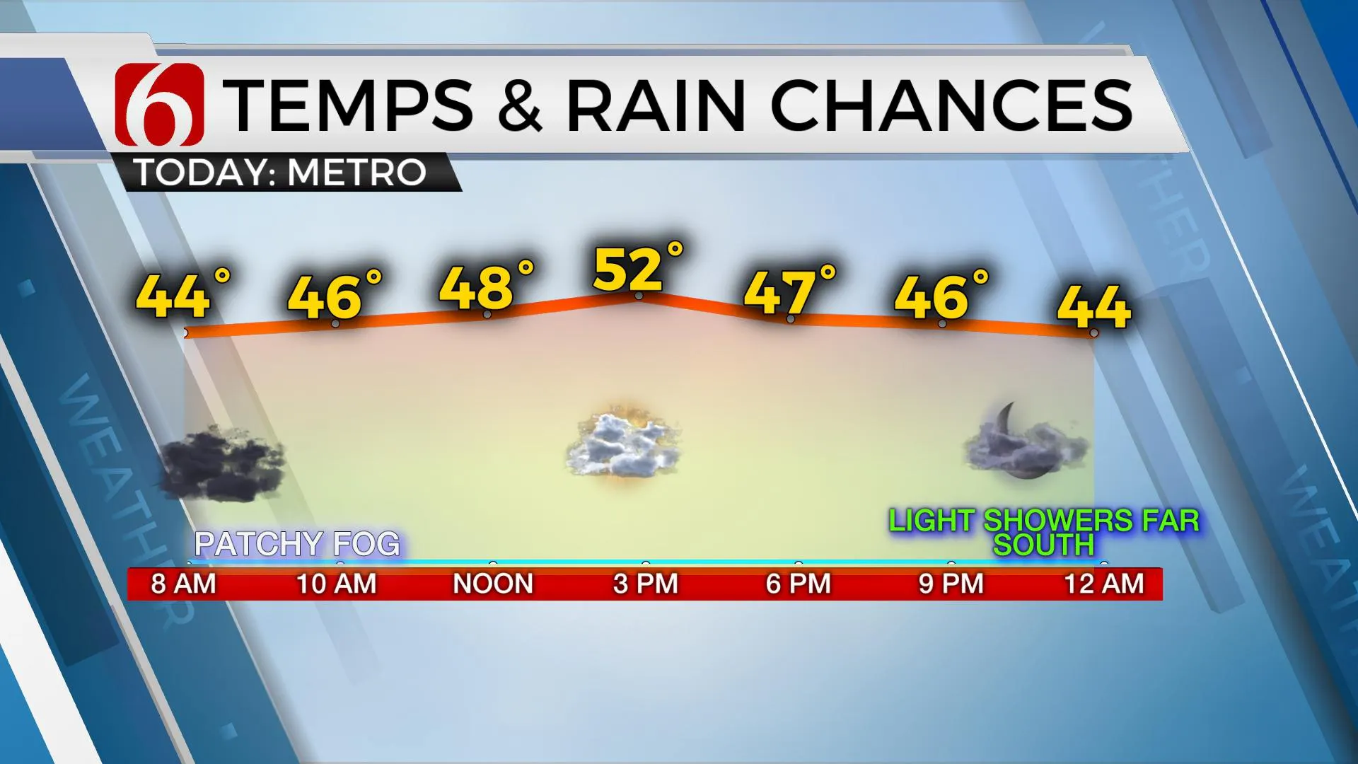
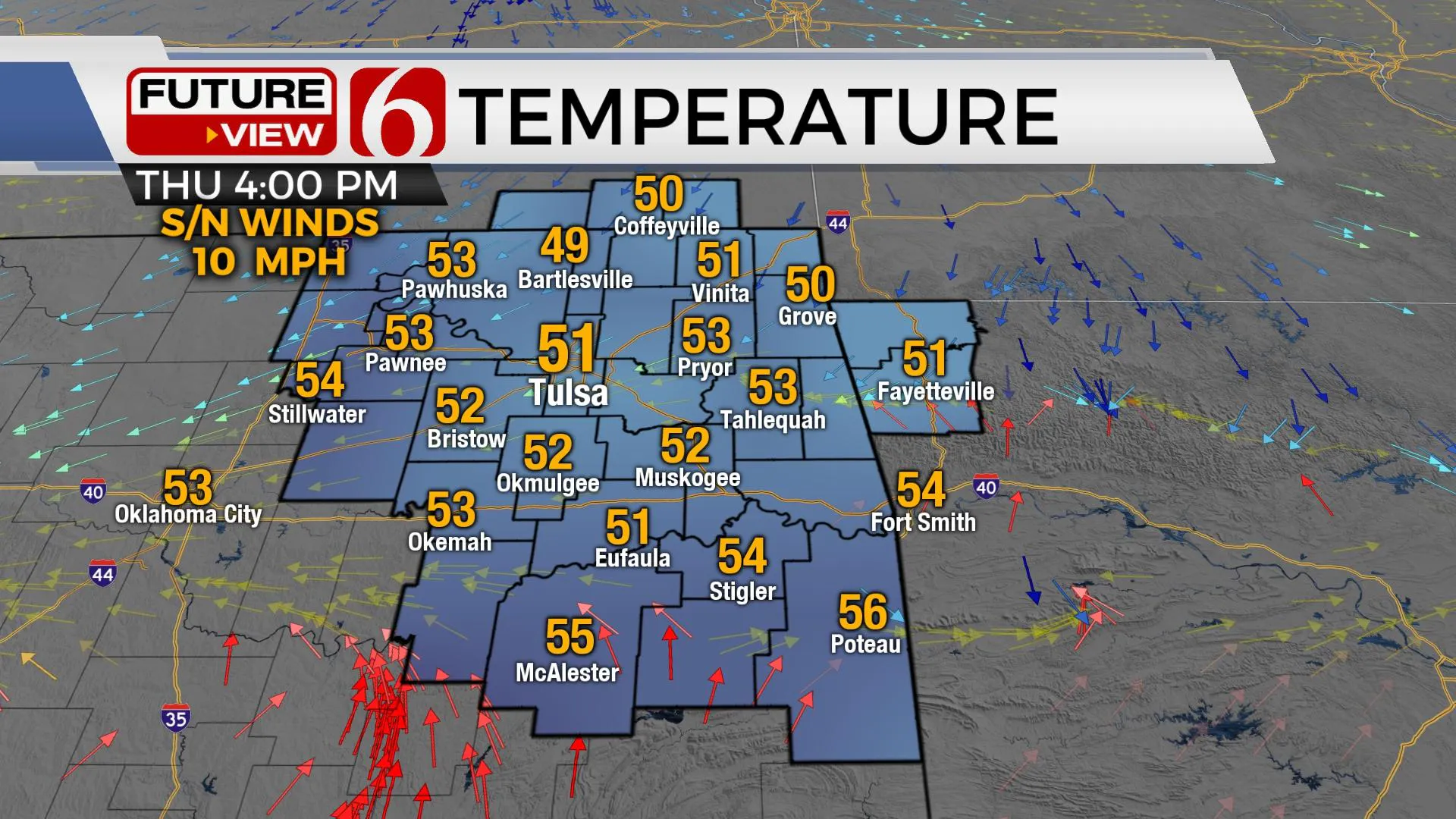
The main storm system we’ve been tracking for the past few days will eject across North Texas later tonight and exit the region early Friday morning. While it is quite strong right now, by the time it arrives, it will be weakening quickly. A few showers will remain possible this evening, mostly to our south, as it scoots across the area. Temps will stay in the 30s and 40s this morning but may struggle to break out the upper 40s and lower 50s north due to cloud cover. The afternoon temperature forecast is quite tricky and will have a large margin of error today. Highs could range from 48 to 52 with persistent clouds or up to 58 with a few sun breaks. I’ll stay on the low side for the afternoon temps. A front arrives later today, and this will bring north winds back from 10 mph this afternoon with colder air arriving later tonight into Friday morning. Highs Friday will reach the upper 40s and lower 50s with some sunshine. The next system will queue up quickly and impact part of the area for part of the weekend. This system has some differences in the data that could result in some big changes for the Monday morning to midday forecast. Highs Sunday will reach the lower 60s along with gusty south winds before a few showers and storms develop ahead of the cold front. This system appears to be slowing down in most data and will not clear the region until Monday morning.
Lots of differences remain in the data regarding the weekend system. I’ll stay out of the weeds for now but will briefly highlight the scenarios. Most data support a decent upper-level system nearing by Sunday evening and a surface low developing across southwestern kanas Sunday and ejecting northeast. Most data support increasing low-level moisture ahead of these features Saturday evening into Sunday with a few showers developing. But the data differs on the exact location of developing showers and storms. The latest EURO is slower. The GFS is faster. A slower solution could result in a few stronger storms near the ArkLaTex late Sunday evening into early Monday morning along the Red River due mostly to the presence of strong deep-layer shear. For now, any severe threat will be across part of Texas and far southeastern OK Sunday evening. More northward, a faster system may bring colder air quickly across northeastern OK Sunday night and offer a window for some wintry precipitation Monday along and north of the OK-KS state line region. My forecast will keep a 40% chance of showers and storms during the day Sunday with an 80% chance Sunday night into early Monday. Temps will start Monday morning in the lower 40s and reach the upper 40s or near 50 midday and drop into the mid-40s by afternoon with north winds. Colder air may stick around for a day or two next week, but any true arctic air will remain north of the state.
Thanks for reading the Thursday morning weather discussion and blog.
Have a super great day!
Alan Crone
KOTV
If you listen to podcasts, try my daily weather update.
Search for NewsON6 and ‘Weather Out The Door’ on most podcast providers, such as here on Spotify.
More Like This
January 21st, 2021
February 14th, 2022
January 26th, 2022
January 25th, 2022
Top Headlines
April 18th, 2024
April 18th, 2024
April 18th, 2024


