Warming Trend Remains Before Cold Fronts Move In
A warming trend will remain for the next 48 hours before the first of three shallow cold fronts roll across the state bringing colder weather back to northeastern Oklahoma. The 2nd front currently scheduled to arrive Saturday will bring the coldest air of the winter season into our area that may last for a few days into early next week. This pattern can produce wintry precipitation, but our chances currently remain very low for the weekend system. We may experience a few showers Thursday as theTuesday, February 2nd 2021, 5:14 am
TULSA, Okla. -
A warming trend will remain for the next 48 hours before the first of three shallow cold fronts roll across the state bringing colder weather back to northeastern Oklahoma. The 2nd front currently scheduled to arrive Saturday will bring the coldest air of the winter season into our area that may last for a few days into early next week. This pattern can produce wintry precipitation, but our chances currently remain very low for the weekend system. We may experience a few showers Thursday as the first system quickly advances through the plains, but the overall impact and probability will remain low.

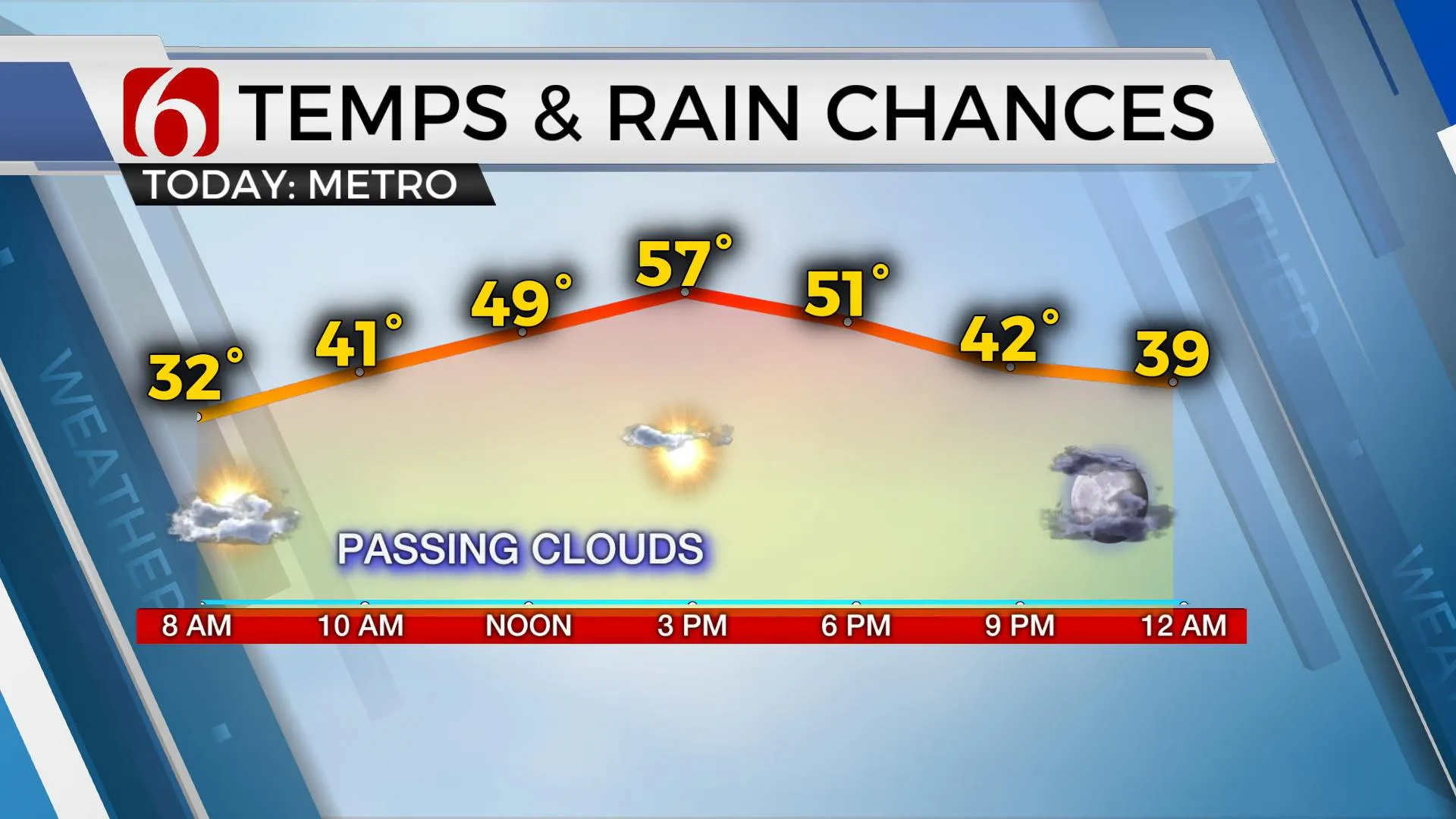
A mid-level ridge of high pressure currently positioned to our southwest will bring pleasant weather both today and tomorrow with afternoon highs reaching the mid to upper 50s today and into the lower 60s Wednesday. As the main upper trough approaches the intermountain region Tuesday evening, gusty south winds will respond Wednesday across the plains as upper-level evacuating mass leads to lowering pressures east of the Rockies. Temperatures will also remain quite mild Wednesday night into Thursday with temps in the 50s for many spots before the first cold front approaches the area early to midday Thursday. A surface area of low pressure is expected to scoot across either northern OK or southern Kansas along this boundary and may provide enough convergence for a few showers along the boundary as it moves quickly southeast. Colder air will arrive Thursday evening but most of the moisture will be removed from the state by late evening and I have removed any mention of snow flurries or mix on the backside of this first front. The timing of the system will remain problematic for the Thursday maximum temperature forecast, but I’m always inclined to ‘go under’ in these situations and will keep the inverted profile Thursday with midday readings in the upper 50s and lower 60s dropping into the lower to mid-40s by afternoon with gusty northwest winds.

Friday a fast return to a south wind by afternoon should bring the daytime highs back a few degrees, possibly into the lower 50s before the 2nd front bringing the colder plunge of arctic air arrives Saturday.
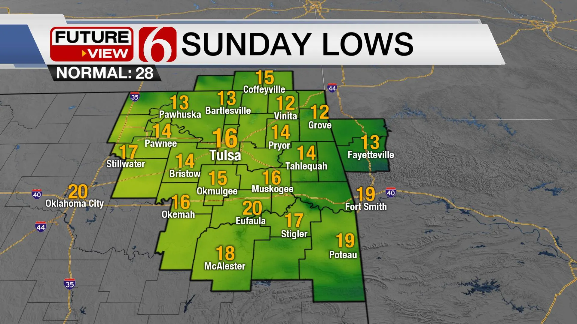
Saturday starts near 40, but the leading edge of the colder air may not arrive until midday. I have also undercut these numbers for Saturday with highs only reaching the upper 30s and lower 40s due to the usually faster nature of arrival times of arctic air masses when compared to suggestions by computer models. Temps will eventually drop from the upper 30s into the 20s Saturday afternoon and evening and into the teens Sunday morning with gusty north winds. A weak upper-level disturbance will be possible Saturday evening into Sunday that would produce a chance for some light snow or flurries. Regardless, if this happens, the impact will be minor.

I’ll keep the cold arctic air in place for at least the first two days of next week before another very strong looking front arrives Wednesday. When shallow cold air moves into northeastern OK, it many times will also remain longer than conventual model suggestions. This pattern next week would need to be watched closely. Any disturbance arriving from the southwest over the shallow cold air would be a wintry precipitation maker for the state.
Thanks for reading the Tuesday morning weather discussion and blog.
Have a super great day!
Alan Crone
KOTV
Be sure and check out my daily podcast update. Search for NewsOn6 and ‘ Weather Out The Door’ on most podcast providers, including here on Spotify.
More Like This
February 2nd, 2021
February 14th, 2022
January 26th, 2022
January 25th, 2022
Top Headlines
December 12th, 2024
December 12th, 2024
December 12th, 2024


