Breezy, Mild Afternoon Ahead Of Windy, Raw Thursday
We’re ramping up for a breezy, yet mild afternoon followed by a windy and raw Thursday as the first of several cold fronts will move across the state, including the Tulsa metro. We’ll rebound briefly Friday with highs in the lower 50s before we track the eventual arrival of arctic air into the state. The very latest data this morning suggests the leading edge of colder air will trickle down into northern OK Saturday night and may briefly retreat Sunday before power housing south next week. The dWednesday, February 3rd 2021, 6:15 am
TULSA, Okla. -
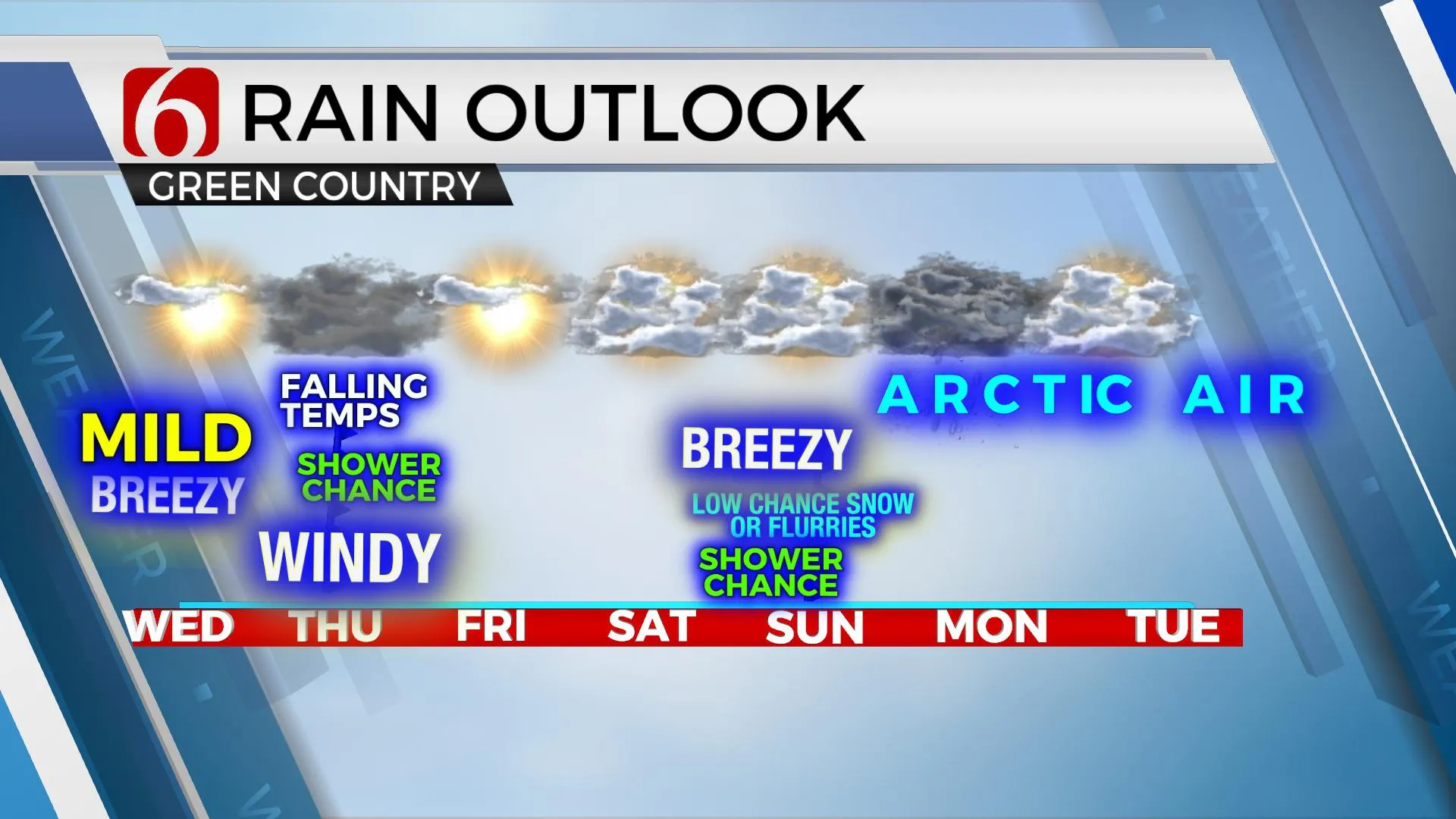
We’re ramping up for a breezy, yet mild afternoon followed by a windy and raw Thursday as the first of several cold fronts will move across the state, including the Tulsa metro. We’ll rebound briefly Friday with highs in the lower 50s before we track the eventual arrival of arctic air into the state. The very latest data this morning suggests the leading edge of colder air will trickle down into northern OK Saturday night and may briefly retreat Sunday before power housing south next week. The data for next week looks like we’re in the freezer for a while. A few showers may develop with the Thursday front, but chances remain near 20%. While a few snow flurries or showers can’t be ruled out with the Saturday evening, this should not be significant, and the chance remains around 30% at this moment.

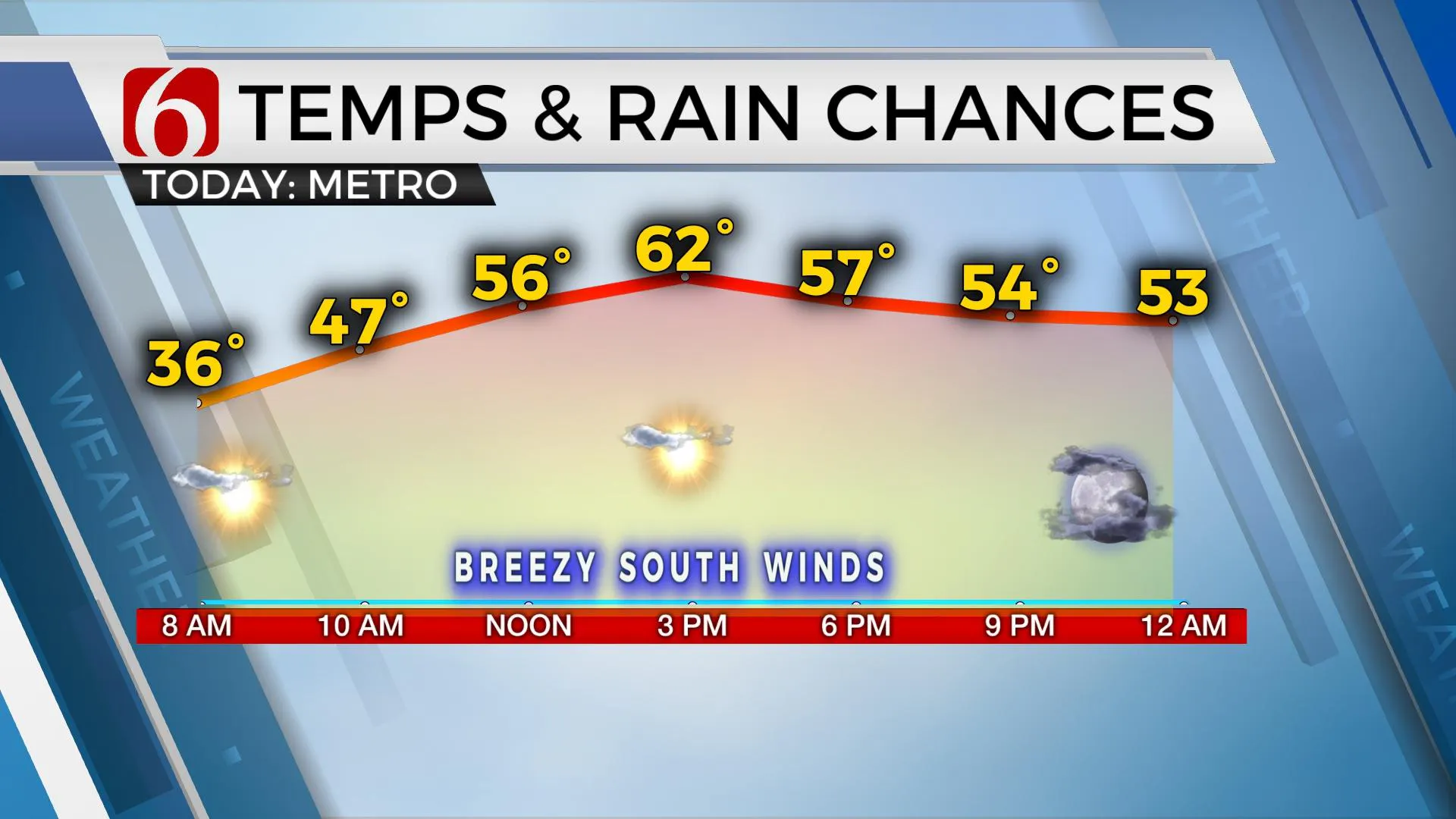
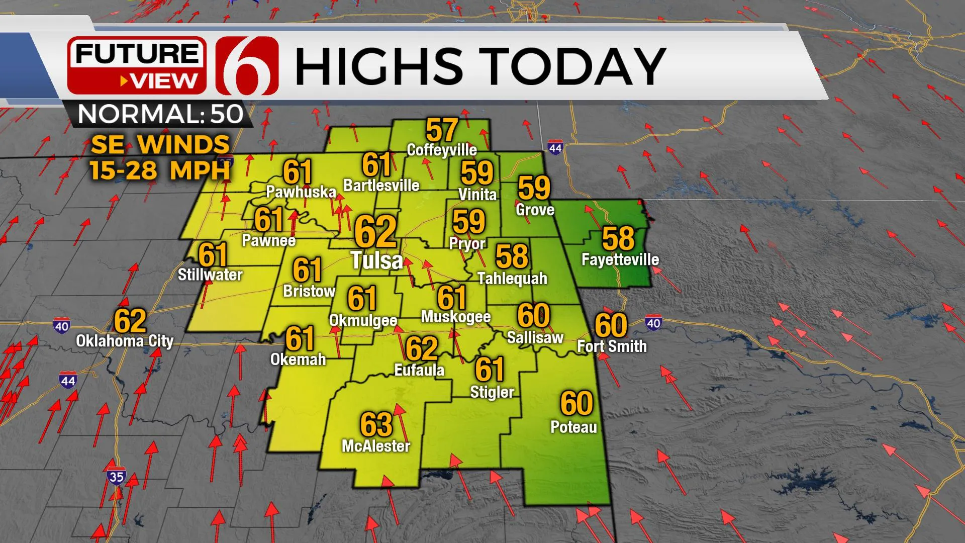
Before the cold weather arrives, we’re moving up today with highs reaching the upper 50s and lower 60s. The main long wave trough is dropping across the northern intermountain region of the Rockies and pressures will be falling quickly today ahead of this system. This means our winds will be increasing speeds from 15 to 30 mph with temperatures remaining rather mild for early February. While we’re not breaking any records today, temps will remain pleasant even though gusty south winds will require most folks to keep jackets and sweaters for the afternoon.

Late tonight into early Thursday, as the trough nears the state a surface cold front will surge southward and a small area of low pressure will develop on this boundary. A few showers will attempt to develop along and ahead of this boundary across eastern OK with snow post-frontal across part of central Kansas. I’ll keep a low chance for a few showers or sprinkles Thursday as the boundary moves south. The larger issue will be the dropping temps through the day from the 50s into the 40s by midday and possibly into the upper 30s by the evening commute. Northwest winds from 20 to 35 mph will be likely and wind chills dropping into the 30s. Friday morning starts in the upper-20s and lower-30s, but a southwest surface wind brings highs back into the upper 40s or lower 50s Friday before the first attempt of arctic air arrives Saturday afternoon or evening.
Most data support the main surge of cold air arriving Saturday evening, but we know these types of air masses tend to arrive faster compared to model data solutions. But data this morning suggest a surface low develops on the front across the central plains Saturday and this may keep the coldest air slightly north longer. I’m delaying the arrival of the really cold air compared to yesterday’s data. This means we could move back into the upper 40s Saturday afternoon, or even some lower 50s before dropping Saturday evening. As the front arrives, a few sprinkles or showers will be possible ahead of the front and even a few snow showers across far southeastern Kansas post-frontal, but nothing significant.

Later Saturday night into Sunday morning temps will drop into the upper teens and lower 20s with wind chills supporting 5 to 20. Data this morning suggest winds may return from the south Sunday midday to afternoon and keep temps into the mid-30s before more cold air arrives Sunday into Monday sticking around through the middle of next week. As I mentioned yesterday, this pattern next week would need to be watched closely. Any disturbance arriving from the southwest over the shallow cold air would be a wintry precipitation maker for the state. Stay tuned for details about some wintry precip chances for next week.
Thanks for reading the Wednesday morning weather discussion and blog.
Have a super great day!
Alan Crone
KOTV
Be sure and check out my daily weather podcast. Search for NewOn6 and "Weather Out The Door" on most podcast providers, including here on Spotify.
More Like This
February 3rd, 2021
February 14th, 2022
January 26th, 2022
January 25th, 2022
Top Headlines
December 12th, 2024
December 12th, 2024
December 12th, 2024
December 12th, 2024


