Friday Pattern Brings Sunshine, Warming Trend
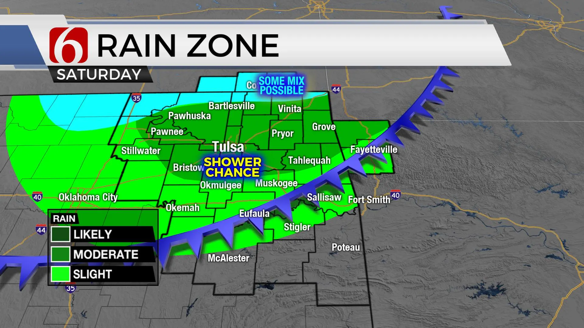
A great Friday pattern brings mostly sunshine and a warming trend into the area today as a shallow cold front (arctic air) begins invading northern OK tomorrow afternoon and evening. Before the surface front arrives, a fast-moving disturbance scoots across the state tomorrow with a mention for some light shower activity. Locations along the Ok-Kansas state line region could see some mixing with sleet or even flakes midmorning. Once this wave exits the area, the leading edge of colder air will moFriday, February 5th 2021, 7:18 am
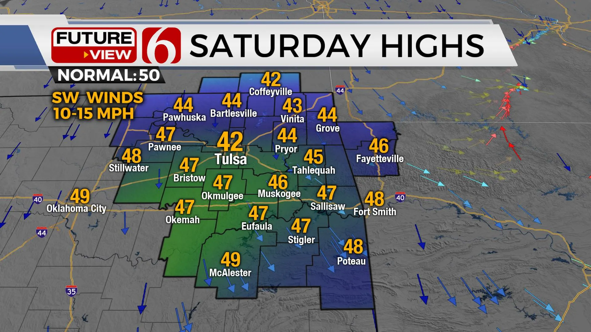
A great Friday pattern brings mostly sunshine and a warming trend into the area today as a shallow cold front (arctic air) begins invading northern OK tomorrow afternoon and evening. Before the surface front arrives, a fast-moving disturbance scoots across the state tomorrow with a mention for some light shower activity. Locations along the Ok-Kansas state line region could see some mixing with sleet or even flakes midmorning. Once this wave exits the area, the leading edge of colder air will move southward into the area Saturday afternoon with falling temps and north winds. This front will move into at least northern OK stalling Saturday night south of Tulsa, creating a broad range of Sunday afternoon readings. Colder weather would be likely across the northern sections Sunday with highs remaining into the 30s. Locations southeast of I-40 could move back into the 40s and 50s. This shallow cold front may briefly lift northwest Sunday night into Monday morning for a few hours before finally plunging southward Monday afternoon encompassing almost the entire state with the coldest air of the season.

We’ve been watching this system for many days, and this weekend should represent the first attempt of the cold air moving southward. The pattern last week depicted a signature representing the potential for arctic air to dislodge and move southward and this should happen this weekend. A major trough is rolling across the Prairie Provinces of Canada and will eject into the upper Midwest. The broad upper flow from the northwest will drive a strong midlevel wave southeast and this will pass our area Saturday bringing the shower chances. At the surface, the leading edge of cold air will drive southward. An elongated arctic high-pressure ridge across the central plains early next week will keep the cold air southward before this feature moves east, yet another surge of cold air arrives for the middle of the week.

If one takes most operational data, the potential for a long duration period of subfreezing temperatures will be likely from Monday evening, potentially, through next weekend. When shallow arctic air becomes entrenched across northeastern OK, it takes a major pattern change to scour the airmass. We don’t see that in the pattern for next week. We do see the potential for a disturbance or two approaching from the southwest that could easily bring relatively warm and moist air up and over the shallow dome resulting in light wintry precip. The current data set and pattern recognition would bring chances similar to this Monday night into Tuesday with some freezing drizzle, and possibly by the end of next week with some light snow or a mix.

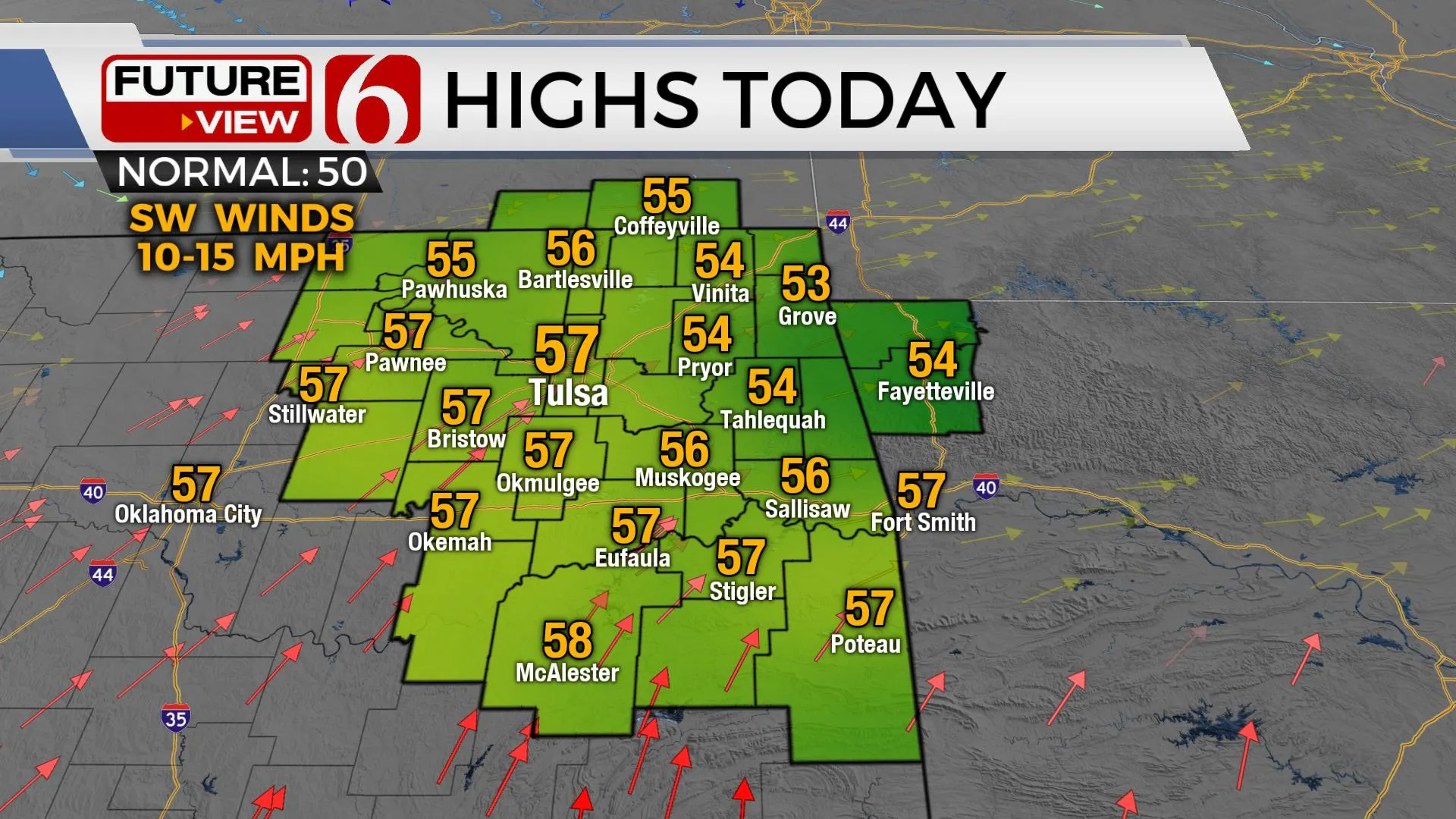
Today looks great. Enjoy this nice weather. We’ll experience some sunshine before a few clouds arrive with highs reaching the mid to upper 50s.
Thanks for reading the Friday morning weather discussion and blog.
Have a super great day!
Alan Crone
KOTV
Be sure and check out my daily weather podcast. Search for NewsOn6 and ‘ Weather Out The Door’ on most podcast providers, including here on Spotify.
More Like This
February 5th, 2021
February 14th, 2022
January 26th, 2022
January 25th, 2022
Top Headlines
December 13th, 2024
December 13th, 2024
December 13th, 2024
December 13th, 2024


