Pleasant Weather Continues Before Shower Chances Arrive Thursday Night
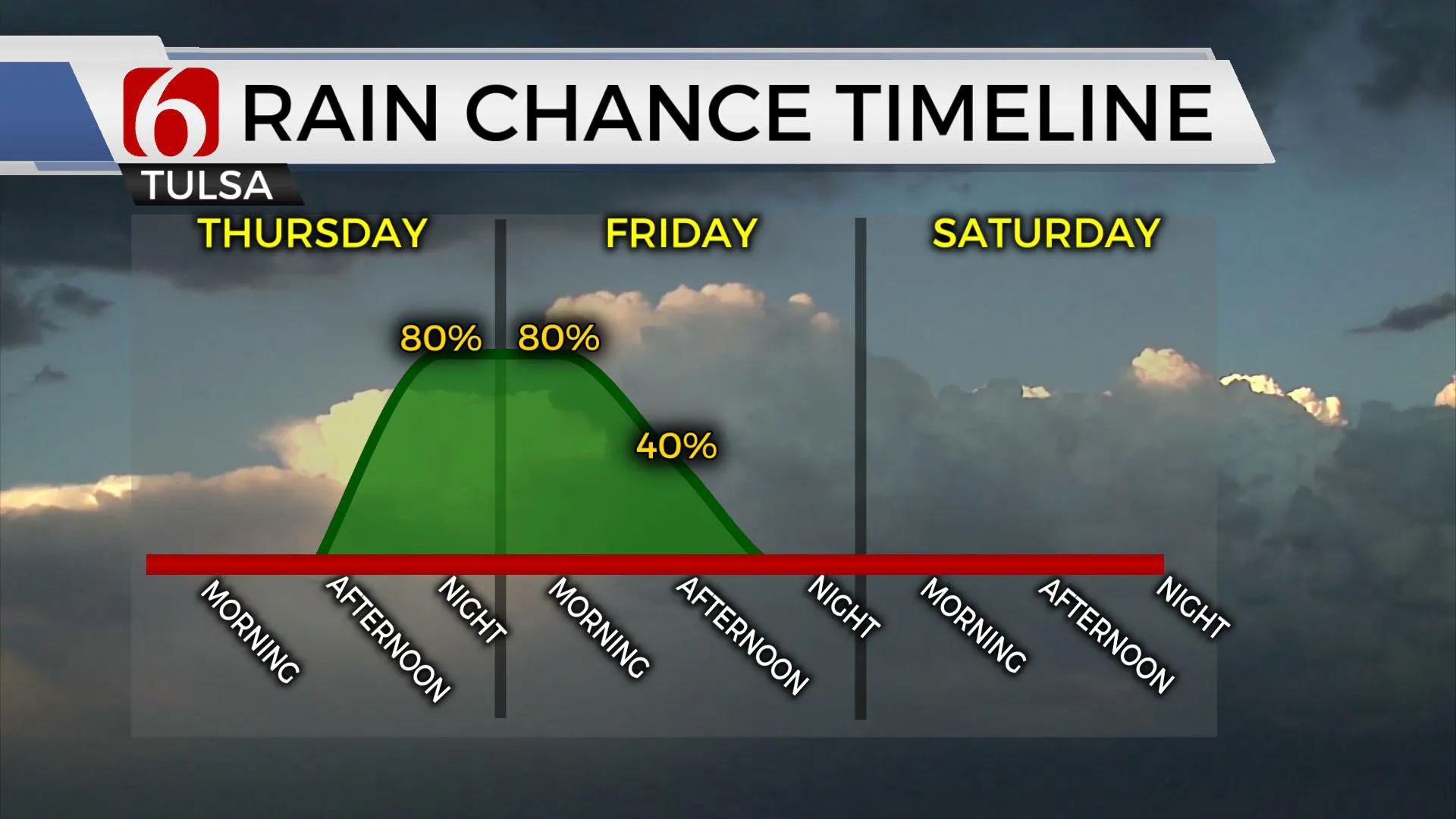
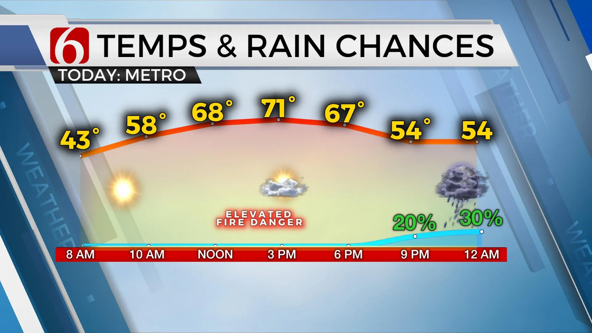
The pleasant weather will continue for most of the day, but our next rain maker arrives tonight with increasing rain chances and some thunder. Cool to blustery weather is expected for most of Friday before improving this weekend. Temperatures are currently in the 30s and 40s this morning and will reach the upper 60s and lower 70s once again this afternoon before the first part of our approaching system nears the region later this evening.Thursday, March 4th 2021, 7:31 am
TULSA, Okla. -
The pleasant weather will continue for most of the day, but our next rain maker arrives tonight with increasing rain chances and some thunder. Cool to blustery weather is expected for most of Friday before improving this weekend. Temperatures are currently in the 30s and 40s this morning and will reach the upper 60s and lower 70s once again this afternoon before the first part of our approaching system nears the region later this evening.

Clouds will be increasing later this afternoon and evening as the main upper-level system draws closer to the area. A surface low positioned across southeastern Colorado will drop southeast and end up across north-central Texas early Friday morning. The strong upper-level closed low will drop from the Rockies across central Ok early Friday morning before opening and weakening as it moves away from the area tomorrow afternoon and evening. Before this occurs, southeast winds will bring low-level moisture into central Ok later today with dew point temps reaching into the mid to upper 40sF near or west of I-35 as the first spoke of energy triggers a few storms across northwestern Ok by this evening. A few of these will produce some nickel hail but the overall threat will remain isolated and mostly west of I-35 for tonight. As the low drops southeast, a band of rain will set-up across the northeast side of the low, across northeastern OK and southern Kansas, and will persist in a few locations for Friday morning. This activity will not be severe. Friday midday to afternoon, this weakening band will pivot southward and cross the I-40 corridor while dropping southeast. If all goes as planned, precipitation will be exiting our area by the noon hour across the north and may linger slightly longer south before ending. Some locations may remain dry with this system due to the banding nature of the precipitation, but I’ll need to keep rather high probabilities for most spots. This system will exit our area by Friday evening bringing us pleasant weather for the weekend before active weather returns next week.

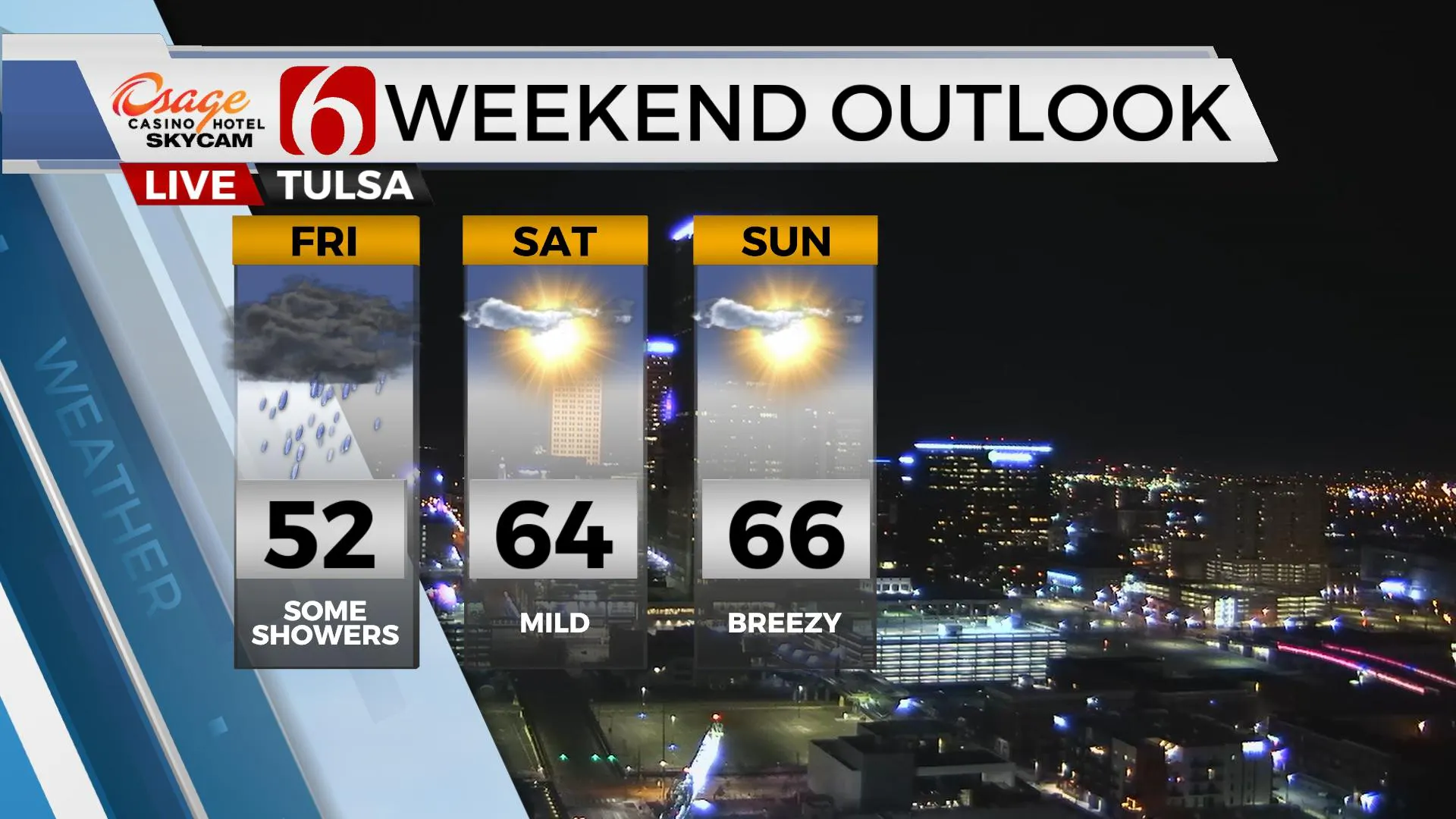
Daytime highs this weekend will range from the mid-60s Saturday to the upper 60s Sunday. The only issue I see will be increasing wind speeds Sunday, and more so early next week as a powerful western U.S. trough deepens across the Rockies. We may be dealing with wind advisory criteria winds if not Monday, then Tuesday and Wednesday with south winds from 20 to 40 mph. A few showers or storms will also be possible Wednesday, but higher chances should follow late next week, perhaps into next weekend. The overall synoptic pattern for next week would support severe thunderstorm threats returning to the state, but the specifics cannot be resolved at this point in the forecast process.

Thanks for reading the Thursday morning weather discussion and blog.
Have a super great day!
Alan Crone
KOTV
If you’re into podcasts, check out my daily weather update below. Search for NewsOn6 and ‘Weather Out The Door’ on most podcast providers, including Apple, Stitcher, Tune-In and down below on Spotify.

More Like This
April 17th, 2024
September 23rd, 2023
August 16th, 2023
Top Headlines
December 12th, 2024
December 12th, 2024
December 12th, 2024
December 12th, 2024


