Cool Brisk Friday With Occasional Showers
We’ll track occasional showers this morning across part, but not all of the area. After a cool and brisk Friday, most of the weekend looks good. The strong closed upper low is diving across NW OK this morning but will rapidly weaken and exit the area by midday to afternoon. A surface low associated with this system is located to the southwest of the metro and will also continue moving southeast into North Texas by midday. A band of precipitation will rotate around the northern periphery of the lFriday, March 5th 2021, 5:22 am
We’ll track occasional showers this morning across part, but not all of the area. After a cool and brisk Friday, most of the weekend looks good.
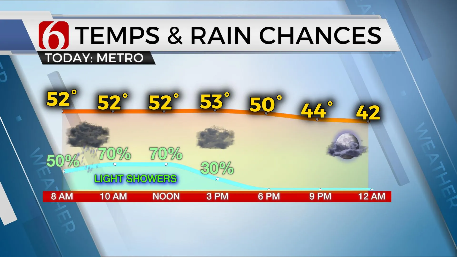
The strong closed upper low is diving across NW OK this morning but will rapidly weaken and exit the area by midday to afternoon. A surface low associated with this system is located to the southwest of the metro and will also continue moving southeast into North Texas by midday. A band of precipitation will rotate around the northern periphery of the low for the next few hours before dropping south and weakening by midday to afternoon. Southern OK experienced a few showers overnight with the initial development of the band but will be dry for most of the morning before having a few showers this afternoon. Northern sections of the region, near and north of the Tulsa metro, will see precipitation thinning early this morning but should redevelop for some showers through the first half of the day. Amounts will be light. And, due to the banding nature of the precipitation, some locations will remain dry, even across northern OK.

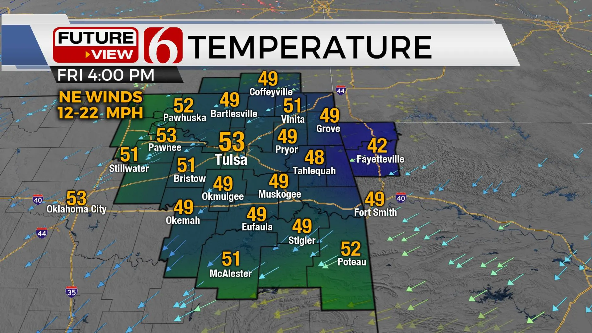
Temperatures will vary greatly today due to the variability of precipitation coverage. Far northeastern OK may remain in the upper 40s to lower 50s while locations south of I-40 may reach the upper 50s before dropping into the upper 40s and lower 50s later today. All locations will experience a brisk northeast wind from 12 to 22 mph. This entire system will be removed from the area tonight with pleasant weather expected this weekend. The only issue may be some fog or low clouds early Saturday morning along and north of Highway 412. Some hi-res data support fog developing across the northern sections of the region for a few hours Saturday morning. If this occurs, it would be dense through 10 a.m.

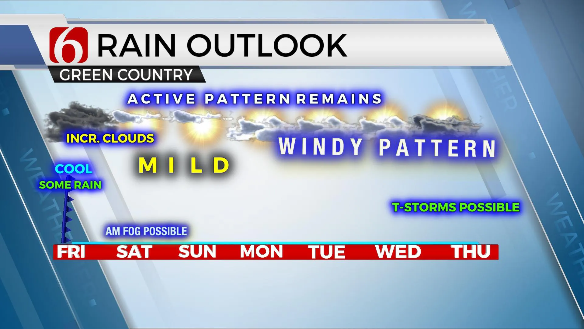
A mid-level ridge of high pressure will temporarily bring some mild and pleasant weather Saturday with lows in the 40s and highs in the mid-60s. South winds return tomorrow but will remain mostly light. A weak wave passes south, across central Texas Sunday, while a stronger disturbance is likely across the northern high plains. Our weather will remain good, but a few more clouds will be likely along with gusty south winds from 15 to 30 mph.
Next week the upper air pattern becomes established from the southwest and will bring several items of interest into the southern and central plains including the eventual potential for strong to severe storms by late next week based on the pattern and not necessarily any model outputs.

A major trough will become established across the western U.S. next week with several waves or disturbances rounding the basal region and ejecting into the plains. The falling pressures across the intermountain region will cause extremely strong southerly flow, with wind speeds from 20 to 40 mph likely Tuesday into Wednesday. Wind advisories are likely during these periods. Low-level moisture will also be increasing and eventually becoming deeper in the atmosphere giving credence to the eventual thunderstorm chances expected in this pattern. The exact scenario cannot be timed-out at this point, but storm chances will remain for late next week and possibly some active weather into part of the following weekend.
Thanks for reading the Friday morning weather discussion and blog.
Have a super great day!
Alan Crone
If you’re into podcasts, check out my daily weather update below. Search for NewsOn6 and ‘Weather Out The Door’ on most podcast providers, including Apple, Stitcher, Tune-In and down below on Spotify.

More Like This
March 5th, 2021
February 14th, 2022
January 26th, 2022
January 25th, 2022
Top Headlines
December 13th, 2024
December 13th, 2024
December 13th, 2024


