Gusty South Winds, Mild Temperatures
Gusty south winds, mild temps with occasionally smoke-filled skies will be expected across northeastern OK. The windy weather pattern early this week keeps our fire danger threats high, but storm chances will bring some relief for the latter half of the week. Some of these storms could be strong to severe.Monday, March 8th 2021, 5:26 am
TULSA, Okla. -
Gusty south winds, mild temps with occasionally smoke-filled skies will be expected across northeastern OK. The windy weather pattern early this week keeps our fire danger threats high, but storm chances will bring some relief for the latter half of the week. Some of these storms could be strong to severe.

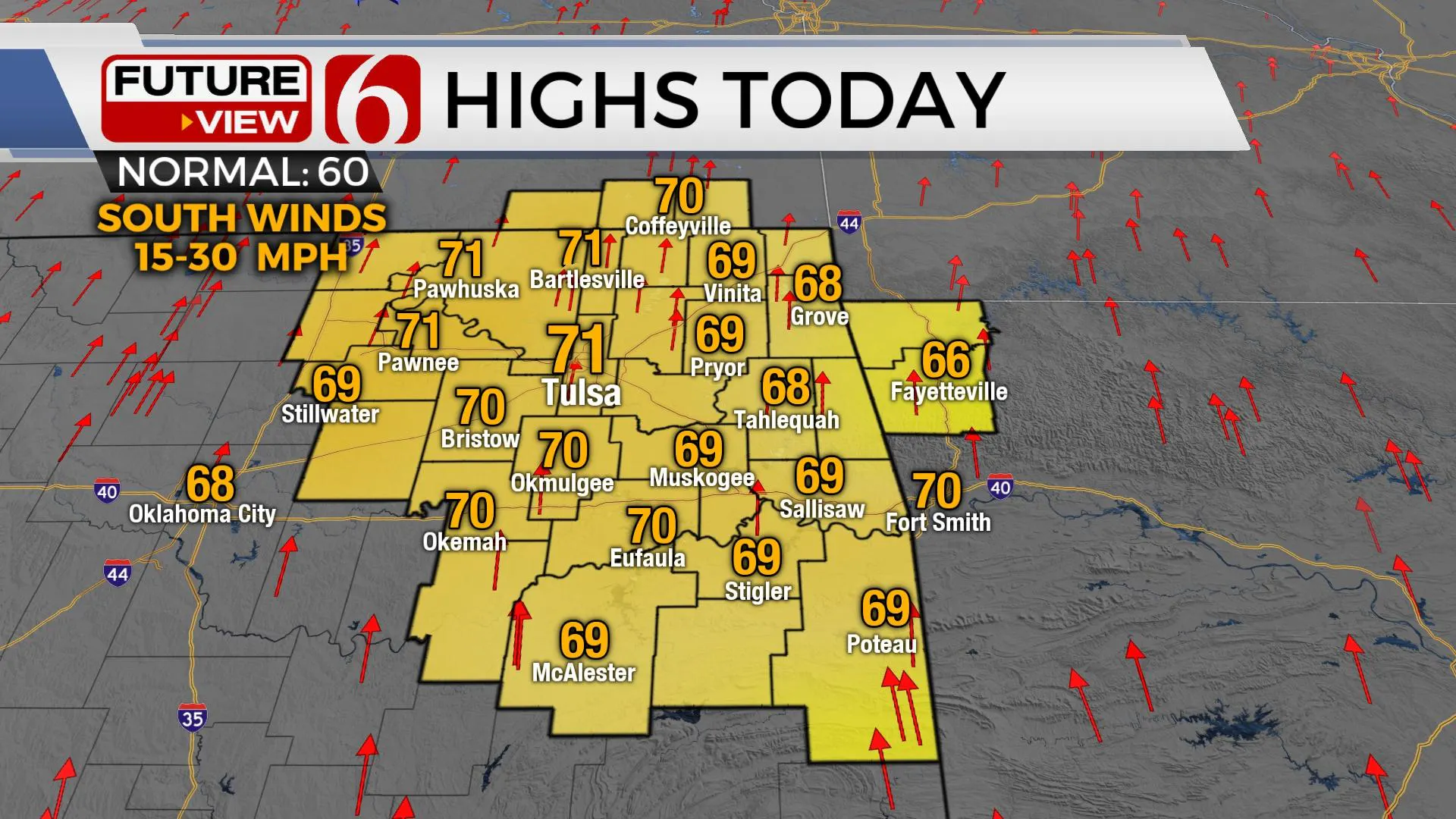
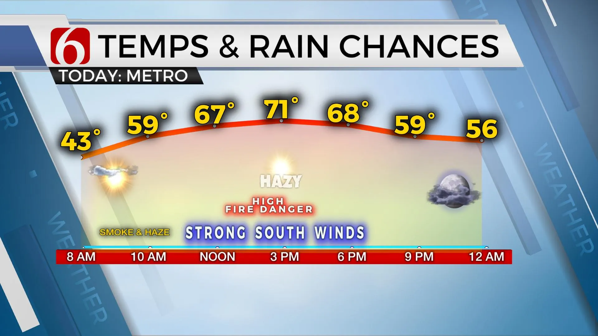
Temperatures will remain cool this morning before moving into the 60s by noon and into the lower 70s this afternoon with strong south winds from 15 to 30 mph. The fire spread rates are increasing once again today, but humidity values may be slightly higher during the peak afternoon hours compared to yesterday. Regardless, the fire danger remains quite high. Red Flag warnings are posted for part, but not all of northeastern OK and southern Kansas this afternoon. Regardless, the simplified message: remain careful and cautious. Burning is discouraged.

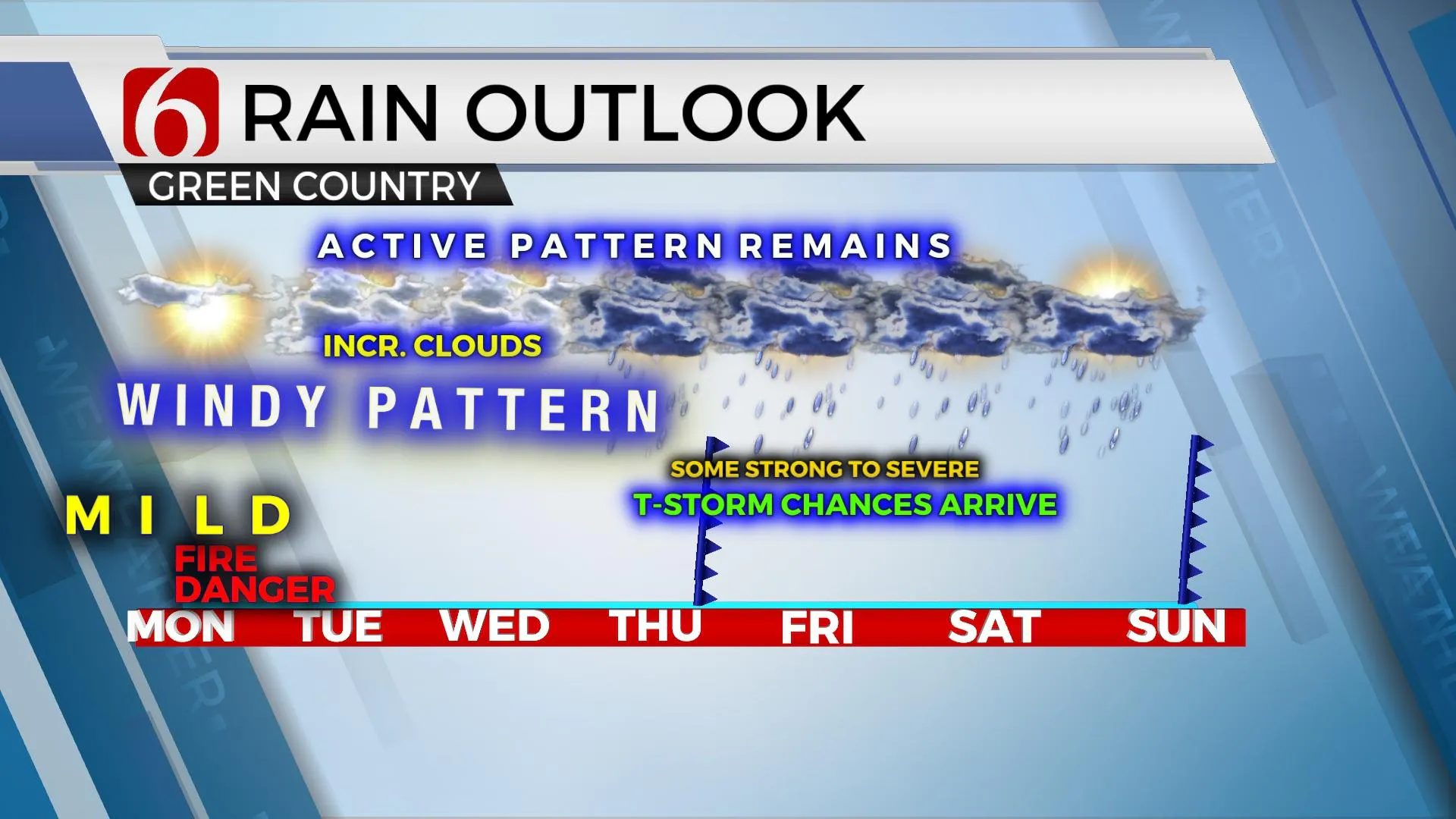
The main upper air pattern is very spring-like for the entire week, and this will bring us storm chances for the second half of the week. We could have a small chance for a storm or two Wednesday, but higher chances will trickle into the region early Thursday morning and continuing Friday through the weekend. Our main weather common denominator for the first half of the week will remain strong southerly flow, including the potential for winds from 20 to 40 mph winds Tuesday and Wednesday. Temps will remain mild through this period, and we should have periods of clouds for the middle to end of the week that could result in less sunshine compared to the expectation of today.

Dew point temps will arrive at the upper 50s and lower 60s by at least Thursday if not Wednesday as a strong upper-level trough will near the southern and central plains. A weak boundary will slide southward and enter northern OK during this period and more than likely stall through the end of the week before slowly lifting northward by early this weekend. Yet as this is occurring, the main closed upper trough will finally be approaching the state with a surface low becoming established across the state. These features will move closer through the end of the week into this weekend with increasing thunderstorm chances, including the threat for severe storms. Locally heavy rainfall may also be a possibility near this boundary for this period. Sunday the main system finally ejects across eastern OK with Sunday morning storms, but most data support our region being dry-slotted Sunday afternoon as the low ejects away from the plains. We’ll cool down some for the weekend with Saturday’s highs near 60 sand Sunday into the lower and mid-50s.
Thanks for reading the Monday morning weather discussion and blog.
Have a super great day!
Alan Crone
KOTV

More Like This
March 8th, 2021
February 14th, 2022
January 26th, 2022
January 25th, 2022
Top Headlines
December 14th, 2024
December 14th, 2024
December 14th, 2024
December 14th, 2024


