Cool Morning Ahead Of Sunny, Breezy Afternoon
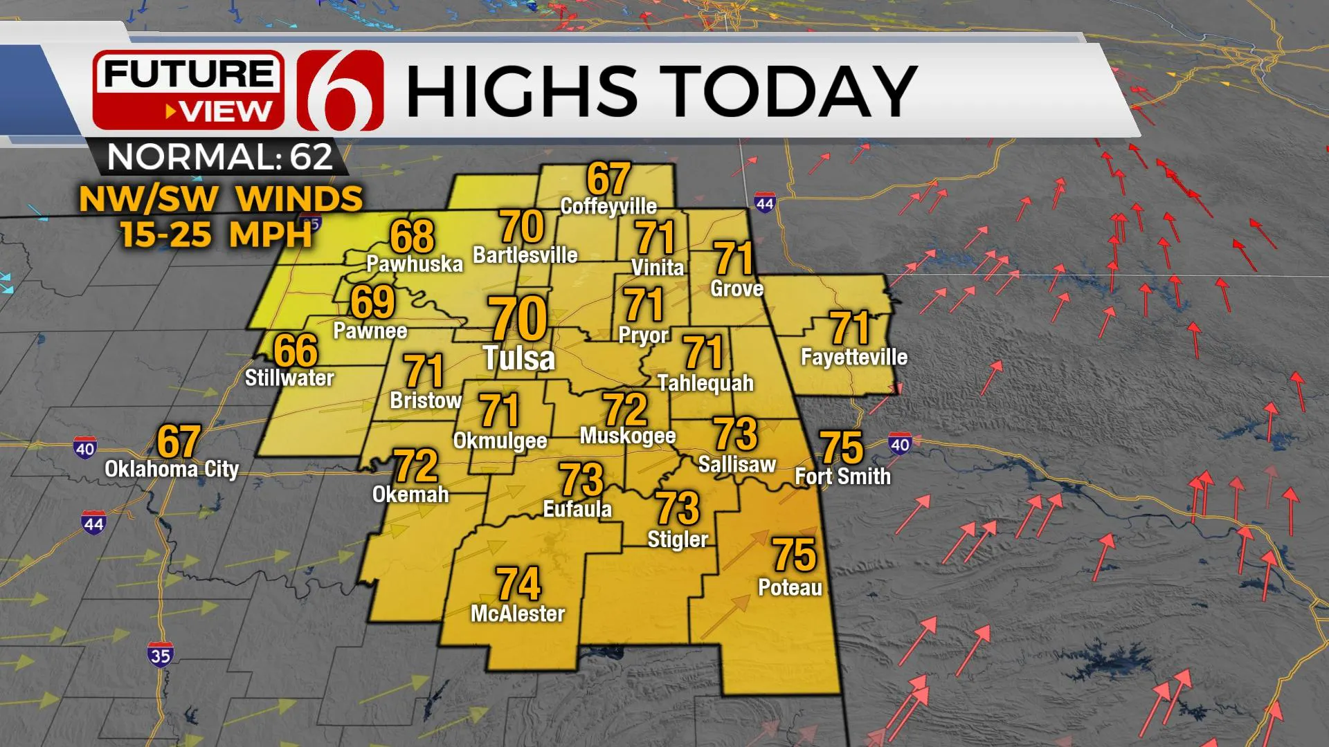
A cool morning yields a mostly sunny and breezy afternoon with highs reaching the upper 60s or lower 70s. But a fast-developing system drops across the state Tuesday night bringing severe weather threats into Eastern OK. This system may produce all modes of severe weather as it quickly enters our region late Tuesday evening into early Wednesday morning. Today is a good in-between day. The only issue may be gusty southwest winds around 15 to 25 mph. We’ll have a sunshine-cloud mix and highs reacMonday, March 15th 2021, 5:19 am
TULSA, Okla. -
A cool morning yields a mostly sunny and breezy afternoon with highs reaching the upper 60s or lower 70s. But a fast-developing system drops across the state Tuesday night bringing severe weather threats into Eastern OK. This system may produce all modes of severe weather as it quickly enters our region late Tuesday evening into early Wednesday morning.

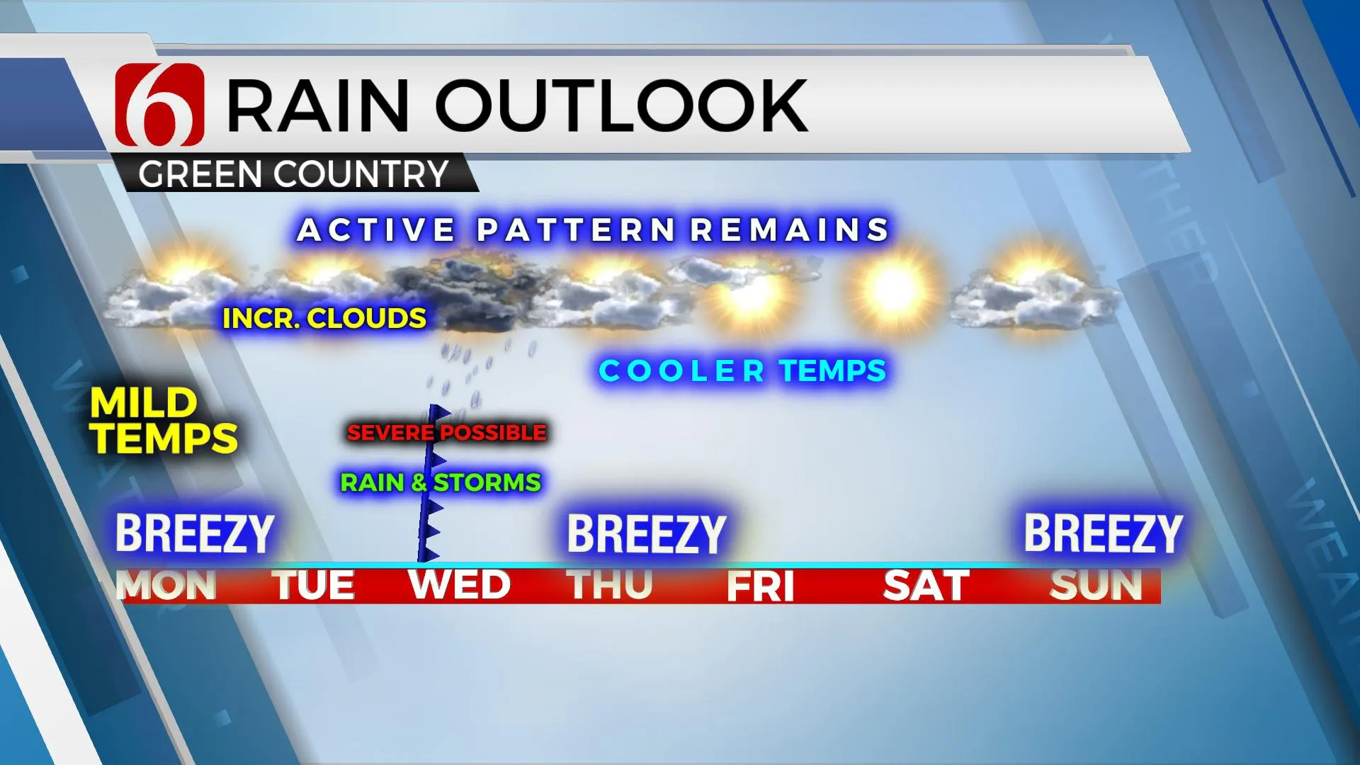
Today is a good in-between day. The only issue may be gusty southwest winds around 15 to 25 mph. We’ll have a sunshine-cloud mix and highs reaching the upper 60s and lower 70s. The second half of the week features cooler, even colder weather Thursday and Friday with morning lows in the 30s and highs in the 50s. But the transition period between Tuesday into Wednesday will be active, including the threat for severe weather.

Another strong upper-level system is already positioned across part of California this morning. This closed upper-level low will move rapidly east across the southwestern U.S. and into the Texas high plains Tuesday morning. By Tuesday afternoon, it's entering far western Oklahoma. A surface low-pressure area will quickly develop and move from near Amarillo to near Tulsa late Tuesday night into Wednesday morning. We'll experience north winds today and even for the first part of Tuesday, but tomorrow afternoon, southeast winds are expected to rapidly develop and transport low-level moisture quickly northwest into the developing storm. This storm system has more than enough shear to produce severe weather. The question for the types of severe weather centers upon the return of low-level moisture and how far north this moisture can arrive. Another issue will be the potential capping issues and how long the warm air aloft can suppress thunderstorm activity. For this update, we’ll be preparing for some strong to severe thunderstorms with this system.

The forecast severe parameters will mostly hinge on where a warm frontal zone becomes established late Tuesday evening into early Wednesday. The NAM family of models is most concerning bringing dew points quickly into the lower 60s, directly into the surface low Tuesday night, while the GFS keeps this area of higher quality moisture slightly more southward, mostly across southeastern OK and northeast TX. Even with a lower quality moisture return, some severe storm activity would be possible with this system late Tuesday night, mostly into early Wednesday morning. The surface low and attendant complex upper-level system will quickly exit our region Wednesday morning and take any threats of severe weather quickly eastward. Following this system, a rather stout cool-down will occur Wednesday, but we’ll mostly notice this change for Thursday with gusty northwest winds and highs only reaching the lower 50s. As mentioned above, the 2ns half of the week will be uneventful, other than below normal temps until we reach next weekend. Morning lows will be in the mid to upper 30s along with Saturday highs in the 50s and Sunday reaching the lower 60s with gusty south winds returning Sunday ahead of our next storm system for early next week.
Thanks for reading the Monday morning weather discussion and blog.
Have a super great day!
Alan Crone
KOTV
If you’re into podcasts, check out my daily weather update below. Search for NewsOn6 and ‘Weather Out The Door’ on most podcast providers, including Apple, Stitcher, Tune-In and down below on Spotify.

More Like This
March 15th, 2021
February 14th, 2022
January 26th, 2022
January 25th, 2022
Top Headlines
December 14th, 2024
December 14th, 2024
December 14th, 2024
December 14th, 2024


