Mostly Sunny Conditions, Lighter North Winds
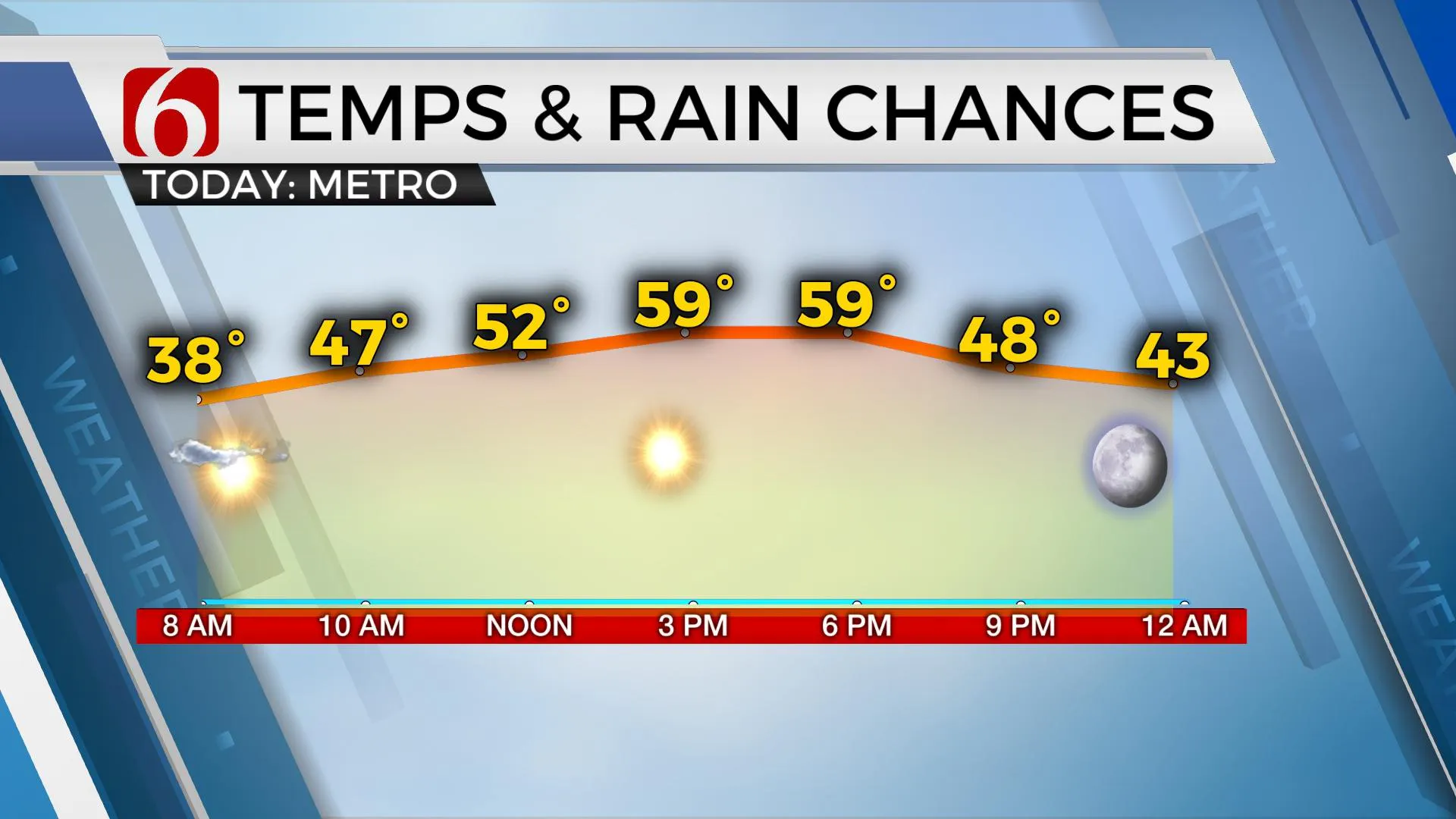
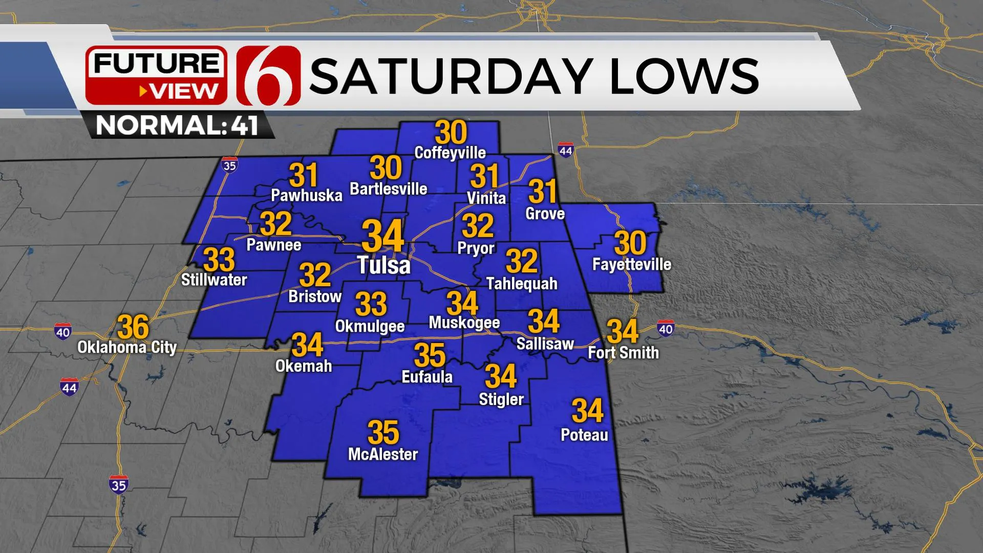
Today looks good. We should finally be removed from the big storm system that brought severe weather and blustery conditions to the state. Clouds will quickly thin this morning with mostly sunny conditions, lighter north winds, and highs in the upper 50s near 60 for most of NE OK. Temps will drop quickly tonight. Saturday morning features a few hours of sub-freezing temperatures along and north of I-40, but mostly in valley locations. Some patchy frost is possible. If you have tender plants, mosFriday, March 19th 2021, 8:20 am
TULSA, Okla. -
Today looks good. We should finally be removed from the big storm system that brought severe weather and blustery conditions to the state. Clouds will quickly thin this morning with mostly sunny conditions, lighter north winds, and highs in the upper 50s near 60 for most of NE OK. Temps will drop quickly tonight. Saturday morning features a few hours of sub-freezing temperatures along and north of I-40, but mostly in valley locations. Some patchy frost is possible. If you have tender plants, mostly tropical in nature, these may briefly struggle in this expected environment. But the duration of the sub-freezing air is minimal. Doesn’t look like a major issue.

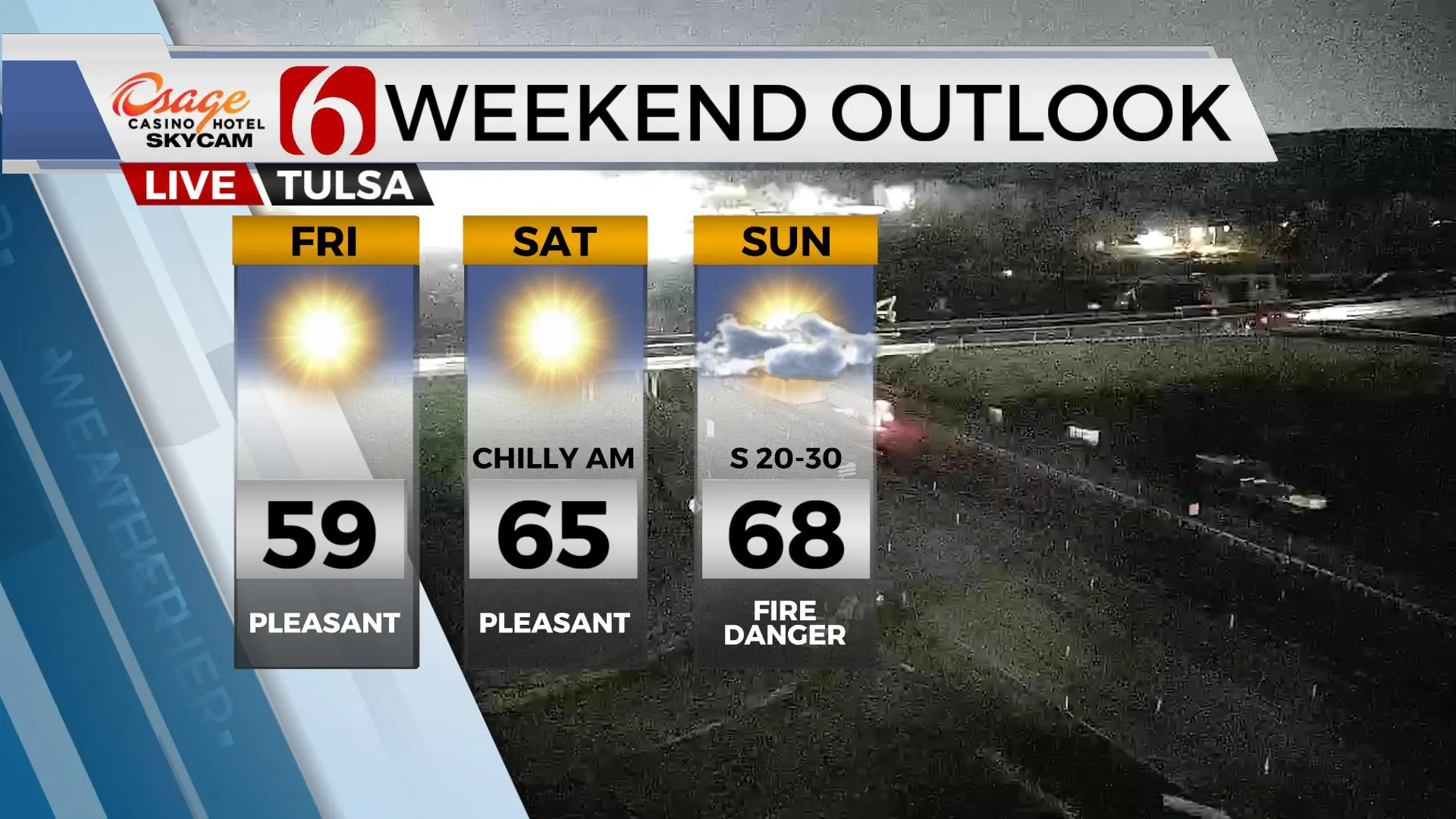
Saturday afternoon should be a 6-Star day with mostly sunny skies and highs in the mid-60s. Southeast winds return around 10 to 15 mph across eastern OK while most of the breezy weather Saturday will be confined to western Oklahoma. The mid-level ridging present Saturday will decrease as our next upper-level trough nears the Rockies and surface pressure begins to fall. Sunday’s temps will be warmer, nearing the upper 60s or even lower 70s, but strong south winds will be noted from 20 to 30 mph. This will increase the fire danger spread rates despite low-level moisture and slowly increasing dew points. The data this morning suggest the humidity during the afternoon may only be in the 35% range, yet rain and storm chances still look decent for early next week as our next system moves across the state.

The timing still supports mostly Monday evening for rain and thunder as a pacific frontal boundary will arrive from the northwest. If we had another day or two of southerly flow, the severe weather threats would be higher, but as of this morning’s data, our threats will be marginal based on most of the model parameters. This also appears to be a rather progressive pattern. This is an extension of our pattern from February. We’ll be tracking upper-level systems every 2 to 4 days. This difference now, of course, is the increasing sun angle, the migration of the polar jet northward and the southern stream becoming more prominent. Monday storms should not linger too much into Tuesday, but another disturbance quickly passes south Wednesday or Thursday and could trigger a few storms in some but not all the data. I’ve elected to carry only a 20% pop for Wednesday, and mostly across southern OK. Then next weekend, another stronger-looking upper trough will approach with increasing chances for storms, but this will hinge on the return of moisture. Data remain inconclusive.

Thanks for reading the Friday morning weather discussion and blog.
Have a super great day!
Alan Crone
KOTV
If you’re into podcasts, check out my daily weather update below. Search for NewsOn6 and ‘Weather Out The Door’ on most podcast providers, including Apple, Stitcher, Tune-In and down below on Spotify.

More Like This
March 19th, 2021
February 14th, 2022
January 26th, 2022
January 25th, 2022
Top Headlines
December 10th, 2024
December 10th, 2024
December 10th, 2024
December 10th, 2024


