Temperatures In The 50s, Increasing Rain Chances Later In The Day
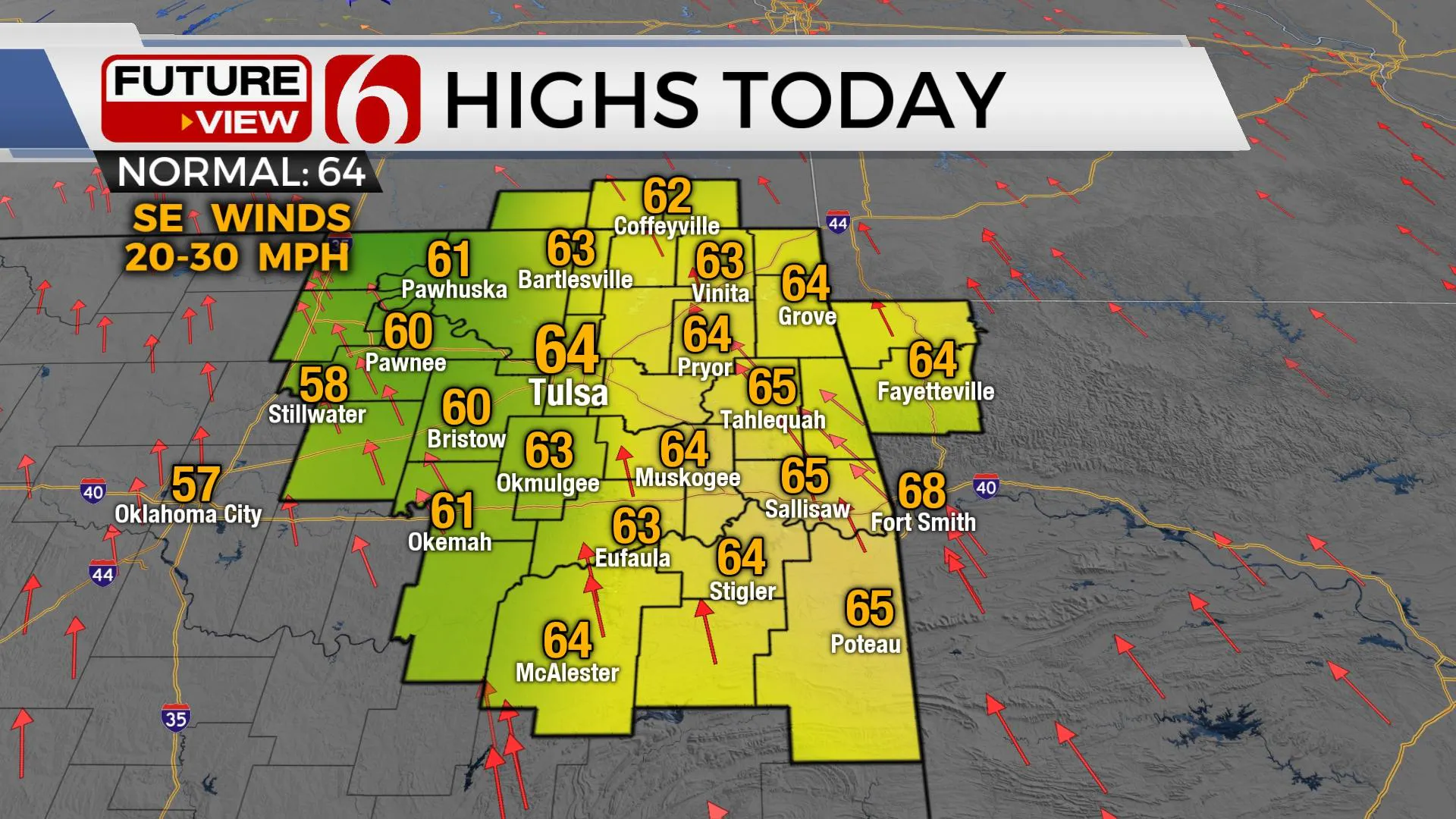
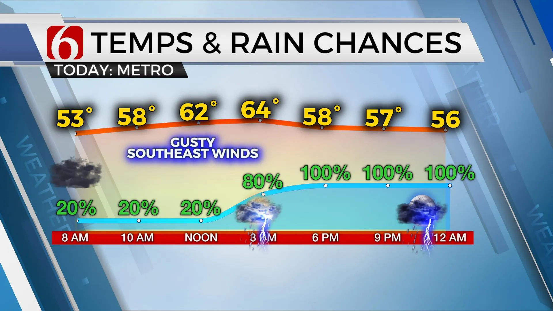
Temps in the 50s this morning will yield highs into the lower 60s, but with increasing clouds and increasing rain chances later today and tonight. Our active weather pattern remains. We’re tracking three systems over the next seven days. The timing of this system has changed a little in the last few runs, but our main impacts should continue to be from early afternoon through the evening and overnight hours as the main upper-level system nears the state. The last 48 hours of southerly flow has mMonday, March 22nd 2021, 7:00 am
TULSA, Okla. -
Temps in the 50s this morning will yield highs into the lower 60s, but with increasing clouds and increasing rain chances later today and tonight. Our active weather pattern remains. We’re tracking three systems over the next seven days.

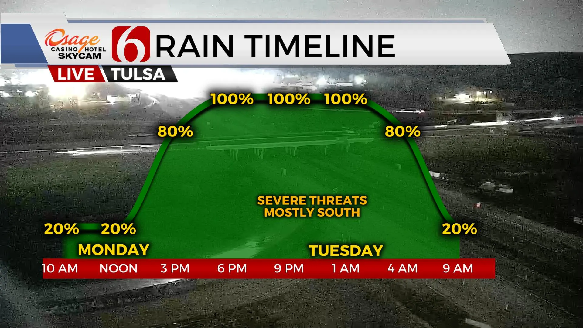
The timing of this system has changed a little in the last few runs, but our main impacts should continue to be from early afternoon through the evening and overnight hours as the main upper-level system nears the state. The last 48 hours of southerly flow has moistened the atmosphere some. The depth and quality of the low-level moisture will support pockets of moderate to heavy rainfall but may also limit the potential for severe weather across the northern sections with more favorable severe weather impacts across southern OK and north TX.

The global runs continue to be rather robust with precipitation output. This could lead to some localized heavy rainfall threats with this system as several rounds of showers and storms migrate across the area. It appears the main surface low-pressure area should move from the southwest into central Kansas Tuesday morning, but a small meso-low could develop on the boundary and enhance some output across southcentral to part of NE OK. This system supports more than adequate wind shear for severe storms. Greater surface instabilities will initially be confined to the west and southwest of our immediate area this afternoon and evening. This pocket of instability could migrate northward overnight, but most data keep severe parameters along or south of the I-40 corridor.

While the majority of this precipitation should be exiting the area overnight, some leftovers will remain across extreme northeastern OK early Tuesday for a few hours before we get a break for most of Wednesday before another fast-moving system approaches with another round of storms Wednesday evening into early Thursday morning. Most of the forcing for this system takes a southern route across Texas. Low-level moisture returns just enough to support the precipitation, but higher dewpoint temps should remain across north TX for this system. Severe weather threats for the Wednesday evening and Thursday morning storm system currently appear very low and mostly across parts of Texas.
A quick wave moves across the state Friday night into part of Saturday, but the return of moisture is also highly questionable. I’ll carry only low pops for this potential. At this point, the weekend remains good with highs in the 60s.
Thanks for reading the Monday morning weather discussion and blog.
Have a super great day!
Alan Crone
KOTV
If you’re into podcasts, check out my daily weather update below. Search for NewsOn6 and ‘Weather Out The Door’ on most podcast providers, including Apple, Stitcher, Tune-In and down below on Spotify.

More Like This
March 22nd, 2021
February 14th, 2022
January 26th, 2022
January 25th, 2022
Top Headlines
December 12th, 2024
December 12th, 2024
December 12th, 2024


