Gusty Northwest Winds, Highs In The 50s
Our storm system will be exiting the area later this morning, but we’ll be dealing with some showers with this system for a while. These will not be severe for our immediate areas of concern. Later today, this very upper-level system will trigger another severe weather event across a large portion of the Southeastern U.S., including the potential for a few strong and long-track tornadoes. Again, this is well east of our immediate areas across part of Mississippi, Alabama, and Tennessee. Most ofThursday, March 25th 2021, 5:16 am
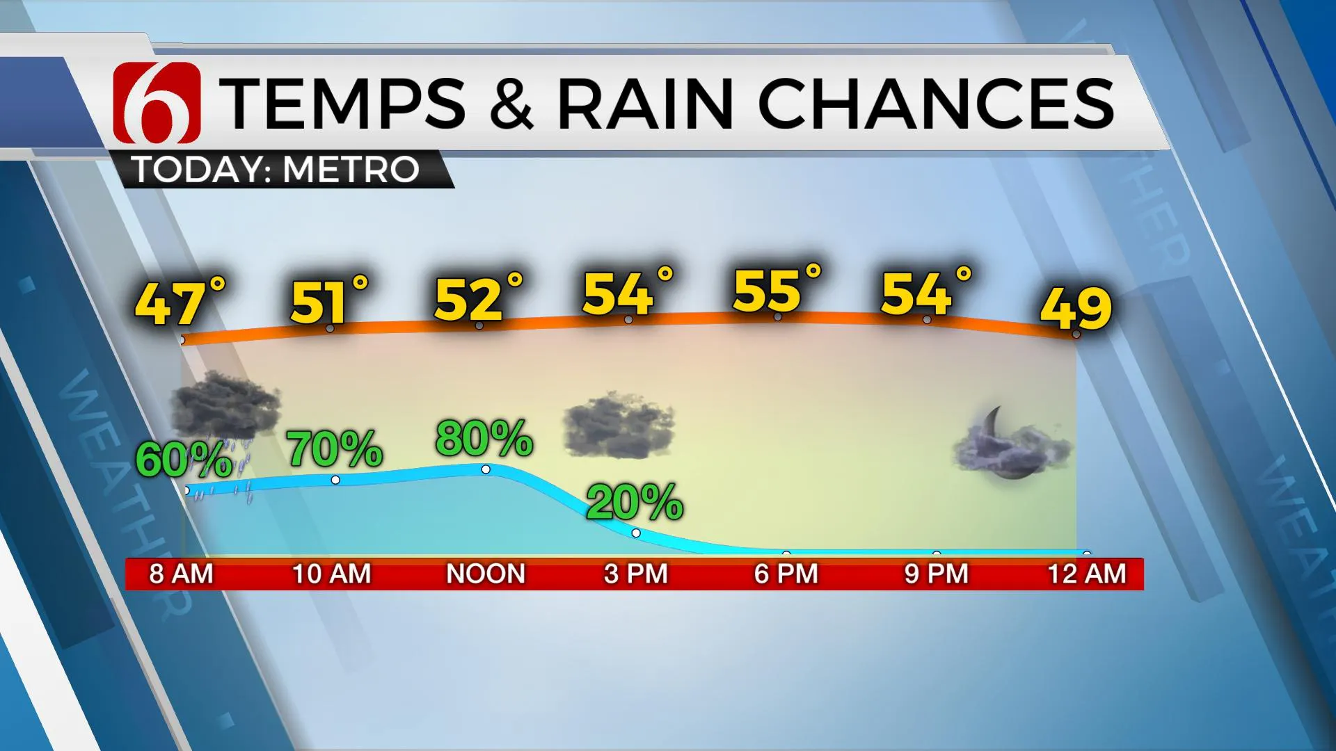
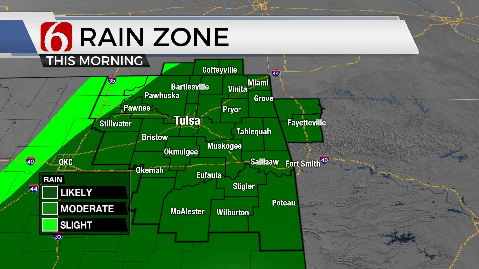
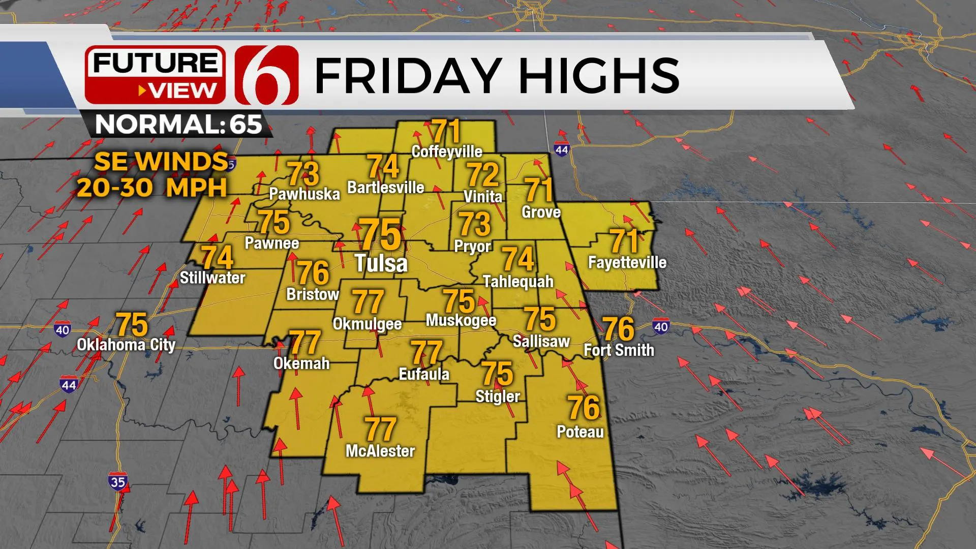
Our storm system will be exiting the area later this morning, but we’ll be dealing with some showers with this system for a while. These will not be severe for our immediate areas of concern. Later today, this very upper-level system will trigger another severe weather event across a large portion of the Southeastern U.S., including the potential for a few strong and long-track tornadoes. Again, this is well east of our immediate areas across part of Mississippi, Alabama, and Tennessee. Most of our weather will be confined to gusty northwest winds, some showers for the first half of the day and highs staying in the 50s. Friday looks good with a return of sunshine and south winds from 20 to 30 mph as highs reach the lower to mid-70s, but another disturbance nears the region with a few showers or storms possible across southeastern Kansas Friday night. Most of the weekend weather remains fine, outside of a low probability for a storm or two across southern OK Saturday evening.

A weak front crosses the area Saturday but highs will still reach the mid-70s along with north winds returning behind the front. This boundary will encounter some low-level moisture Saturday afternoon and evening across southeastern OK and we may see a few isolated storms along this boundary. The chance remains low. But if storms do develop, a few could be strong. Sunday features mostly sunny and pleasant weather with highs in the mid-60s for the northern sections of the state, while a disturbance to our south may trigger an isolated storm near the ArkLaTex before it blossoms into more widespread storms well east of Oklahoma.

Next week remains active. The data has converged on another upper-level system nearing. A longwave trough will advance southward into the state early next week, while the main upper-level closed low should remain well north. While the specifics can’t be ironed out at this point in the forecast process, some threats for a few strong to severe storms will remain as a strong surface front arrives either Tuesday or Wednesday followed by a robust early spring cool-down. Before all of this occurs, strong southerly flow with winds from 20 to 35 mph will be likely early next week with highs reaching the mid-70s Monday and upper 70s Tuesday.
Thanks for reading the Thursday morning weather discussion and blog.
Have a super great day!
Alan Crone
KOTV
If you’re into podcasts, check out my daily weather update below. Search for NewsOn6 and ‘Weather Out The Door’ on most podcast providers, including Apple, Stitcher, Tune-In and down below on Spotify.

More Like This
March 25th, 2021
February 14th, 2022
January 26th, 2022
January 25th, 2022
Top Headlines
December 10th, 2024
December 10th, 2024
December 10th, 2024
December 10th, 2024


