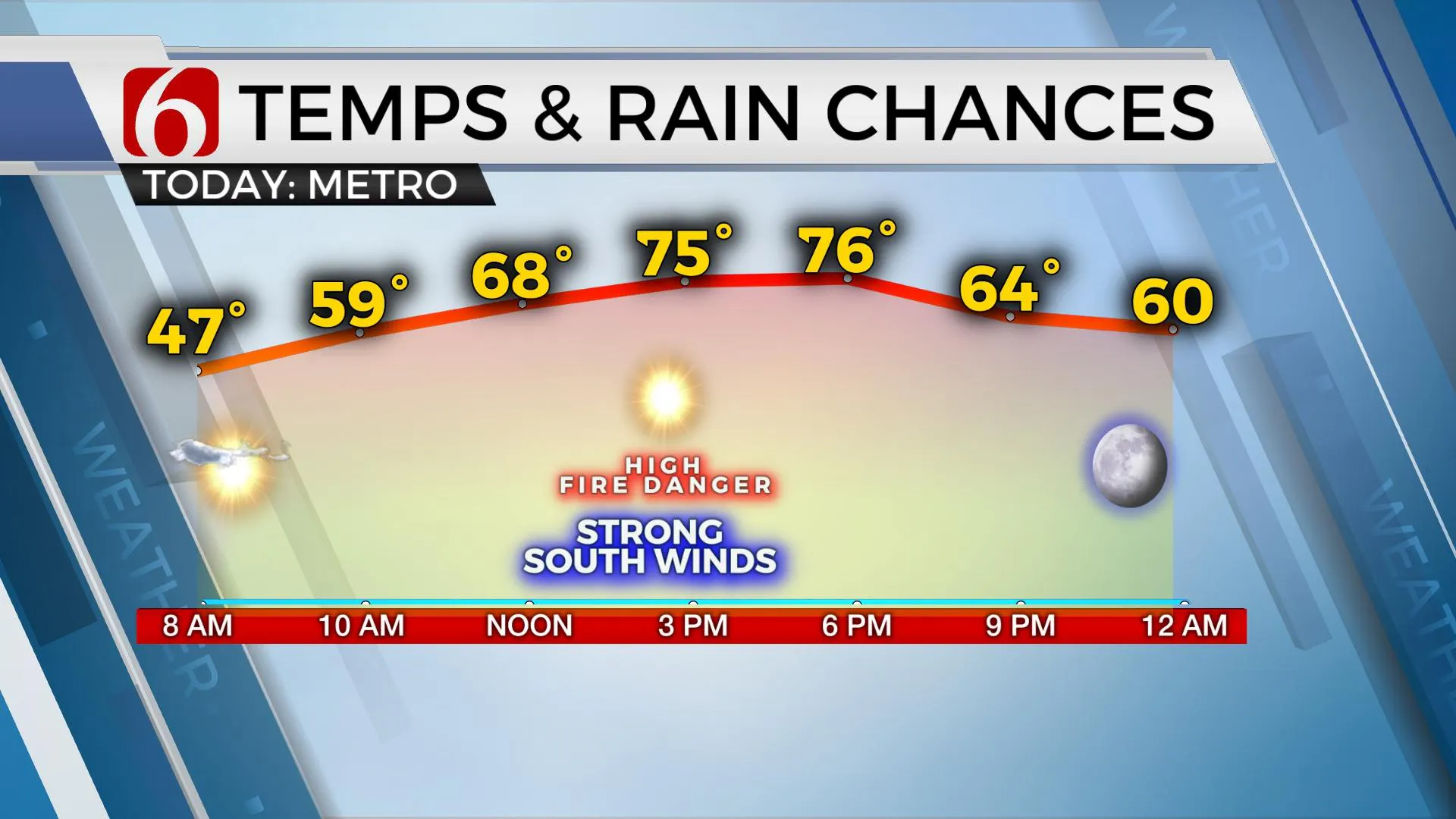
Gusty South Winds, High Fire Danger
Gusty south winds, sunshine and high fire danger will be our main weather concerns today before our next cold front moves across the state Tuesday with very limited shower chances, mostly across southeastern Oklahoma. The main upper airflow is characterized by a strong and fast flow, yet the main upper-level low will remain well north of the region, mostly across the northern High plains into southern CanadaMonday, March 29th 2021, 7:52 am
Gusty south winds, sunshine and high fire danger will be our main weather concerns today before our next cold front moves across the state Tuesday with very limited shower chances, mostly across southeastern Oklahoma.
The main upper airflow is characterized by a strong and fast flow, yet the main upper-level low will remain well north of the region, mostly across the northern High plains into southern Canada. This is highly unusual for late March and should be considered an anomaly and not any major change in the pattern. The longwave trough associated with this low will brush the southern plains Tuesday evening while helping to push a cold front across the state either Tuesday afternoon or late evening. Before this occurs, strong winds are likely today that will contribute to extremely high fire danger spread rates across all Oklahoma and the surrounding region. Red Flag warning criteria should be met across at least northern OK and southern Kansas this afternoon along with wind advisory levels. South winds are likely today from 20 to 40 mph, along with sunshine and highs reaching the mid70s. Tuesday brings a very low mention for a few showers or rumbles of thunder, mostly south of the metro, as a front nears the area along with highs in the 60s and winds changing from the south to north. Wednesday starts in the upper 30s and lower 40s and may stay in the mid to upper 50s for highs along with north winds a chance for a few showers, mostly to the south.

The intrusion of dry air last Saturday afternoon brought us super-great weather Sunday, and this dry air will remain today before moisture attempts a fast comeback Tuesday ahead of our next quick-hitting front. It doesn’t appear we’ll have enough time for a big return of low-level moisture, so the chance for showers and storms will remain mostly low Tuesday into Wednesday, and mostly to the south of the metro as the next system quickly moves across the area. Stronger storms will again be relegated to southeastern OK or northeast TX where dew points in the upper 50s and lower 60s will be collocated. Even in these areas, the moisture will be limited in depth. As the front clears the area Tuesday evening into Wednesday, another notable cool-down will follow, with some locations nearing Freezing Thursday morning.

South winds will return by the end of the week and strengthen next weekend as deeper low-level moisture will eventually return to the state. A weak upper-level disturbance may brush the state Friday, but the chance for any shower activity will remain very low, if not zero for this update. Weekend temps currently appear to start in the 40s for lows and end with highs in the upper 60s Saturday and lower to mid-70s Easter Sunday with increasing south winds from 20 to 30 mph.
Thanks for reading the Monday morning weather discussion and blog.
Have a super great day!
Alan Crone
KOTV
If you’re into podcasts, check out my daily weather update below. Search for NewsOn6 and ‘Weather Out The Door’ on most podcast providers, including Apple, Stitcher, Tune-In and down below on Spotify.

More Like This
March 29th, 2021
February 14th, 2022
January 26th, 2022
January 25th, 2022
Top Headlines
December 12th, 2024
December 12th, 2024
December 12th, 2024


