Strong South Winds Bring Tuesday Morning Storm Chances
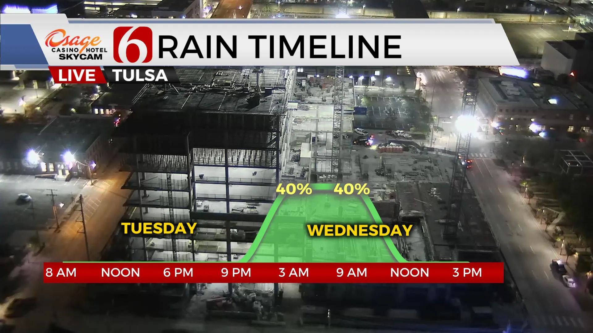
A powerful upper-level trough will move out of the Rockies and into the central plains later tonight and Wednesday morning before exiting into the Midwest by Thursday morning. This system will bring a pacific front across northeastern OK pre-dawn Wednesday along with a chance for a narrow line of storms. The CAP, or layer of warm air aloft may suppress most storm activity ahead of this system later tonight but could allow a window for storm development from approximately 2 a.m. to 9 a.m. WednesdTuesday, April 6th 2021, 4:53 am
TULSA, Okla. -
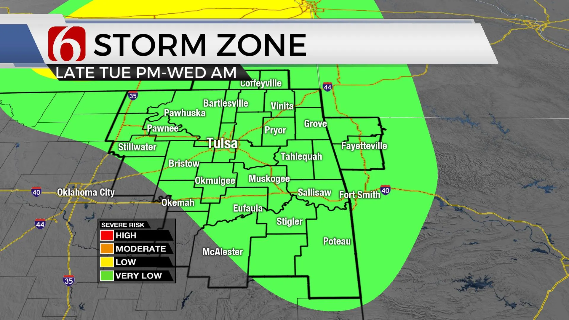
A powerful upper-level trough will move out of the Rockies and into the central plains later tonight and Wednesday morning before exiting into the Midwest by Thursday morning. This system will bring a pacific front across northeastern OK pre-dawn Wednesday along with a chance for a narrow line of storms. The CAP, or layer of warm air aloft may suppress most storm activity ahead of this system later tonight but could allow a window for storm development from approximately 2 a.m. to 9 a.m. Wednesday across eastern OK. The threat for strong to severe storms will remain very low for our immediate areas but will increase into Arkansas by midday to early afternoon. Additional chances for a few storms will arrive Friday night into Saturday morning across the Red River Valley region and then again Sunday evening into Monday morning across the northern third of the state.

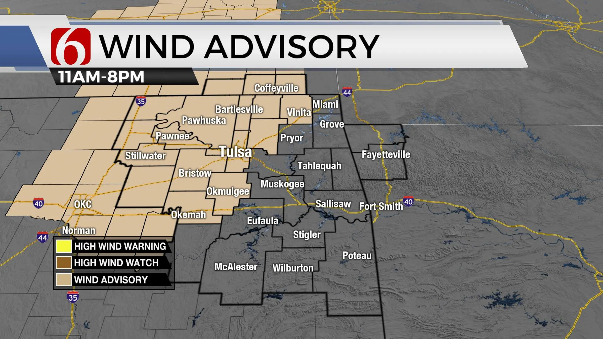
The pressure gradient continues to strengthen this morning and will allow winds gusting from 20 to 40 mph by midday to afternoon. These strong and gusty south winds will also remain later tonight as the main system nears northern Oklahoma. A wind advisory will remain in place for most of the day and possibly into the evening hours. Despite the increased moisture, the fire spread rate remains elevated today.

The increasing low-level moisture and the first wave of energy around the base of the trough may trigger a few showers this morning around the I-35 corridor of north-central OK and south-central Kansas. If so, as these move eastward, they should weaken and fall apart. Gusty to strong southerly flow will bring decent moisture from the Gulf into the state today helping to increase convective and potential energy by late afternoon and evening. But the layer of warm air should suppress storm development for most of the evening, and possibly through part of pre-dawn Wednesday. The latest high-res data continues supporting only limited chances for any strong to severe storms for our immediate areas, but in this pattern, we’ll need to keep mentions in the forecast. The primary threats would be hail and wind gusts. If for some reason storm activity did develop this evening well ahead of the front, severe threats would be much higher.
As the system exits our area Wednesday morning, gusty west to northwest wind quickly returns with dry air invading western OK by midday and eastern OK by early afternoon. The fire spread rates will also increase Wednesday afternoon.

Thursday appears to be the best weather day of the week with morning lows in the 40s and highs reaching the mid-70s. We are planning on mostly sunny sky and winds from the north around 10 to 20 mph. Unfortunately, the dry air and westerly component to the wind keeps the fire spread rates high.
Thursday evening into Friday the inconsistencies in the data will lead to a low confidence forecast for this period. A quick, ballpark summary supports mild temps with morning lows in the upper 40s and lower 50s along with daytime highs mostly in the mid-70s. A few storm chances will remain for late Friday night and Saturday south of the metro with a slightly better chance Sunday night into Monday. If this holds, most of our weekend will be in great shape.

Thanks for reading the Tuesday morning weather discussion and blog.
Have a super great day!
Alan Crone
KOTV
If you’re into podcasts, check out my daily weather update below. Search for NewsOn6 and ‘Weather Out The Door’ on most podcast providers, including Apple, Stitcher, Tune-In and down below on Spotify.

More Like This
April 6th, 2021
February 14th, 2022
January 26th, 2022
January 25th, 2022
Top Headlines
December 13th, 2024
December 13th, 2024
December 13th, 2024
December 13th, 2024


