Afternoon Highs In The Upper 50s, Evening Showers Move In
A few sprinkles or spotty showers will quickly end early this morning but keep the rain gear handy. Later this afternoon and evening the first wave of energy rounding the base of our main upper level low to our west will bring more showers into the area. This activity will begin around the evening commute and continue through this evening. The main trough to our west will begin moving east and bring additional showers and storms into the area by pre-dawn Friday continuing through the day beforeThursday, April 15th 2021, 5:36 am
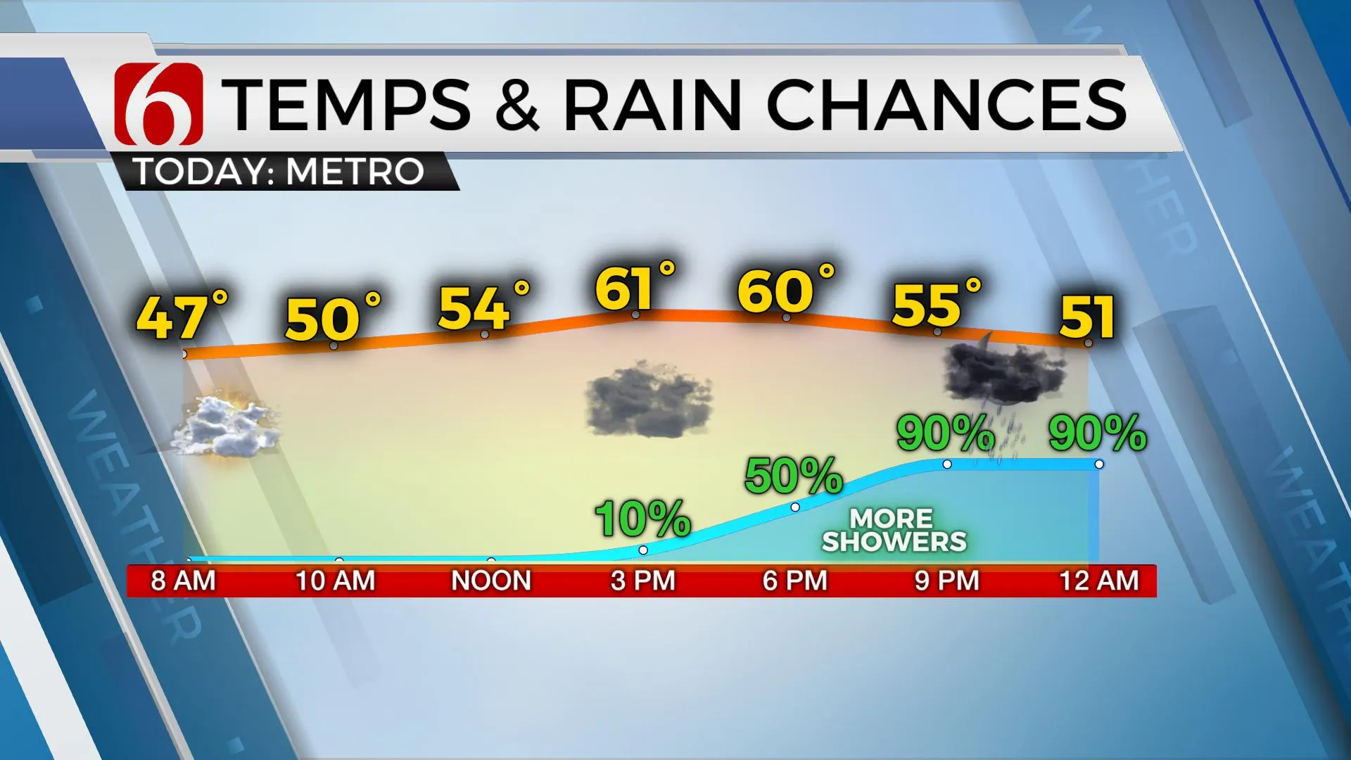
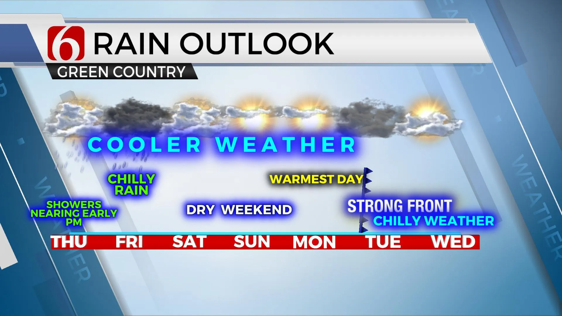
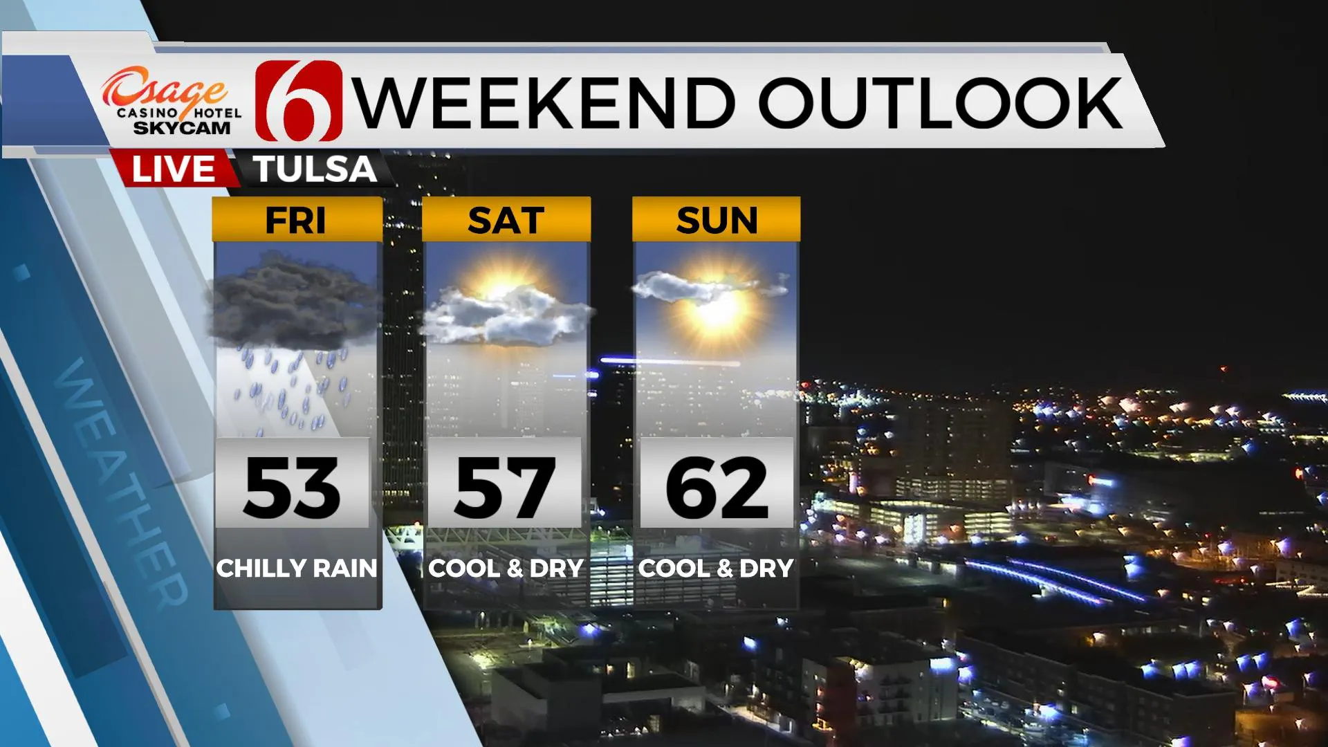
A few sprinkles or spotty showers will quickly end early this morning but keep the rain gear handy. Later this afternoon and evening the first wave of energy rounding the base of our main upper level low to our west will bring more showers into the area. This activity will begin around the evening commute and continue through this evening. The main trough to our west will begin moving east and bring additional showers and storms into the area by pre-dawn Friday continuing through the day before exiting late Friday evening. Highs this afternoon should reach the upper 50s and lower 60s but the onset of rain and clouds Friday will keep us into the lower 50s. Winds remain from the northeast today around 10 to 15 mph but will change direction a few times tomorrow from the southeast to east and eventually northeast by Friday evening as the system pivots away from the state. There may be a few leftover sprinkles or small showers Saturday morning across far northeastern OK, but we’ll be dry for the weekend. Chilly weather remains Saturday with lows starting in the lower 40s and afternoon highs staying in the upper 50s along with partly cloudy sky and north winds from 10 to 20 mph. Sunday morning will stay in the upper 30s with mostly sunny skies and highs reaching the lower 60s. The warmest day of this period occurs Monday after starting that morning in the upper 30s. Southwest winds return Monday afternoon along with more sunshine with highs into the lower 70s. But another strong cold front should arrive either late Monday night or early Tuesday morning.

Some data brings temps crashing down into the 40s for Tuesday afternoon. This would set up the potential for near-freezing temps Wednesday morning. We’re not quite ready to buy into these colder solutions this early in the process, but I have lowered temps several degrees with Tuesday highs in the mid-50s and Wednesday morning lows in the upper 30s. The pattern finally shows signs of bringing near-normal weather back into the plains by late next weekend into the following week. This will eventually bring warmer weather and more active, strong to severe storm chances into the southern plains.

Showers and storms moving into the area later tonight should not be strong or severe across northern OK, but some locations across southwestern sections of the state and the Red River Valley could experience a few stronger updrafts supportive of some marginally severe hail. Early Friday morning, strong winds aloft around the base of the trough will move across northwestern OK and additional storms will develop into central and northeastern OK pre-dawn. A few of these cells may also produce very small, pea-sized hail for a few hours along with locally heavy downpours. This activity should remain well below severe levels. Periodic showers and some thunder should persist through Friday, especially through morning and midday, before slowing thinning out some by late afternoon and early evening. Keep the jacket and the rain gear handy.

Thanks for reading the Thursday morning weather discussion and blog.
Have a super great day!
Alan Crone
KOTV
If you’re into podcasts, check out my daily weather update below. Search for NewsOn6 and ‘Weather Out The Door’ on most podcast providers, including Apple, Stitcher, Tune-In and down below on Spotify.

More Like This
April 15th, 2021
February 14th, 2022
January 26th, 2022
January 25th, 2022
Top Headlines
April 24th, 2024
April 24th, 2024


