Chilly, Raw Day Ahead, Scattered Shower Likely Across Most Of Eastern Oklahoma
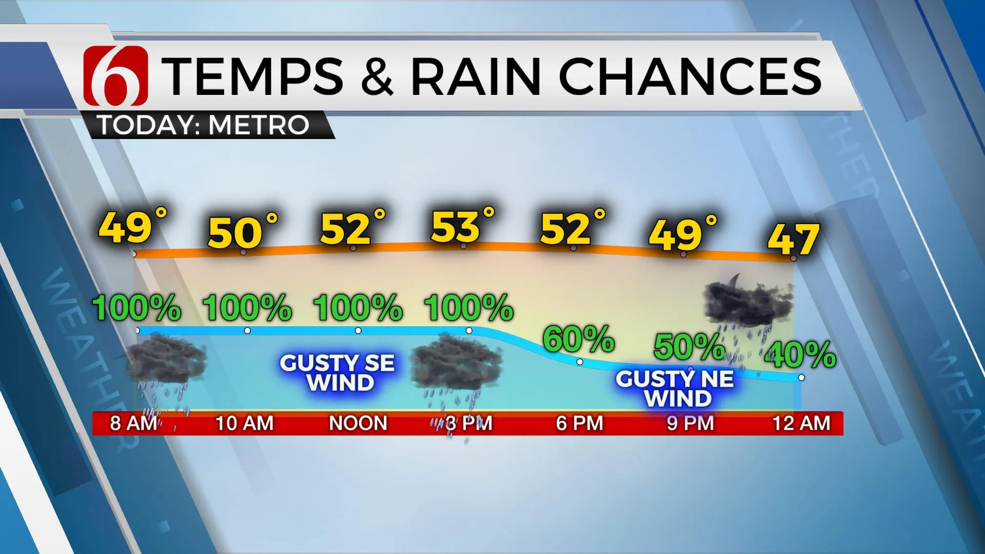
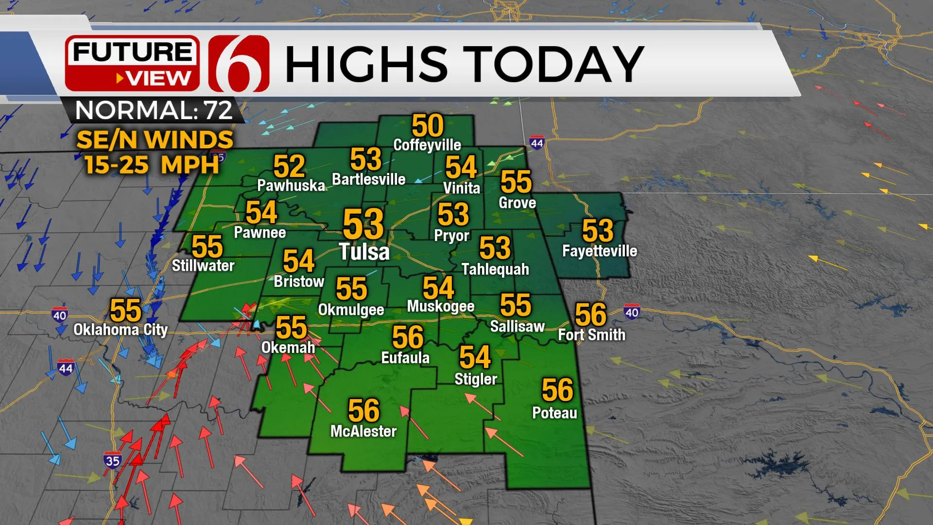
A chilly, raw day is ahead with scattered showers likely across most of Eastern OK, including the Tulsa metro. Along with overcast conditions, this will keep highs almost 20 degrees below seasonal averages today with many locations in the lower 50s. Winds will change direction from the southeast to north later today, gusty at times and will be more noticeable later tonight through Saturday as the main storm system finally exits the region. The weekend will offer some improvement, but chilly weatFriday, April 16th 2021, 5:17 am
TULSA, Okla. -
A chilly, raw day is ahead with scattered showers likely across most of Eastern OK, including the Tulsa metro. Along with overcast conditions, this will keep highs almost 20 degrees below seasonal averages today with many locations in the lower 50s. Winds will change direction from the southeast to north later today, gusty at times and will be more noticeable later tonight through Saturday as the main storm system finally exits the region. The weekend will offer some improvement, but chilly weather is likely to remain. We may have some locations dropping into the upper 30s Sunday and Monday morning for a few hours. The warmer day of the next 7 occurs Monday with highs reaching the lower 70s. But another strong cold front rolls across the state Monday night or early Tuesday morning bring another unseasonably cold stretch of weather into the state. Some data keep us mostly in the 40s and 50s for Tuesday afternoon with the potential of mid-30s Wednesday morning. This front may also bring some post-frontal precipitation across part of the region. This unusual weather pattern for April will finally begin later next weekend with springlike conditions returning by the last full week in the month.

No severe storm activity is expected this morning but a few cells with stronger updrafts may produce some pea-sized hail, mostly across extreme southeastern OK or north TX. Instability is very low across most of northern OK and very little lightning or thunder will be expected north of I-40. Even though we have high probabilities in the forecast for the day, there will occasionally be some dry spots before the eventual end of showers from the west to east early this evening. The main upper-level system will remain across southern Missouri Saturday morning and a few showers or sprinkles may persist for a short period Saturday, but the chances remain too low to place any significant probability on the 7-day planner at this point. I’ll keep a 10% chance. A stout-looking upper-level disturbance drops down the central plains Saturday evening but should mostly influence the Missouri Valley Sunday morning with a few clouds or sprinkles. This is something that could throw us a knuckleball if it drops more southwest than anticipated.

Another major upper-level trough develops across southern Canada this weekend and moves southward into the northern high plains Monday before pivoting eastward into the upper Midwest Tuesday. At the surface, a strong cold front will develop and move southward, across the central and southern plains either Monday late or early Tuesday. You’ll hear and see a lot about this system over the next day or two. Yes, it has some very cold air, including the potential for some frost or freeze issues for the morning hours Wednesday depending upon the speed of the system. We’ll discuss more about the precipitation potential in our next update.
Thanks for reading the Friday morning weather discussion and blog.
Have a super great day.
Alan Crone
KOTV
If you’re into podcasts, check out my daily weather update below. Search for NewsOn6 and ‘Weather Out The Door’ on most podcast providers, including Apple, Stitcher, Tune-In and down below on Spotify.

More Like This
February 14th, 2022
January 26th, 2022
January 25th, 2022
Top Headlines
December 10th, 2024
December 10th, 2024
December 10th, 2024
December 10th, 2024


