

Severe Weather Threats, Heavy Rainfall Move In Tuesday Evening
It will be a warm and windy Tuesday before severe weather chances move in.Tuesday, April 27th 2021, 5:33 pm


TULSA, Oklahoma -
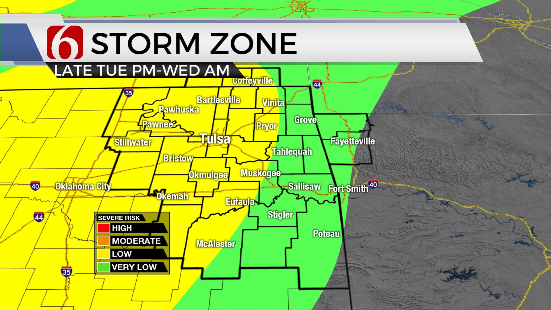
A strong upper-level storm system, currently to our west, will bring thunderstorm chances into the state later this afternoon and evening. Higher likelihoods will remain along and slightly ahead of the dry line across far western OK, but a few storms may also develop across I-35 near the Arbuckles and move northeast into our immediate area of concern later this evening. Any mature storms could be severe, but the likelihood for severe weather remains mostly west for the early evening hours.

Pre-dawn Wednesday, a line of thunderstorms will near I-35 and enter part of northeastern OK and may bring some strong to severe activity into the area early Wednesday. As this activity moves northeast, additional storms will attempt to develop across central and eastern OK as the main upper-level low draws closer to the area. Additional strong to severe thunderstorms may also develop near and south of the I-40 corridor Wednesday afternoon and evening as the surface cold front enters northern OK and moves southeast. Moisture, lift and shear will be maximized across far southern OK and north TX Wednesday evening where severe storms capable of all modes of severe weather will remain. The front finally exits the area early Thursday morning taking the precipitation out of the state. Moisture content is expected to remain high during this forecast cycle, and heavy rainfall threats, including flash flooding and stream-river flooding will be possible.

Temps today will still reach the upper 70s and lower 80s along with increasing clouds and another gusty south wind from 20 to 30 mph. The top-end wind speed may not be as strong as yesterday and wind advisories are not expected in our immediate region.

A few spotty showers or even storms may develop this afternoon in the warm sector, basically anywhere across central to eastern OK, but the chances will remain very low. A few scattered storms will attempt to fire up near I-35 late this afternoon and could move northeast nearing part of northeastern OK this evening. Not all data support this activity, but I have included this probability for the metro around the 8 p.m. to 10 p.m. period. Higher chances will arrive later evening ahead of the dry line well west of our area as strong forcing aloft moves across that region of the state. This activity is expected to move northeast and should coalesce into at least one, possibly two-line segments or even a small MSC while advancing east-northeast into or near the metro early Wednesday morning. The main threats would be hail and wind, but the shear will be increasing during this period. We will be watching closely Wednesday morning for any severe threats.
The severe threat Wednesday afternoon and evening mostly depends on exactly what happens Wednesday morning. For now, we think the better chance for severe storms Wednesday afternoon should remain mostly south of the metro, but the surface front will be approaching from the northwest Wednesday evening and may still have a shot at a few severe storms during this period nearing the metro.
After some leftover showers and storms early Thursday across southeastern OK, slowly decreasing clouds and highs reaching the 70s will be likely and pleasant weather should extend into Friday also.
Temps this weekend will move back near 80 Saturday and into the lower 80s Sunday.
The next upper-level wave will near the area early next week with rain and thunder chances nearing for some locations.

Thanks for reading the Tuesday morning weather discussion and blog.
Have a super great day!
Alan Crone
KOTV
If you’re into podcasts, check out my daily weather update below. Search for NewsOn6 and ‘Weather Out The Door’ on most podcast providers, including Apple, Stitcher, Tune-In and down below on Spotify.

Get The Daily Update!
Be among the first to get breaking news, weather, and general news updates from News on 6 delivered right to your inbox!
More Like This
April 27th, 2021

June 21st, 2023

June 19th, 2023

June 13th, 2023
Top Headlines

December 14th, 2024

December 14th, 2024

December 14th, 2024
