Mostly Sunny Skies, Mild Temperatures, Storm Chances Return Early Next Week
Alan Crone says great weather is expected on Friday and updates when storm chances could returnFriday, April 30th 2021, 8:04 am
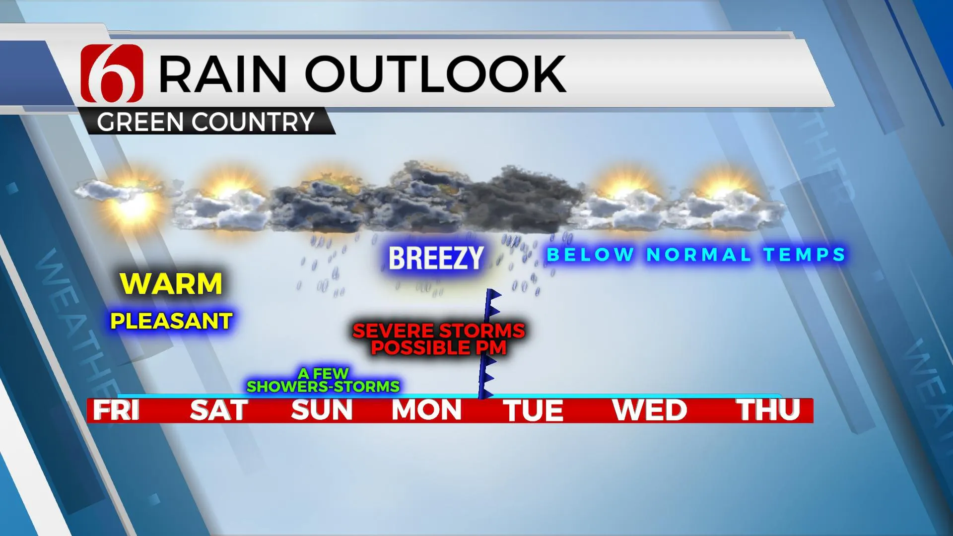
Our weather looks great today with mostly sunny sky, light winds and mild temperatures. A few areas of patchy fog will be possible for the early morning hours, but this should become widespread nor significant. A shower or two will remain possible across extreme southwestern OK this morning but should be well removed from northeastern OK. We’ll be tracking two systems over the next five days, including the chance for strong to severe storms Monday evening.

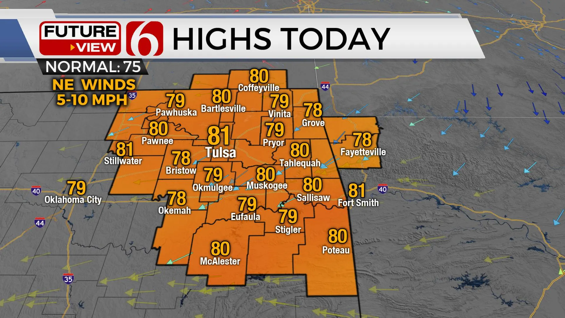
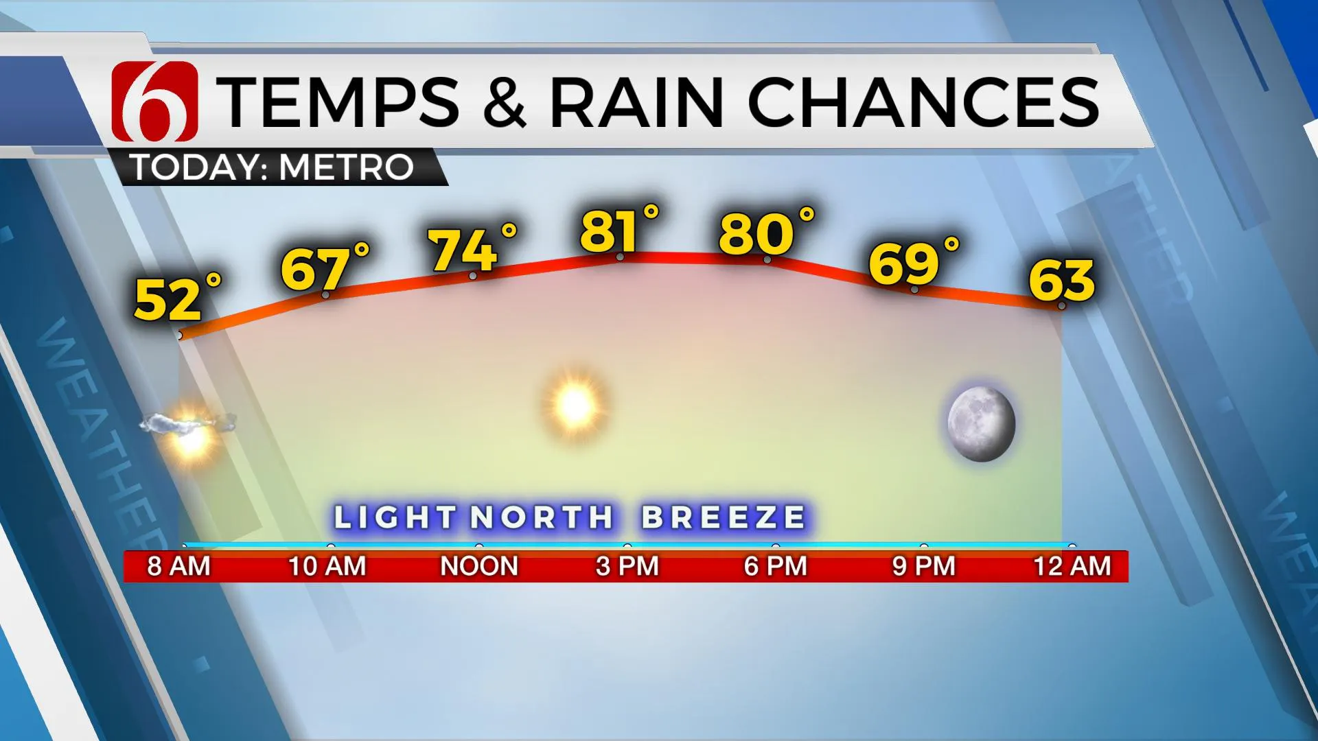
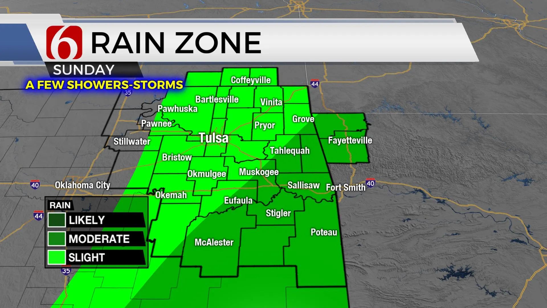
The main upper low that brought our active weather the past few days has taken a scenic jog to the south this morning and will remain too far away from most of our area for any impacts. We’ll expect sunshine, light north winds and highs reaching the upper 70s and lower 80s. South winds return late tonight and will increase speeds Saturday around 10 to 22 mph with highs reaching the mid to upper 70s. The upper system will begin moving northeast again Saturday afternoon and bring a few showers across southern OK late Saturday evening. By Sunday morning through the day, a few showers or storms will brush southeastern and east-central OK as this upper trough begins exiting to the east. We’ll have a chance for a few showers or rumbles of thunder in the metro, but higher chances will remain slightly east. Sunday afternoon temps will stay in the mid to upper 70s with south winds from 15 to 25 mph. A much stronger upper-level system will arrive from the west Monday bringing another chance for storms, including severe weather threats to part of Eastern Oklahoma.

Low-level moisture begins a quick journey northward Saturday evening into Sunday as local dew points move back into the upper 50s and lower 60s through this period. Monday a surface low should develop around the Red River with southeast winds returning from northeast Texas into southeastern OK where dew points in the lower 70s will be possible by Monday afternoon and evening. More northward, the positioning of the surface low may keep far northern OK, with an easterly or northeasterly wind for the late afternoon hours as a warm front attempts to nudge northward through the afternoon and early evening hours. As the main upper level low and colder air aloft arrives from the west, thunderstorms would attempt to develop in the warm sector and could become strong to severe. There remain a few questions regarding how far north the true warm sector can expand, but for this update, we’ll mention the potential for severe storms for most of Eastern OK Monday late afternoon into the evening hours.

Tuesday morning the trough is moving east, and a strong cold front enters northern OK with below normal temps for the middle of the week. Tuesday morning lows will be in the 50s and highs in the mid-60s. Wednesday morning starts in the upper 40s with highs nearing 70 Wednesday afternoons.

Thanks for reading the Friday morning weather discussion and blog.
Have a super great weekend!
Alan Crone
KOTV
If you’re into podcasts, check out my daily weather update below. Search for NewsOn6 and ‘Weather Out The Door’ on most podcast providers, including Apple, Stitcher, Tune-In and down below on Spotify.

More Like This
February 14th, 2022
January 26th, 2022
January 25th, 2022
Top Headlines
December 11th, 2024
December 10th, 2024
December 10th, 2024
December 10th, 2024


