Warm Humid Tuesday, Scattered Showers & Storms Arrive In The Afternoon
A warm and humid day is ahead, scattered showers and storm move in toward the afternoon.Tuesday, May 18th 2021, 7:17 am
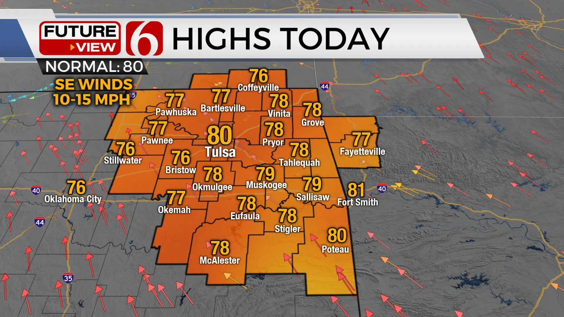
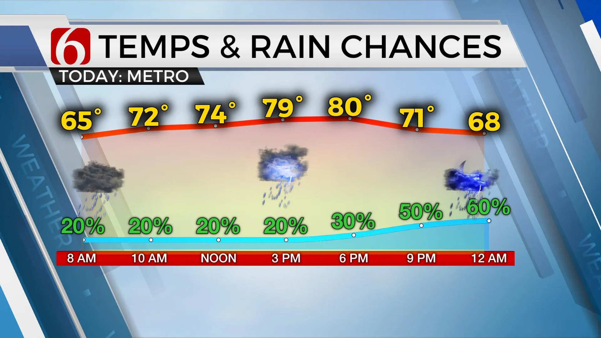
Another humid and warm day is likely with highs nearing 80. A few showers or storms will be possible for the next few hours, but many locations will remain dry until later this afternoon and tonight when higher probabilities arrive.

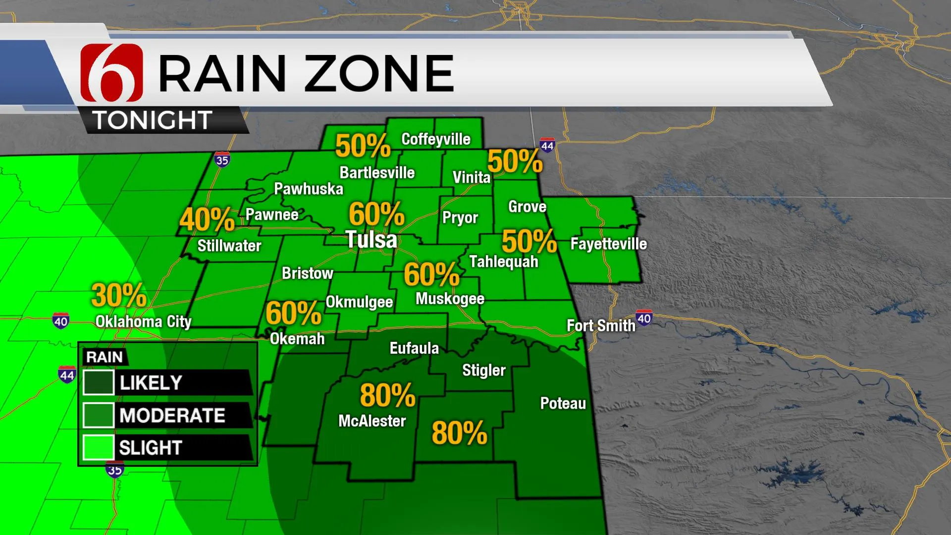
The complex of storms across the western part of the state continues to weaken as it moves eastward and is not expected to move into eastern Oklahoma this morning. The real atmosphere is not following model depictions from yesterday morning. We will be making some adjustments to the forecast for the morning hours, but based on observational data, and attempting to discern the latest offerings in the model suites, we’ll need to keep rather high probabilities for showers and storms late today, and once again late tonight into early Wednesday morning. A few of the storms, if they do indeed develop, could be strong, but the main threat would be locally heavy rainfall.
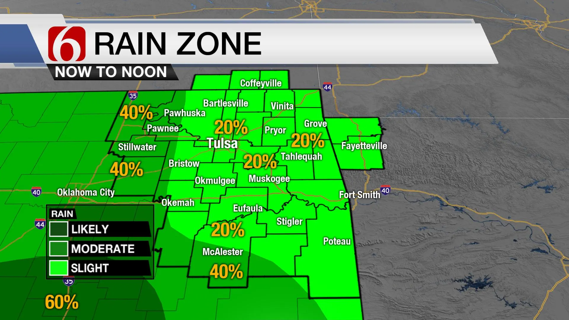
Early this morning through the first half of the day, a few showers and storms will attempt to develop across part of northern OK, but this chance will remain low. By midday to noon, additional, scattered showers or storms will also try to fire up near and north of the highway 412 corridor. These will be highly scattered.

Storms currently along the Red River Valley, mostly west of I-34, should continue to weaken some this morning, but additional storms are likely to develop later this afternoon or early evening along any residual outflow boundaries as the main upper-level trough to our west begins moving closer to the state. Most of these storms will be focused along and south of the I-40 corridor. But this system is expected to lift northeast later tonight into Wednesday while weakening but will continue to bring periodic thunderstorms into the region. A few of these storm chances will include strong to severe mentions for the southern sections of the state. The possibility for locally heavy rainfall, however, will remain for the next few days before some minor changes in the pattern begin focusing most of the activity to our west Friday through the weekend.

Flood watches currently remain from Stillwater southward to the Red River and east into far southeastern OK through Thursday morning. As of this morning, northeastern OK counties are not included in any flood watches.
The upper air pattern should change slightly later this week into the weekend as a fast Omega block establishes slightly east. This will not take the storm chances totally out of the forecast, but this change will lower our chances in the metro compared to current probabilities.
A mid-level ridge of high pressure will become centered across Arkansas eastward into Mississippi and Alabama while slowly expanding west. The next upper-level trough will be developing again across the southern California area into the southwestern U.S. The net impact will take most of the deeper moisture, currently across central and eastern OK, and shove it slightly more west. We’ll still have some rain and storm chances Thursday, but I have lowered chances Friday into the weekend based on this minor pattern change of mostly a meridional flow located on the western fringe of the Omega Block. This pattern is expected to revert to a southwest flow early next week with additional storm chances returning to northeastern OK by the middle of next week.

Temps for the next few days will not change much with morning lows in the mid-60s and afternoon highs reaching the upper 70s to near 80. Slightly humid weather will remain likely for May standards and will become more noticeable this weekend into early next week.
Thanks for reading the Tuesday morning weather discussion and blog.
Have a super great day!
Alan Crone
KOTV
If you’re into podcasts, check out my daily weather update below. Search for NewsOn6 and ‘Weather Out The Door’ on most podcast providers, including Apple, Stitcher, Tune-In and below on Spotify.

More Like This
June 21st, 2023
June 19th, 2023
June 13th, 2023
Top Headlines
December 12th, 2024
December 12th, 2024
December 12th, 2024
December 12th, 2024


