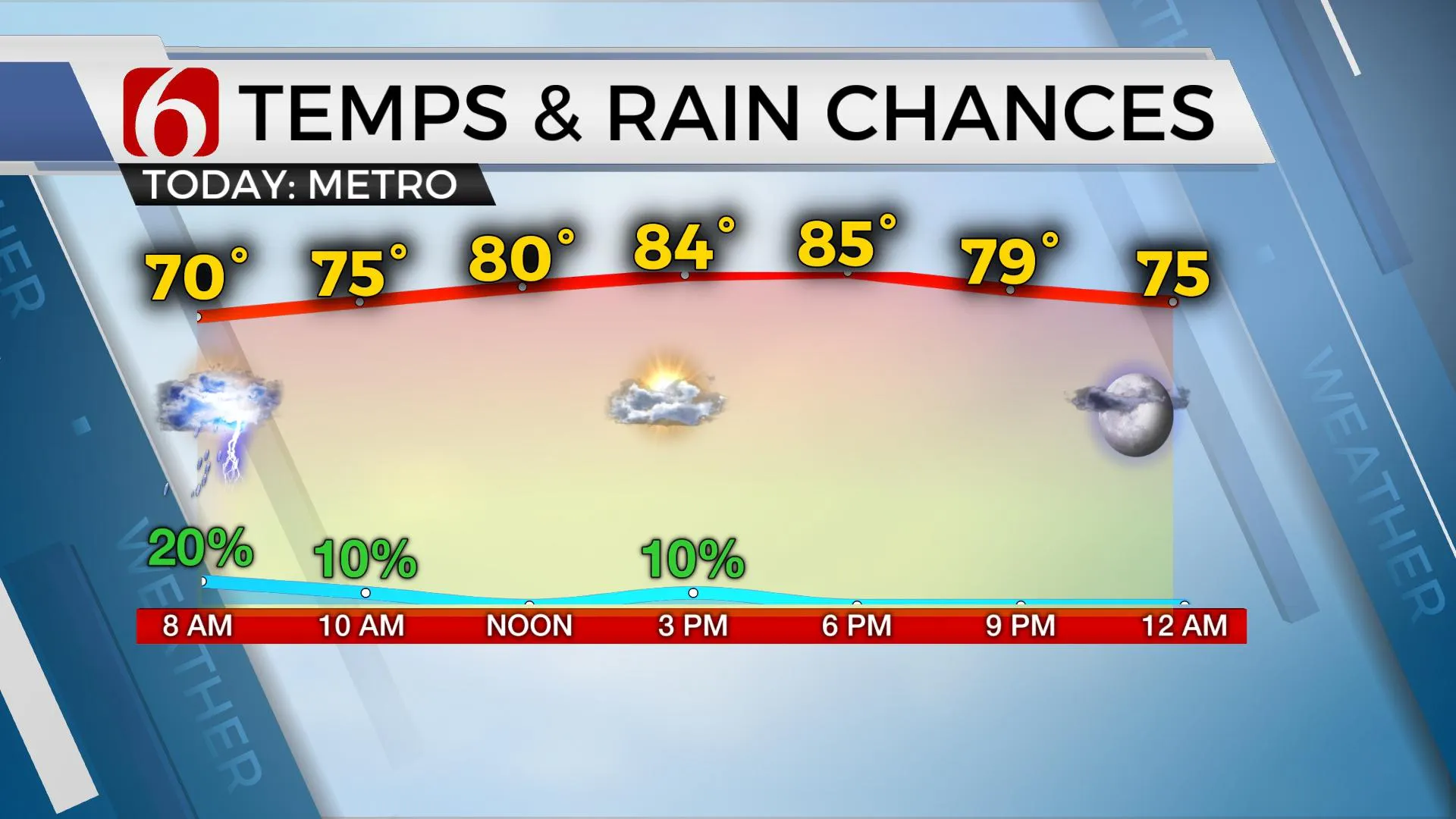
Storms, Showers Possible Tuesday, Temperatures Begin To Climb
Storms chances remain for parts of northeast Oklahoma, temperatures climb into the lower 90s by the end of the week.Tuesday, June 8th 2021, 9:05 am
After heavy and significant rainfall yesterday near and south of the metro, a few storms will remain possible over the next 36 hours, but the pattern will begin to limit storm chances as temperatures climb into the lower 90s by the end of the week. The tropical moisture will support heat index values nearing or even above 100 Thursday and Friday.

The mid-level trough is currently slightly northeast of the region with a trough axis trailing southwest. While this feature is slowly weakening and exiting our immediate area, a few additional showers and storms will attempt to fire up this morning across the Red River Valley and later this afternoon mostly in this same area. Our probability in the metro region remains around 20% this morning and into the afternoon. Tropical-like moisture will remain and even reinforce with additional moisture as 70-degree dew points arrive over Eastern OK early tomorrow morning. As this occurs, some additional lift in the atmosphere will be nearing and a few storms will be possible pre-dawn Wednesday near Tulsa. There will also be at least a slight mention for a few afternoon storms Wednesday near and northeast of the developing ridge. This midlevel ridge of high pressure will expand across western OK and nudge into the eastern third of the state bringing the first real taste of summerlike weather with highs nearing 90 and heat index values nearing 100 to 104 Thursday and Friday. The ridge is expected to retro some to the southwest this weekend as a weak surface front attempts to move southward into the state Saturday afternoon and evening. Despite the proximity of the ridge, the front will have a chance to trigger a few scattered storms this weekend, mostly Saturday as the initial boundary tries to move southward. Most data support this front passing the metro before stalling to our south Sunday before becoming diffuse or lifting northward Monday as the ridge remains west, and a northwest flow pattern attempts to develop.

Thanks for reading the Tuesday morning weather discussion and blog.
Have a super great day!
Alan Crone
KOTV
If you’re into podcasts, check out my daily weather update below. Search for NewsOn6 and ‘Weather Out The Door’ on most podcast providers, including Apple, Stitcher, Tune-In and down below on Spotify.
More Like This
February 14th, 2022
January 26th, 2022
January 25th, 2022
Top Headlines
December 11th, 2024
December 11th, 2024
December 10th, 2024


