Unseasonably Warm, Humid Weather Sticks Around
Wednesday morning lows in the lower 70s and afternoon highs in the upper 80s to lower 90s.Wednesday, June 9th 2021, 5:54 am
TULSA, Oklahoma -
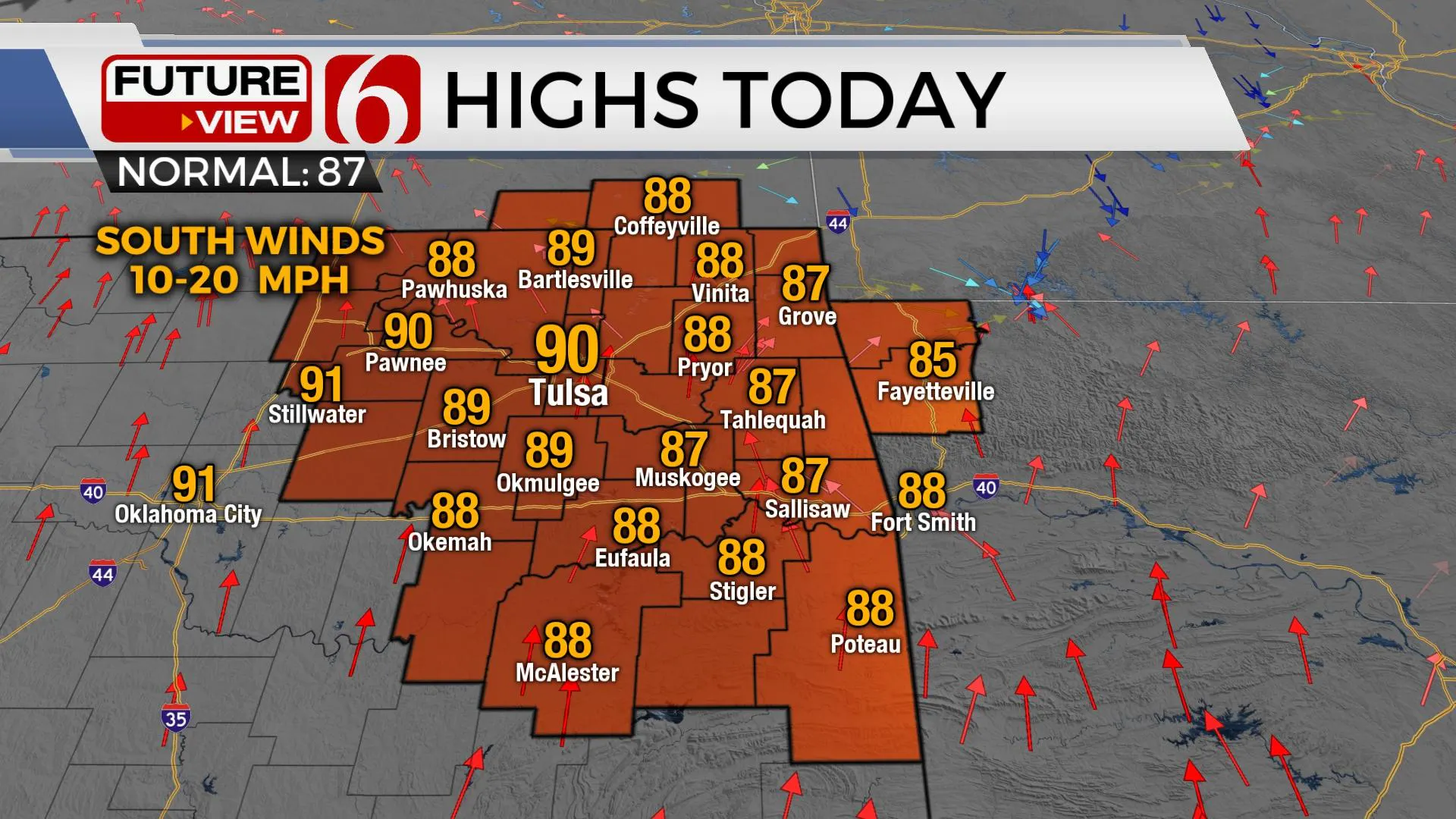
The next few days will be characterized by unseasonably warm and humid weather, including morning lows in the lower 70s and afternoon highs in the upper 80s to lower 90s. But the combination of a tropical air mass with dew points in the lower-70s will create heat index values near or above 100, especially noticeable Thursday and Friday when some locations may be included in heat advisories. A weak front arrives Saturday with no major cool-down or airmass change. The pattern will change some early next week and may allow for some additional showers and storms and a minor reduction in temperature.

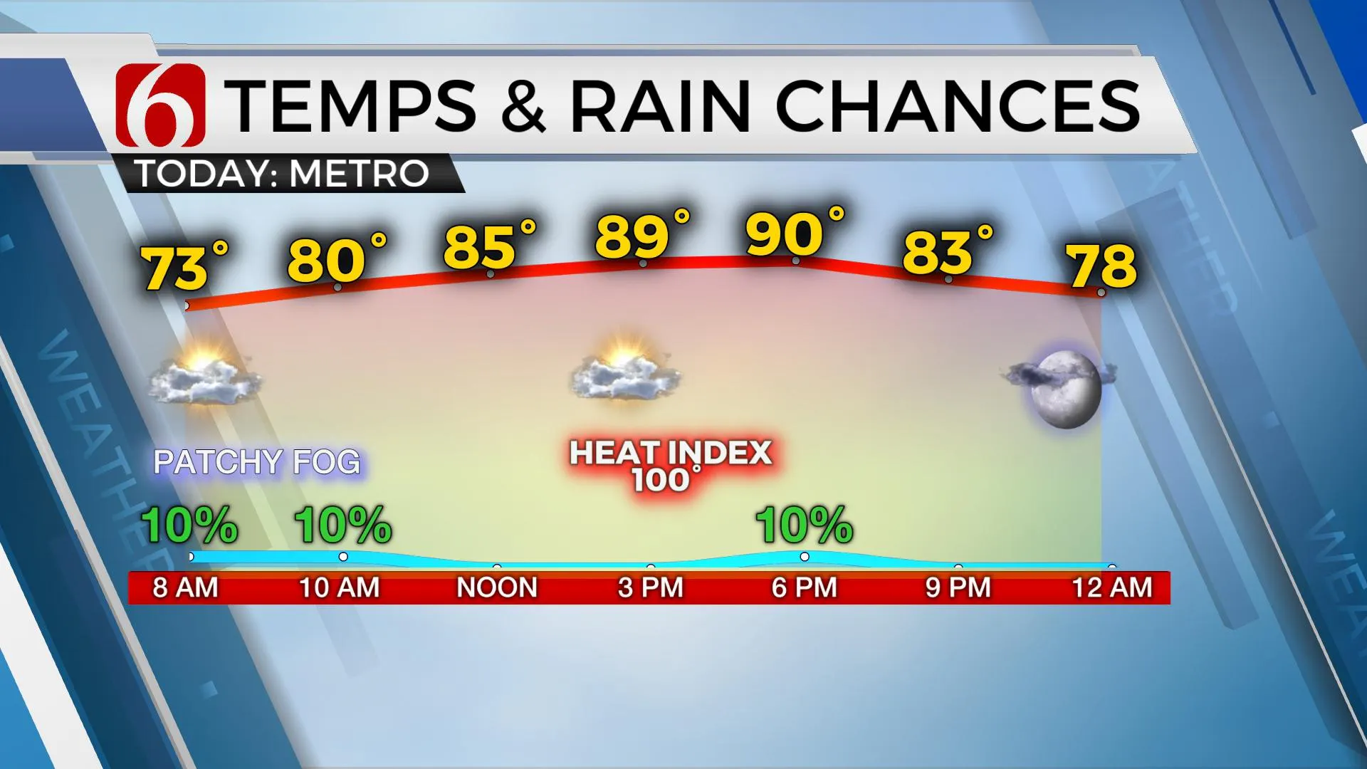
A few storms will remain possible during the next few days despite a mid-level ridge attempting to expand from western OK eastward. Highs this afternoon will reach the upper 80s and lower 90s, yet we’ll need to keep a mention for a few isolated showers or storms nearby, including a slight chance this morning and additional chances later this afternoon and early evening. Most locations will remain dry, but any isolated storm would produce locally heavy downpours.

Local dewpoints are already into the lower 70s this morning. Some hi-res data suggest that additional moisture will move northward later this afternoon and would become enforced by some evapotranspiration from recent rainfall to create dew points in the mid-70s. If this occurs, heat index values today will range over 100 to near 104 in a few spots. These same conditions are expected Thursday and Friday with a small increase in afternoon highs. This would place some locations nearing heat advisory criteria.

Most data support the ridge expanding far enough east to limit storm chances to the extreme eastern sections of the state Friday, but there will remain enough wiggle room in the data for a few systems to brush the region on the periphery of the ridge. Early next week, the ridge weakens some and becomes less prominent allowing a storm system to near the state.
Thanks for reading the Wednesday morning weather discussion and blog.
Have a super great day!
Alan Crone
KOTV
If you’re into podcasts, check out my daily weather update below. Search for NewsOn6 and ‘Weather Out The Door’ on most podcast providers, including Apple, Stitcher, Tune-In and down below on Spotify.

More Like This
June 9th, 2021
February 14th, 2022
January 26th, 2022
January 25th, 2022
Top Headlines
December 13th, 2024
December 13th, 2024
December 13th, 2024
December 13th, 2024


