Heat Advisories Return To Northeastern Oklahoma Before Weekend Storm Chances
Hot and muggy weather returns, along with gusty south winds.Thursday, June 24th 2021, 7:05 am
TULSA, Oklahoma -
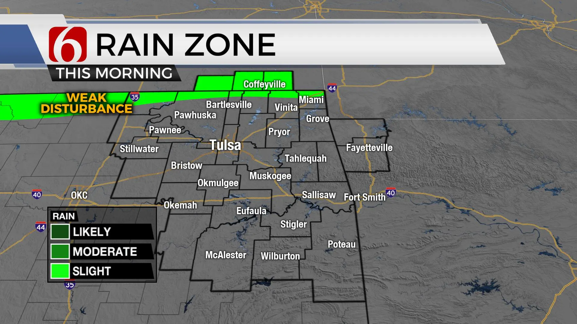
Muggy weather is underway this morning with most locations reporting the upper 70s with gusty south winds. A weak outflow boundary may approach southern Kansas and far northern OK during the next few hours and could spark off a few isolated storms. This is a very low, but not a zero probability. The additional moisture and increasing temperatures will be the focus for the next two days before storm chances return this weekend and will continue for several days next week.

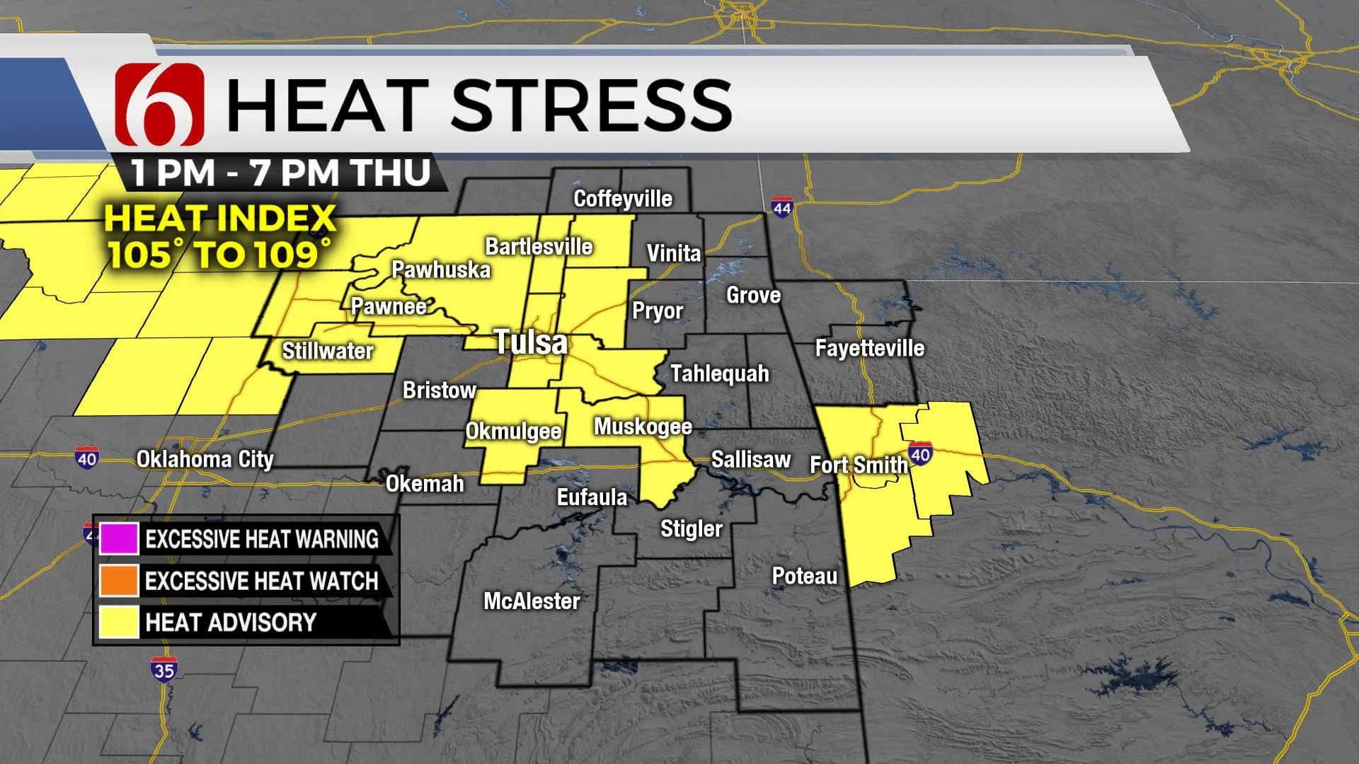
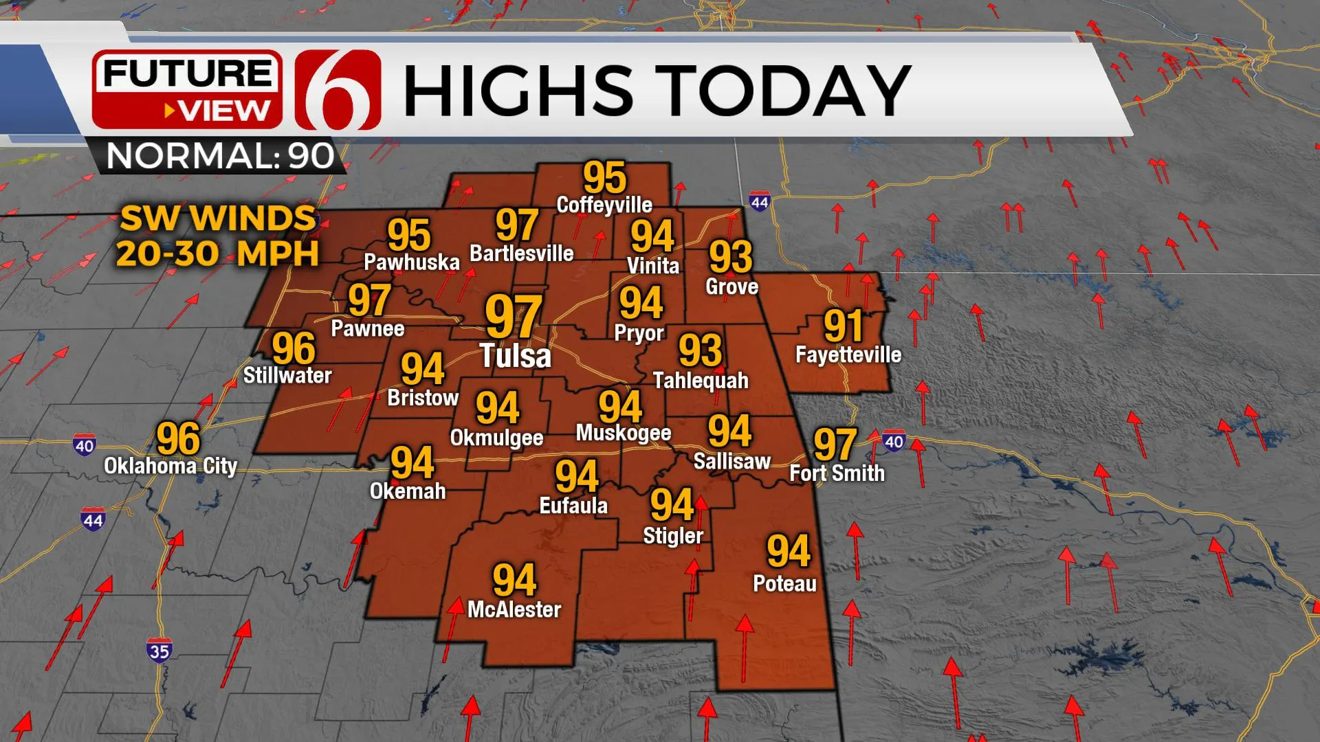
You’ll notice the increasing heat index values today with afternoon highs reaching the mid-90s and heat indices reaching between 105 to 109. This will trigger heat advisories for some locations across northeastern Oklahoma today and possibly Friday before our next front slowly moves into the region bringing scattered showers and storms. Another MCS is likely to develop later today well north of our area but could drop southeast and spread a few showers or storms near or north early Friday morning. This probability again remains very low. Higher chances will arrive later Friday night and continues for several days thereafter into early next week.

A few strong to severe storms will be possible late Friday night into Saturday but the main threat will quickly transition to pockets of moderate and heavy downpours resulting in localized flooding. Data this morning is keeping the front mostly north of the metro for Saturday before slowly moving the boundary southward Saturday evening into Sunday. This will create some different scenarios for timing. A few showers and storms will be possible late Friday night into Saturday morning across far northern Ok and southern Kansas for a few hours. The amount and exact location of these storms will have direct influence of the position of the boundary and additional storm chances Saturday evening into Sunday. At this point, we’re lowering probabilities some for Saturday and increasing for Saturday evening into Sunday. A few of the storms could be strong to severe with damaging winds the main convective threat. Winds aloft will generally be stronger north of the state. Additionally, the flow is expected to parallel the boundary and provide a slow-moving front with training of convective cells resulting in pockets of moderate to heavy tropical downpours.

This front will linger near or slightly south of the metro Sunday into Monday with some additional storm chances as daytime highs begin dropping a few degrees below seasonal averages into early next week. The upper airflow will keep a deep trough positioned near and northeast of the region early next week and this will support shower and storm chances in the forecast through at least Wednesday.
Thanks for reading the Thursday morning weather discussion and blog.
Have a great day!
Alan Crone
KOTV
If you’re into podcasts, check out my daily weather update below. Search for NewsOn6 and ‘Weather Out The Door’ on most podcast providers, including Apple, Stitcher, Tune-In and down below on Spotify.

More Like This
February 14th, 2022
January 26th, 2022
January 25th, 2022
Top Headlines
December 11th, 2024
December 11th, 2024
December 11th, 2024
December 11th, 2024


