

Tropical Downpour Possibilities Remain
Scattered rain and storm chances continue under mostly cloudy skies.Tuesday, June 29th 2021, 9:27 am
TULSA, Oklahoma -
The deep plume of tropical moisture remains across central to eastern OK this morning and shouldn’t change too much for the next few days. A weak surface boundary located northwest of the Tulsa metro combined with weak disturbances in the mid to upper flow will trigger scattered showers and storms through the end of the week before some changes occur taking this current air mass mostly south of our immediate area. This should bring mostly dry and pleasant weather for the Holiday Weekend, even though we may need to keep a very slight chance for an isolated shower or storm nearby. Temps will not change much for the next few days but will gradually see an increase for daytime highs. Morning lows are expected to remain in the lower 70s with highs ranging from the 83 to 87 range across eastern sections of the state through Thursday before our next front enters the picture.

Most of the short-term, hi-resolution data will suggest higher probabilities should be confined to locations near or west of the highway 75 corridor for most of the day before moving eastward later this afternoon and evening. I’ll fashion the hour-by-hour forecast in this manner, meaning each period will have some probabilities with higher chances nearing by afternoon and early evening. Temps outperformed again yesterday between the downpours, and I’ll also nudge our high up a few degrees from most of the guidance to account for this possibility.

The current upper air chart depicts a very strong ridge across the pacific northwest into Canada, with another mid-Atlantic ridge positioned southeast of the New England coastal region. A strong mid-level trough will develop across Hudson Bay soon and pivot southward into the Midwest Thursday and Friday before closing over the northeastern U.S. this weekend bringing a major cool-down to these locations. This same trough will help to push a surface cold front southward into Oklahoma Thursday with scattered thunderstorms along the boundary. The trough should be strong enough to push this front across most of the state before stalling across Texas this weekend. The current tropical air mass will slowly move southward Friday with some drier air moving from the Missouri Valley into part of the state this weekend resulting in morning lows in the 60s and afternoon highs in the mid to upper 80s.

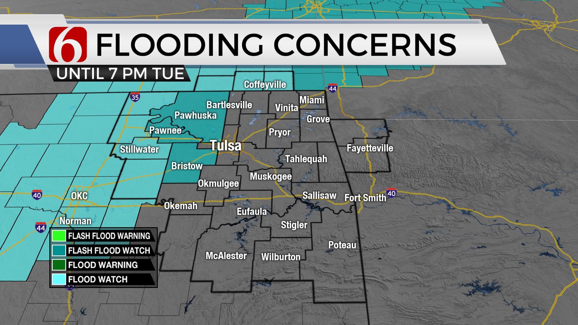
Additional heavy rainfall threats will be possible for the next few days. Remain aware of low water crossing regions and locations that are flood-prone. While activity will be mostly slow movers and highly efficient rainmakers, the general movement of cells should mitigate some of these flooding concerns across the eastern sections of the state with flood watches mostly north or northwest of the metro.
Thanks for reading the Tuesday morning weather discussion and blog.
Have a super great day!
Alan Crone
KOTV
If you’re into podcasts, check out my daily weather update below. Search for NewsOn6 and ‘Weather Out The Door’ on most podcast providers, including Apple, Stitcher, Tune-In and down below on Spotify.


Get The Daily Update!
Be among the first to get breaking news, weather, and general news updates from News on 6 delivered right to your inbox!
More Like This
June 29th, 2021

June 21st, 2023

June 19th, 2023

June 13th, 2023
Top Headlines

December 12th, 2024

December 12th, 2024

December 12th, 2024
