

Heavy Rainfall Threats Remain Thursday
A weak frontal boundary is beginning to move slowly southward across the region this morning through the day with scattered showers and storms near and behind this front.Thursday, July 1st 2021, 6:29 am
TULSA, Oklahoma -
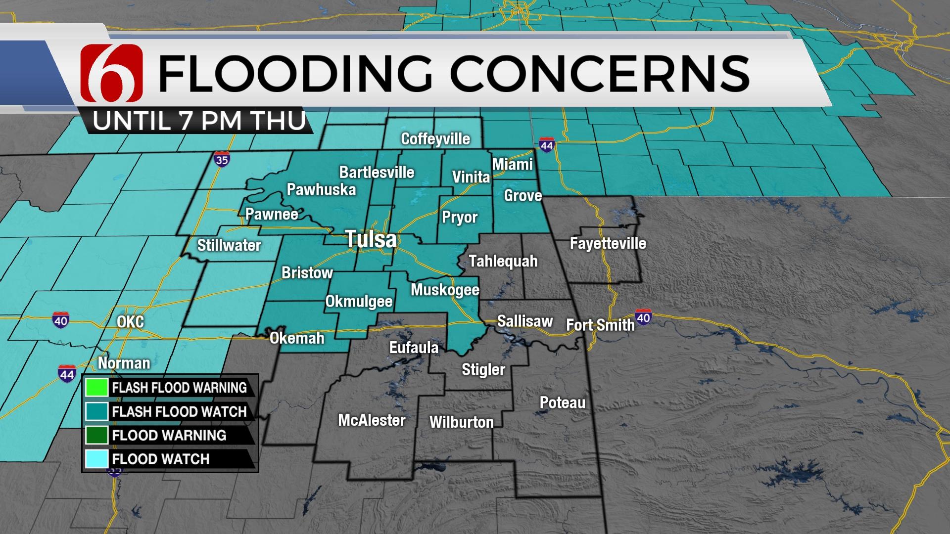
A weak frontal boundary is beginning to move slowly southward across the region this morning through the day with scattered showers and storms near and behind this front. Precipitable water values will support heavy rainfall with some activity that may lead to some localized flooding issues in a few spots. A flash flood watch remains in effect for the metro and surrounding areas through 7 p.m. tonight. As the front moves southward, additional storms are likely to develop across southeastern or east-central OK. These locations have received less rainfall over the past few days compared to the north and flooding concerns are not as high, so a flood watch may not be required for these regions even though some highly localized drainage issues will be possible. Severe weather threats regarding hail and wind will be very low due to the lack of upper-level support and shear, but one or two cells may briefly produce some gusty winds near 40 to 50 mph later today. This front will not bring any appreciable temperature change, yet it will eventually allow some drier air to advect from the Missouri Valley into northeastern OK Friday evening that will drop humidity values some for the extended holiday weekend. Morning lows this weekend will drop into the 60s for most locations with a few upper 50s in the sheltered valleys of far NE OK and NW Arkansas. Dry air cools efficiently but also heats and our daytime highs will be in the upper 80s this weekend nearing 90 Monday before additional gulf moisture quickly returns from Texas Tuesday through the end of next week supporting more showers and storms and increasing heat index values.

Specifics regarding the exact timing and placement of showers and storms today are highly problematic due to the lack of consistency in some data. General thinking combined with early observational data would keep higher chances for the first half of the day across northeastern OK before transitioning southward as the front moves south this afternoon and evening. But since there will be no airmass change with the initial frontal passage, I may need to keep rather healthy pops for the entire period, including some post-frontal precip near and southwest of the metro this afternoon and early evening. The most likely way to communicate this is to keep at least a 50% chance for just about anytime period through the morning to midday but I’ll attempt to tighten up some of these hour-by-hour probabilities early this morning.

Thanks for reading the Thursday morning weather discussion and blog.
Have a super great day!
Alan Crone
KOTV
If you’re into podcasts, check out my daily weather update below. Search for NewsOn6 and ‘Weather Out The Door’ on most podcast providers, including Apple, Stitcher, Tune-In and down below on Spotify.


Get The Daily Update!
Be among the first to get breaking news, weather, and general news updates from News on 6 delivered right to your inbox!
More Like This
July 1st, 2021

June 21st, 2023

June 19th, 2023

June 13th, 2023
Top Headlines

December 11th, 2024

December 11th, 2024

December 10th, 2024
