Hot, Muggy Day With Highs Nearing 100
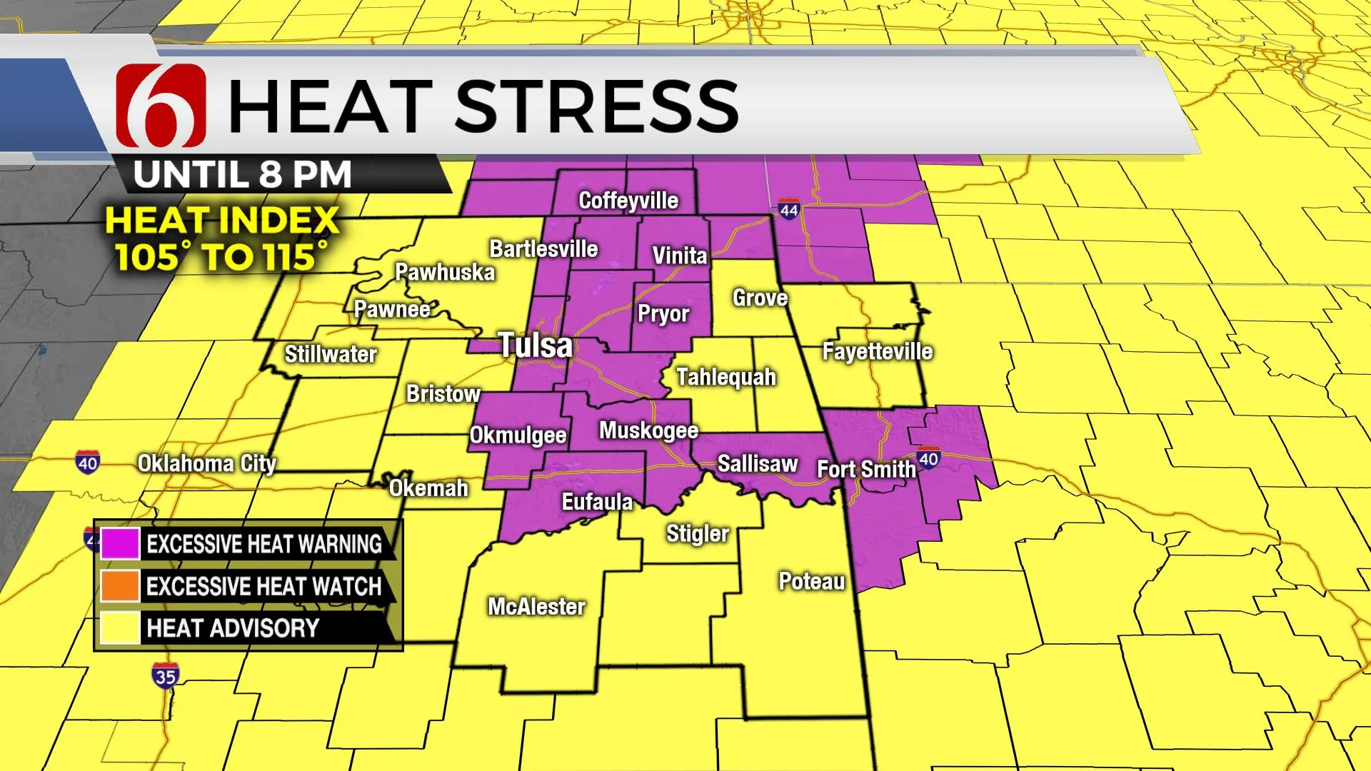
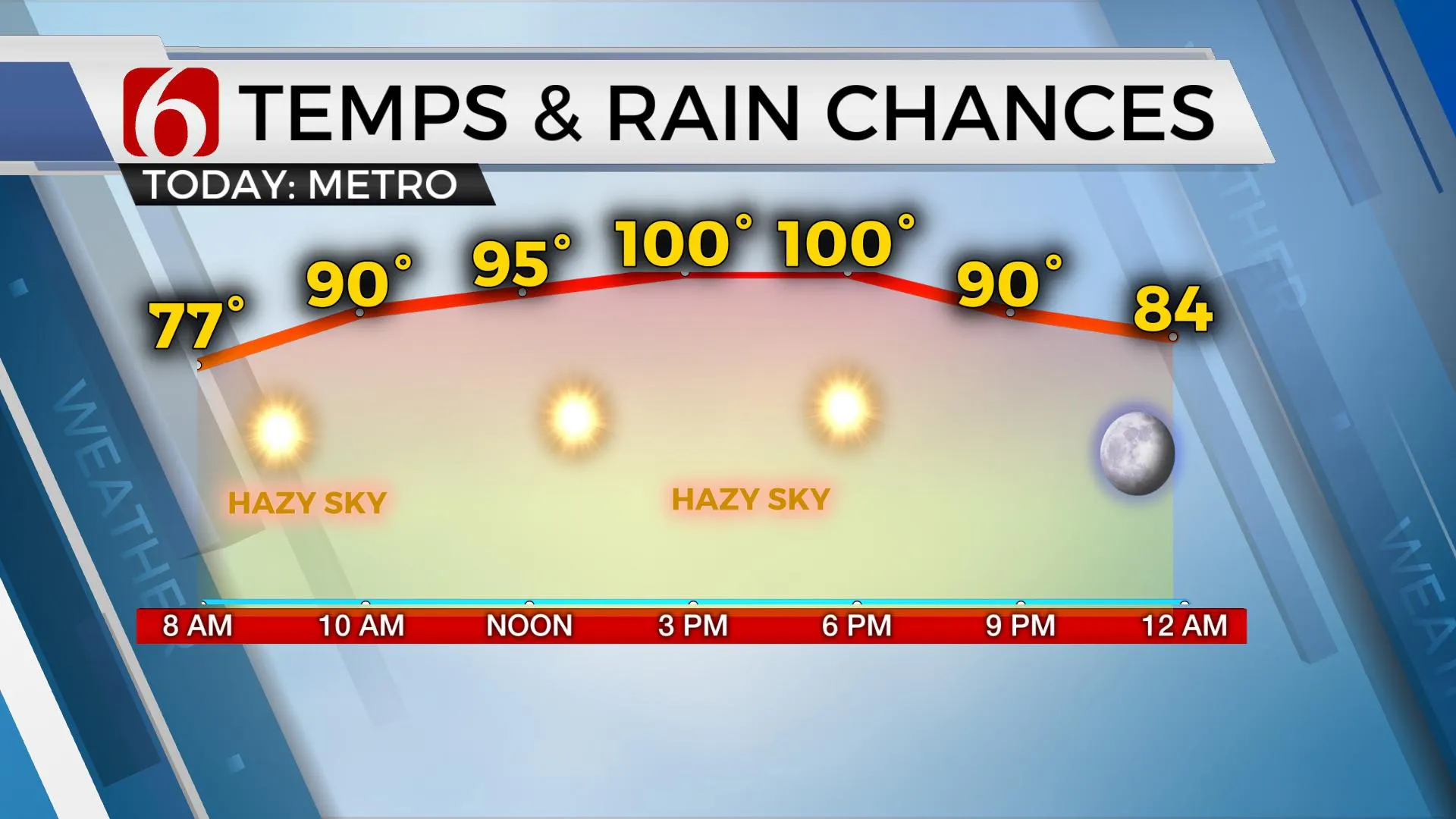
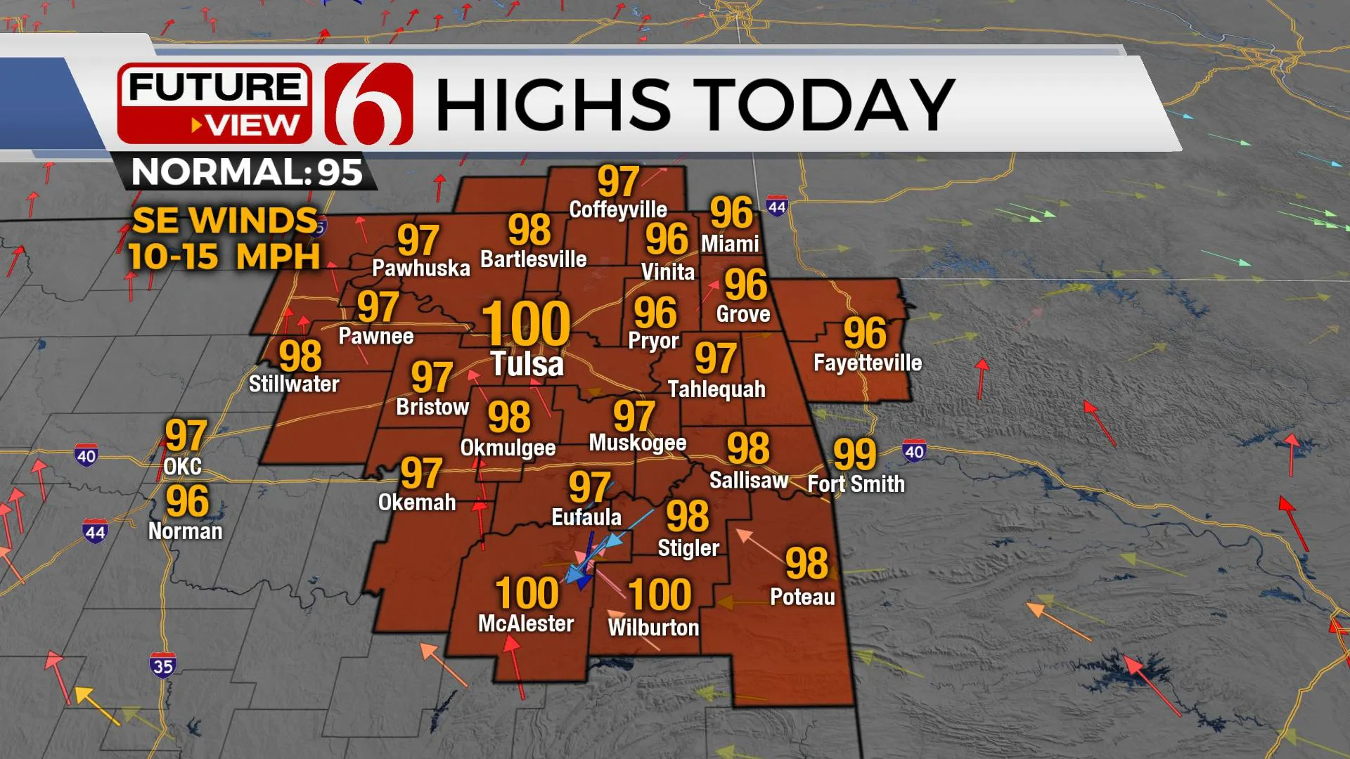
Another day of ridiculous heat index values is expected with afternoon highs reaching the upper 90s near 100, including the Tulsa metro.Thursday, July 29th 2021, 11:57 am
TULSA, Oklahoma -
Another day of ridiculous heat index values is expected with afternoon highs reaching the upper 90s near 100, including the Tulsa metro. We’re anticipating a 100 for the afternoon high today through Saturday before some changes arrive Sunday into early next week as a front move across Oklahoma bringing some minor yet noticeable relief early next week. The ridge of high pressure continues to be the dominant feature in the short term but is expected to retrograde westward some this weekend as another upper-level trough deepens across Hudson Bay into the upper Midwest. The result will be a stout northwest upper air flow developing that should bring some relief into the area as the front moves southeast late Saturday night into Sunday morning through midday. A few showers and storms will be possible but not for all locations. I think a lot of real estate will be dry with the initial front with the better chances remaining across far northern OK Sunday morning and extreme southern OK Sunday evening. The main highlight will be the potential for some reduction in both temps and heat index values for a few days early next week.

The data has been consistent with the front near the state but has changed the timing slightly. Our forecast continues to bring the front across the area late Saturday night into Sunday morning with a few showers or storms, with higher chances mostly across far southeastern Kansas and extreme northeastern OK. Most data suggest a strong CAP ahead of the front with most activity post-frontal. By Sunday afternoon, the front will progress near or south of the I-40 corridor with some additional scattered showers or storms developing across far southern OK or north TX. Temps are expected to drop into the upper 80s and lower 90s Sunday with heat index values around 100 or slightly higher. but Any heat advisory Sunday should be confined to extreme southeastern OK or north TX.

Monday morning northeast winds will remain with morning lows in the upper 60s and lower 70s followed by daytime highs in the upper 80s near 90. Any heat index values will only be a degree or two above the local high temps. Most data continue bringing some drier air. temporarily into the area Monday afternoon into Tuesday morning with dew points dropping into the lower 60s through at least Wednesday and Thursday before more heat and humidity arrive the following weekend.

Thanks for reading the Thursday morning weather discussion and blog.
Have a super great day!
Alan Crone
KOTV
If you’re into podcasts, check out my daily weather update below. Search for NewsOn6 and ‘Weather Out The Door’ on most podcast providers, including Spotify, Stitcher, Tune-In and down below on Apple.
More Like This
July 29th, 2021
February 14th, 2022
January 26th, 2022
January 25th, 2022
Top Headlines
December 12th, 2024
December 12th, 2024
December 12th, 2024


