A Pattern Change Expected Soon
Hot and muggy with highs at or above 100.Friday, July 30th 2021, 10:44 am
TULSA, Oklahoma -
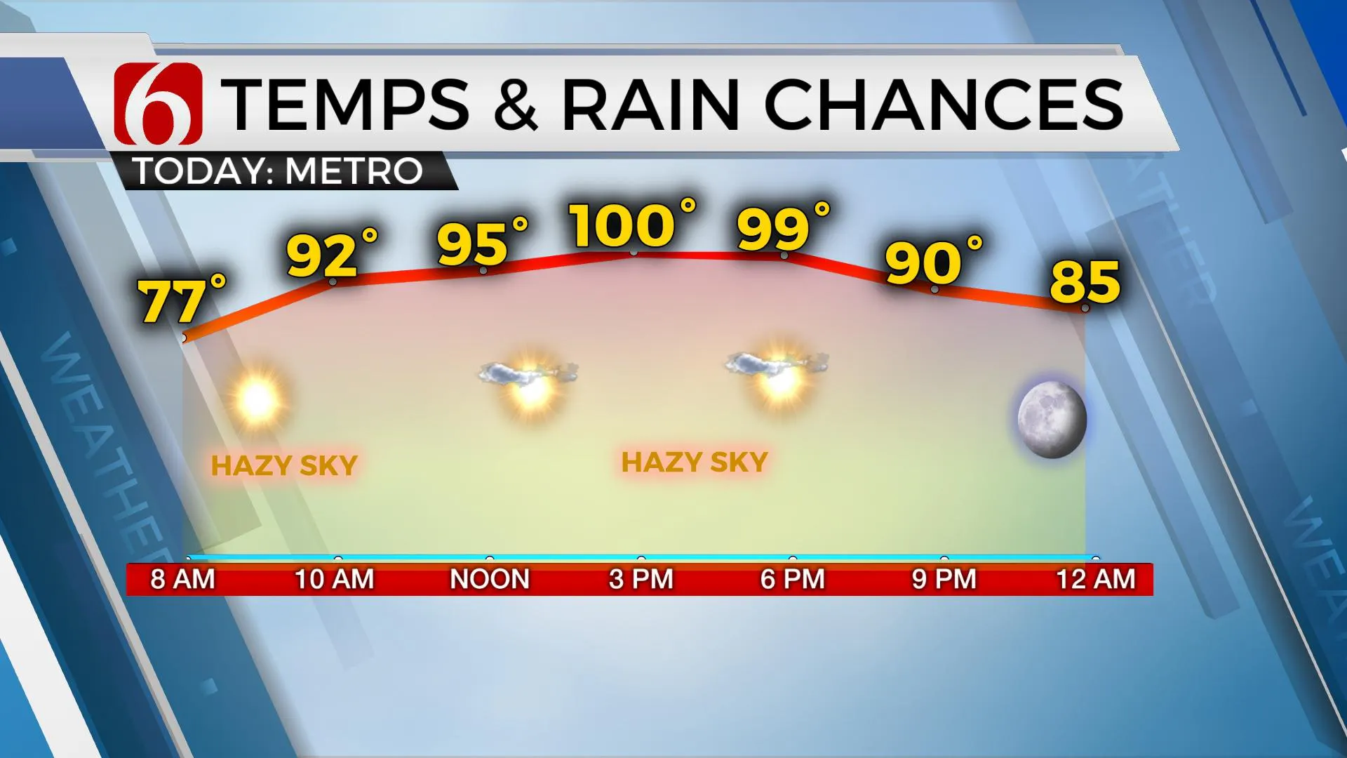
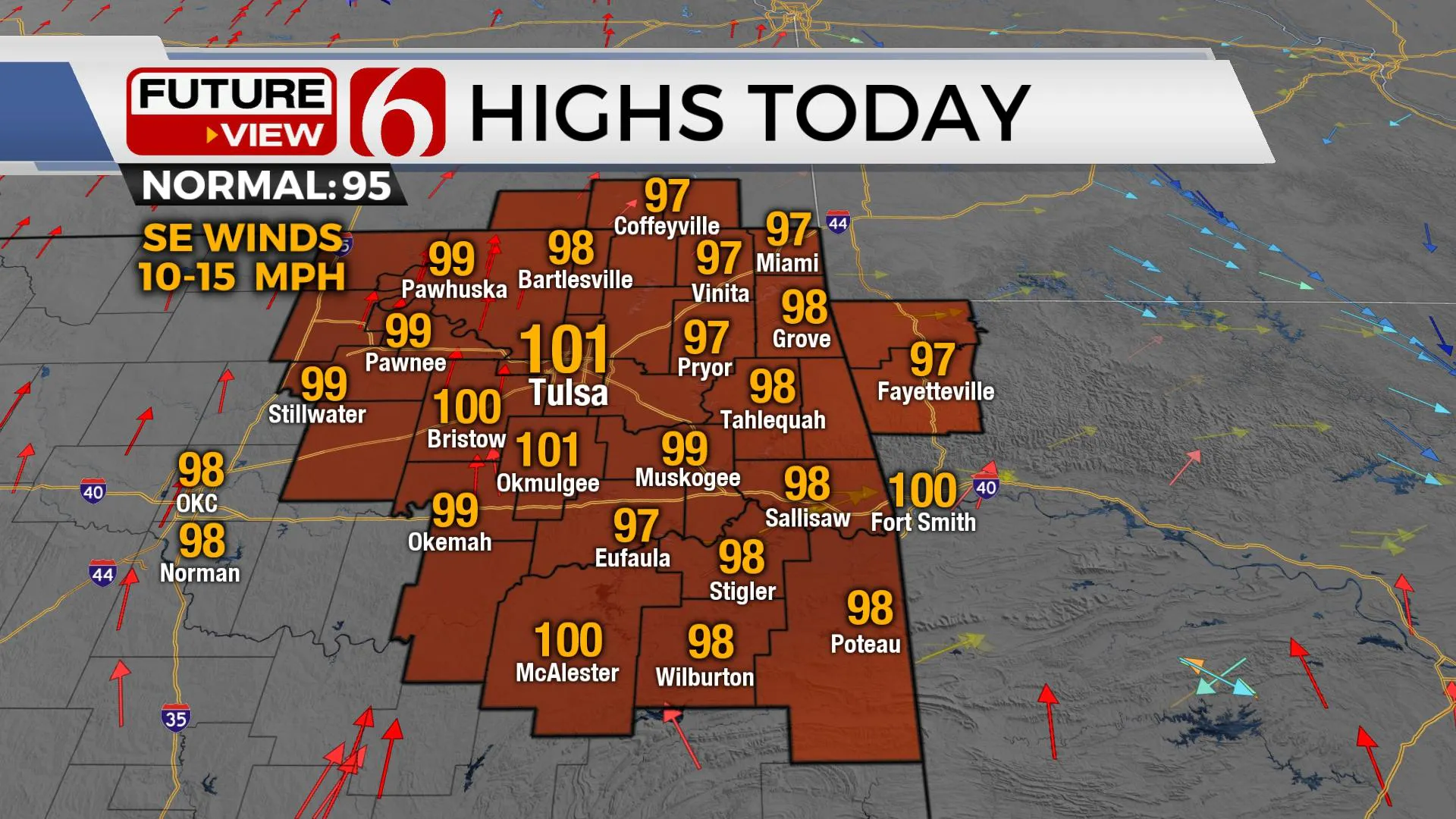
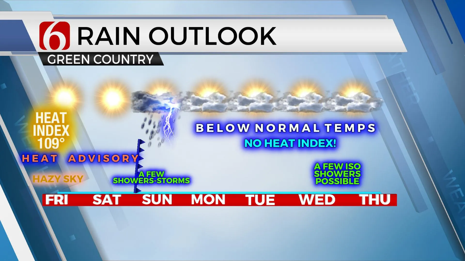
We’re getting ready to experience a minor yet noticeable pattern change early next week that brings us back down with temps below normal for a few days including the disruption of the high heat index values we’ve been experiencing the past week. Heat advisories will remain today and tomorrow but a cold front moving across the area late Saturday night into Sunday morning will bring decreasing temps and a few showers and storms to part of the area. The mini-break in the heat should remain for at least the first half of next week before the ridge attempts to build back near the state by next weekend. Highs this afternoon are expected near 100 with Saturday supporting the hottest temps of the season so far with highs nearing 100 to 102 before the front arrives Saturday night.

The center of the ridge is currently north of the state but is strong enough to keep the entire region hot and humid. A powerful trough will drop down through the Hudson Bay region of Canada this weekend as the ridge expands on a north to south axis but moves westward into the Rockies and four corners region. This will create the northwest flow aloft which will aid in bringing the front southward this weekend.

South to southwest wind is expected Saturday afternoon ahead of the front allowing for some compressional warming that may also act to have a very minor drying influence on local dew points and humidity. This minor reduction in the heat index will be offset with the increase in actual temperature.

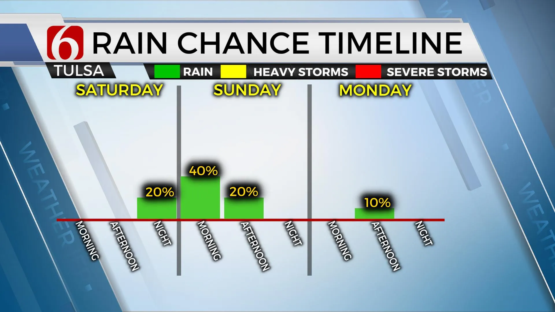
Most data support the front entering southeastern Kansas Saturday evening and advancing into northern OK pre-dawn Sunday before continuing to slowly move southward midday before reaching southeastern OK Sunday evening. Most data also support a strong CAP in place ahead of the front giving us more of a post-frontal precipitation chance with this system. While a few strong storms may be possible, severe threats are limited. Most operational data do not support a big coverage of storms and I continue to keep only a 30 to 40% pop for the metro with higher chances early Sunday morning to the north and much higher chances Sunday evening across far southeastern OK and north TX.

Temps Sunday will reach 90 for the high near Tulsa, but will still reach the upper 90s across southeastern OK where heat index values may require another heat advisory for the afternoon. Slight drier dew points will arrive Monday afternoon and settle across the area Tuesday morning bringing a nice break. Monday’s highs will stay in the upper 80s near 90 with northeast winds and no heat index. Tuesday morning begins in the mid-60s with highs also remaining in the upper 80s. South winds return Wednesday with lows in the upper 60s and lower 70s and highs remaining in the upper 80s. The 2nd part of next week into next weekend will feature slowly increasing heat and humidity as the ridge once again migrates closer to the state. The northwest flow may still be nearby as the ridge center remains west. This would keep us with a low possibility of a few showers or storms Thursday and Friday.
Thanks for reading the Friday morning weather discussion and blog.
Have a super great day!
Alan Crone
KOTV
If you’re into podcasts, check out my daily weather update below. Search for NewsOn6 and ‘Weather Out The Door’ on most podcast providers, including Apple, Stitcher, Tune-In and down below on Spotify.

More Like This
July 30th, 2021
December 12th, 2024
December 12th, 2024
December 12th, 2024
Top Headlines
December 12th, 2024
December 12th, 2024
December 12th, 2024
December 12th, 2024


