Breezy, Hot & Humid Monday, Early Morning Showers Possible
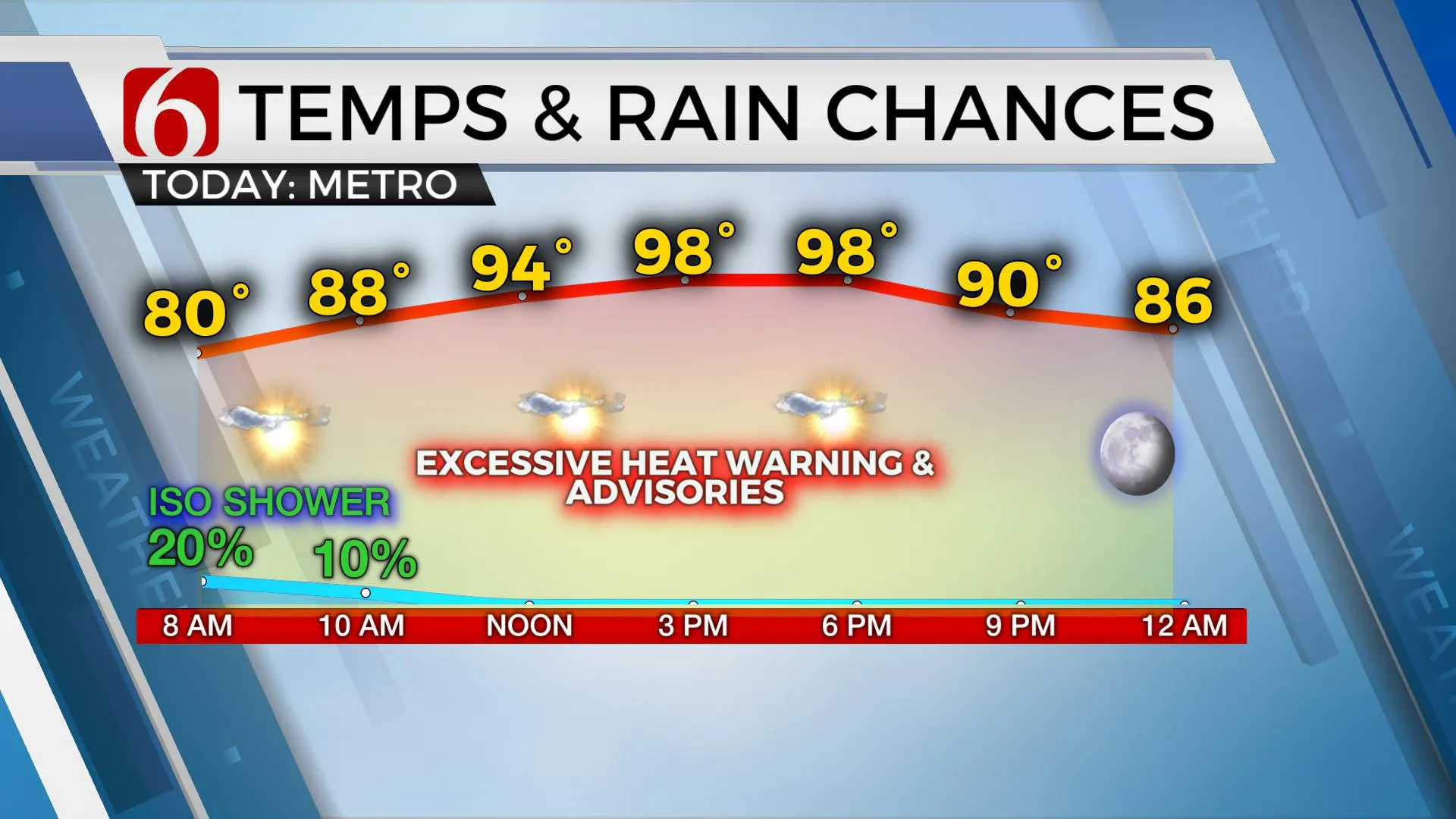
It will be a breezy hot and humid Monday. A few early morning to midday showers are possible.Monday, August 9th 2021, 4:30 am
TULSA, Oklahoma -
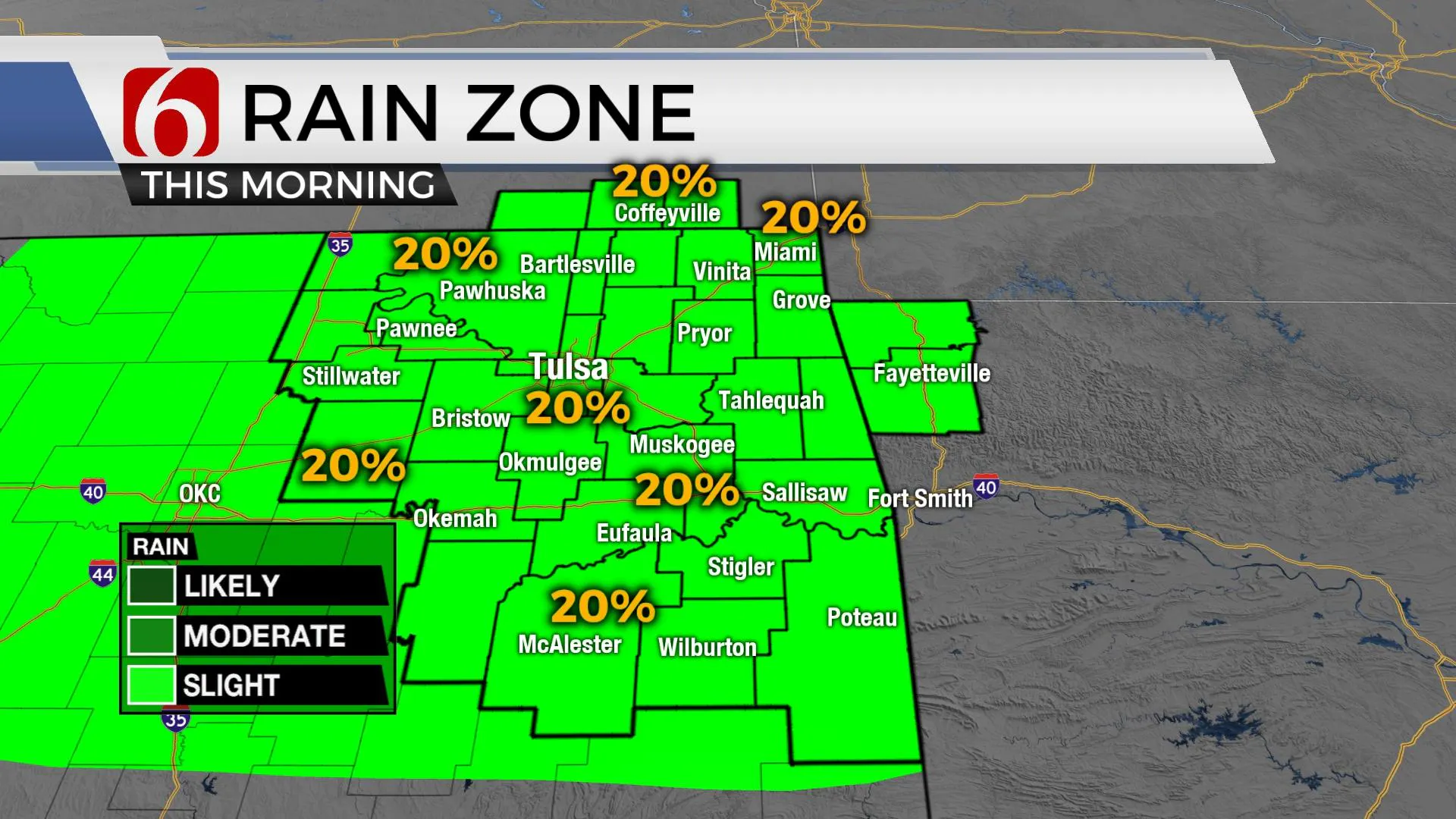
A few spotty showers and storms will remain possible for the morning hours. One or two of these cells may still produce gusty winds and brief heavy rainfall for a few locations, but most of the region remains dry. Heat advisories and excessive heat warnings will be posted today and for the next few days across a large part of the state.

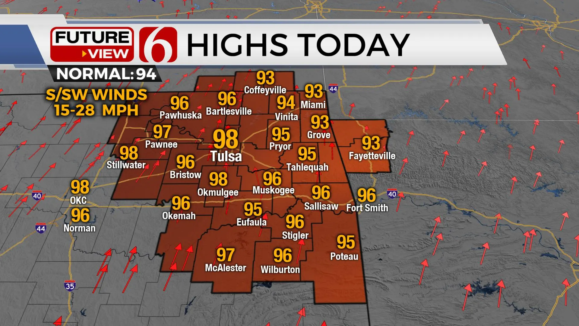
Another heatwave has already started this weekend and will continue for most, if not all the week with heat index values from 105 to 112. Afternoon highs will reach the upper 90s near 100 from the metro west with some locations across far east-central OK remaining in the mid-90s. A gusty south wind will provide some relief but not much. Remain hydrated, take frequent breaks, and wear sunscreen and sun-resistant clothing. Some, but not all data suggest a break by the weekend as another front nears the state by Friday. We're holding off at this point with any major reduction in temps and moisture but will include some minor pops and temps dropping into the lower 90s Friday into the weekend. For the near future, it's heat and humidity.

The upper flow will be quite active to the north, across the central and northern high plains. This is typical for August with the bulk of the westerlies well north. But just like this past weekend (and even this morning) a few showers and storms will be possible as weakening disturbances, outflows and short waves move near or just north.
The near term should keep us very muggy and hot with no major relief from this current stretch of summer weather. But the EURO and a few counterparts do suggest a boundary nears Friday opening the door for some weekend storms and not as hot weather, even some 80s for afternoon highs. The GFS and others keep us mostly on the hot and humid side but also with a slight chance for a few showers and storms. We’ve opted for a blended approach for these periods. This approach will keep us in the ballpark but far from a home run. Changes to these periods from late this week into the weekend are likely.

The Tropical Atlantic has awakened from the past three weeks of slumber and will begin churning out disturbances moving eastward, possibly developing into Tropical storms or hurricanes during the next few weeks as we enter the most active time period of the basin.
Thanks for reading the Monday morning weather discussion and blog.
Have a super great day!
Alan Crone
KOTV
If you’re into podcasts, check out my daily weather update below. Search for NewsOn6 and ‘Weather Out The Door’ on most podcast providers, including Apple, Stitcher, Tune-In and down below on Spotify.

More Like This
August 9th, 2021
April 17th, 2024
September 23rd, 2023
August 16th, 2023
Top Headlines
December 14th, 2024
December 14th, 2024
December 14th, 2024
December 14th, 2024


