More Scattered Storms Expected Across Part of Oklahoma
A weak disturbance embedded in the southwest flow will keep some scattered showers and storms nearby today and for part of Thursday before gradually seeing activity moving away from the region.Wednesday, August 18th 2021, 4:36 am
TULSA, Oklahoma -
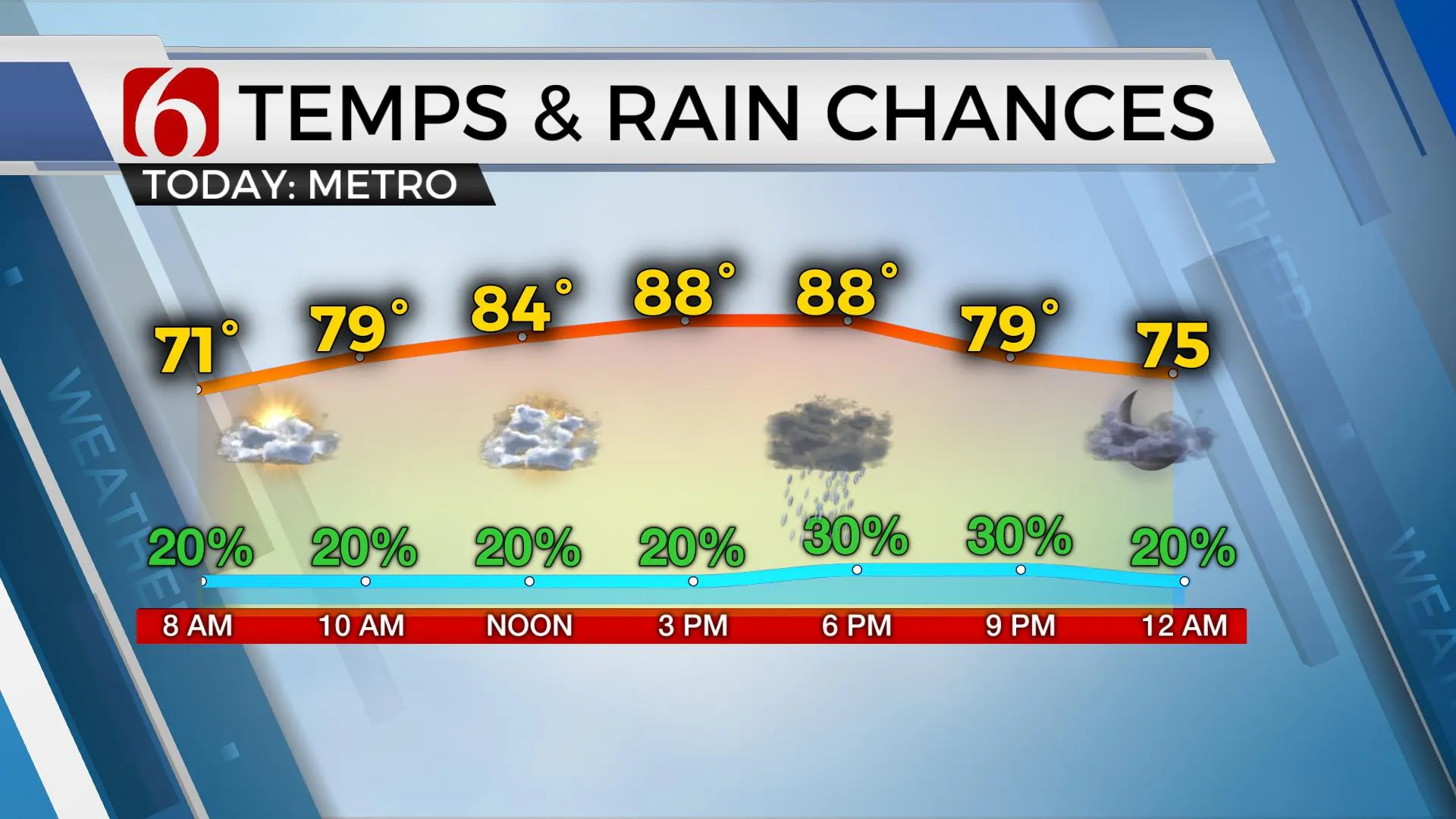
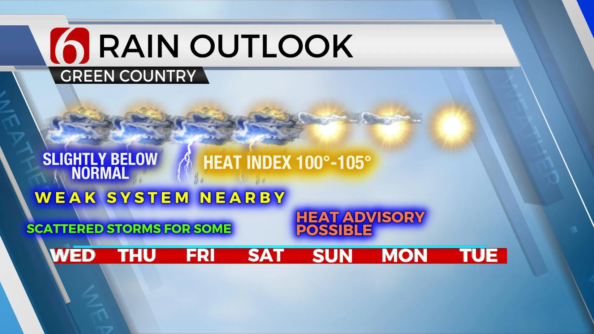
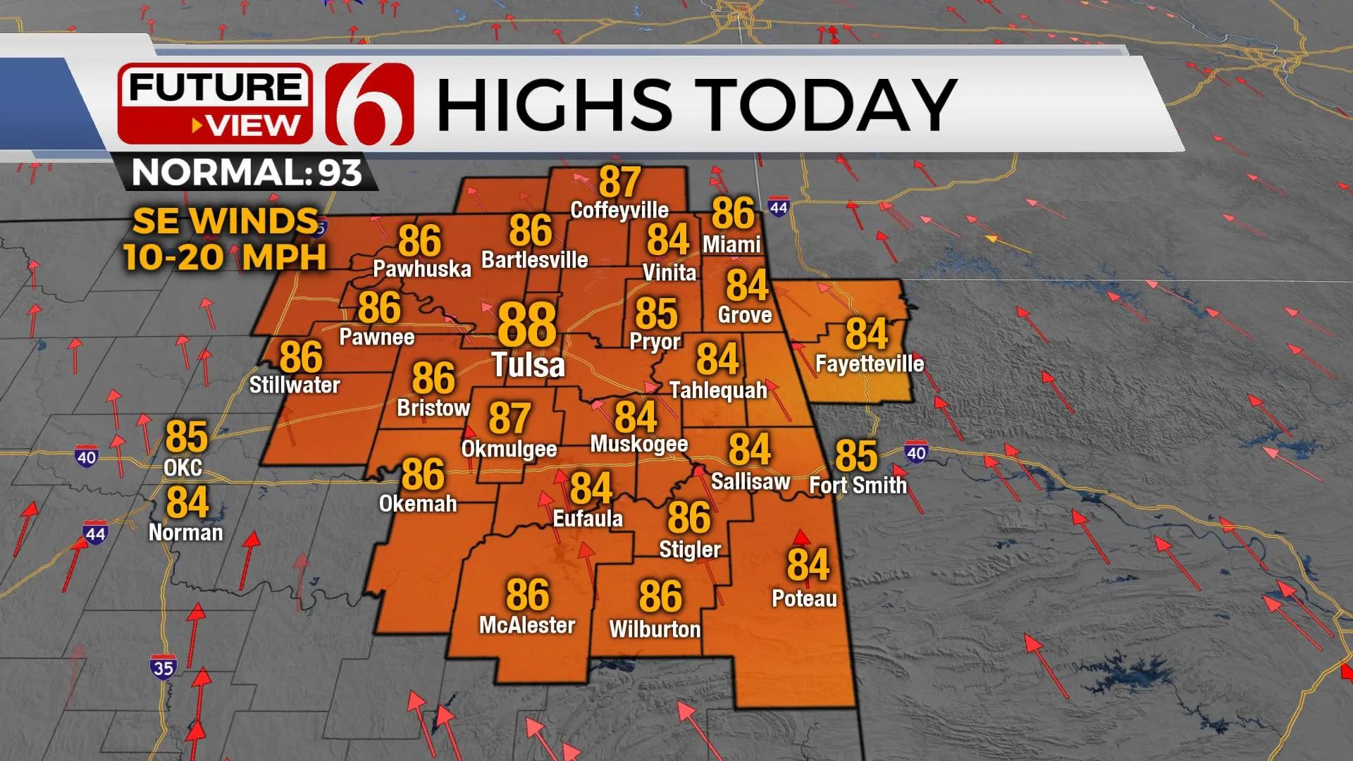
A weak disturbance embedded in the southwest flow will keep some scattered showers and storms nearby today and for part of Thursday before gradually seeing activity moving away from the region. A weak front attempts to influence the southern Kansas region Friday night into part of the weekend but with little impact across most of Oklahoma. By this weekend, a mid-level ridge of high pressure will begin expanding across Oklahoma bringing summerlike weather into the area through early next week. Heat advisories will more than likely be required for eastern Oklahoma beginning sometime this weekend and continuing for several days next week. But in the short term, a mostly cloudy sky and the scattered showers and storms will keep daytime temperatures below seasonal averages for the next few days. The tropical moisture in the lower layer of the atmosphere will keep heat index values into the mid-90s. You’ll notice the humidity. And any storm activity that you encounter could produce locally heavy rainfall quickly. A few storms may also produce gusty winds, but the severe threats will remain limited due to stronger flow well removed from the region.

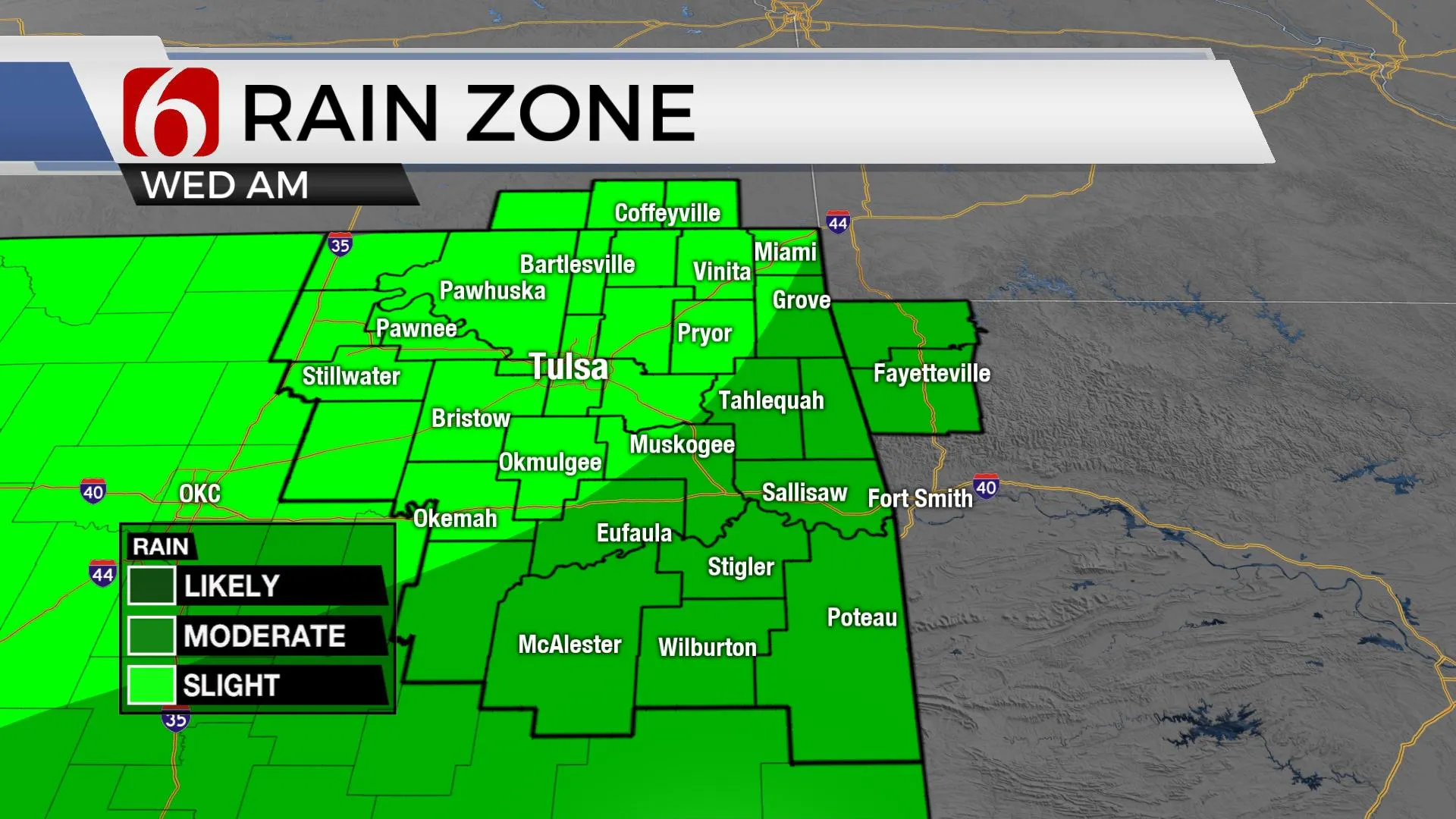
The main forcing of interest this morning continues to be positioned across the north Texas and southern OK region and is lifting slowly northeast. This feature should produce scattered storms through the day, but the coverage will remain spotty. Once again, some locations will have heavy rainfall and others will remain dry. The data Thursday suggests most of this forcing will be exiting the state. But another small disturbance in the southwest flow could trigger a few additional showers and storms and we’ll keep decent chances also for Thursday.

Friday into the weekend, the data has changed some but the probability of the surface front entering northern OK remains too low to mention at this point and we continue to keep the higher pops northward into southern Kansas. As the mid-level ridge begins expanding into the state this weekend, it will eventually drive out the rain chances and bring down the heat and humidity. There may be a small cluster of storms along the OK-Kansas state line region Friday night into Saturday morning, but the data is not consistent from run to run. We will continue keeping a small mention in the forecast for part of the weekend, but mostly north of the metro.

Temps this weekend will start with morning lows in the mid-70s with afternoon highs in the mid-90s. Heat index values are likely to be near 105 Friday and slightly higher for max readings throughout the weekend into early next week. This will require some heat advisories, at least for a few days before our next front nears the state by the middle to end of next week.

The tropics remain active, with Grace and Henri having the potential to become hurricanes soon. Depression Fred is located around the Virginias this morning and continues to weaken as it moves northeast but may still produce some severe weather threats. Grace has the potential to impact the Yucatan Peninsula as a hurricane, with impacts in places like Cancun and Cozumel. Henri is located south of Bermuda but eventually takes a turn northward becoming a hurricane yet remaining well east of mainland U.S. interests.
Thanks for reading the Wednesday morning weather discussion and blog.
Have a super great day!
Alan Crone
KOTV
If you’re into podcasts, check out my daily weather update below. Search for NewsOn6 and ‘Weather Out The Door’ on most podcast providers, including Apple, Stitcher, Tune-In and down below on Spotify.

More Like This
August 18th, 2021
February 14th, 2022
January 26th, 2022
January 25th, 2022
Top Headlines
December 13th, 2024
December 13th, 2024
December 13th, 2024
December 13th, 2024


