More Scattered Storms Before Weekend Heat and Humidity
A weak disturbance in the southwest flow aloft will bring a few more scattered showers and storms into the region today and this eveningThursday, August 19th 2021, 4:22 am
TULSA, Oklahoma -
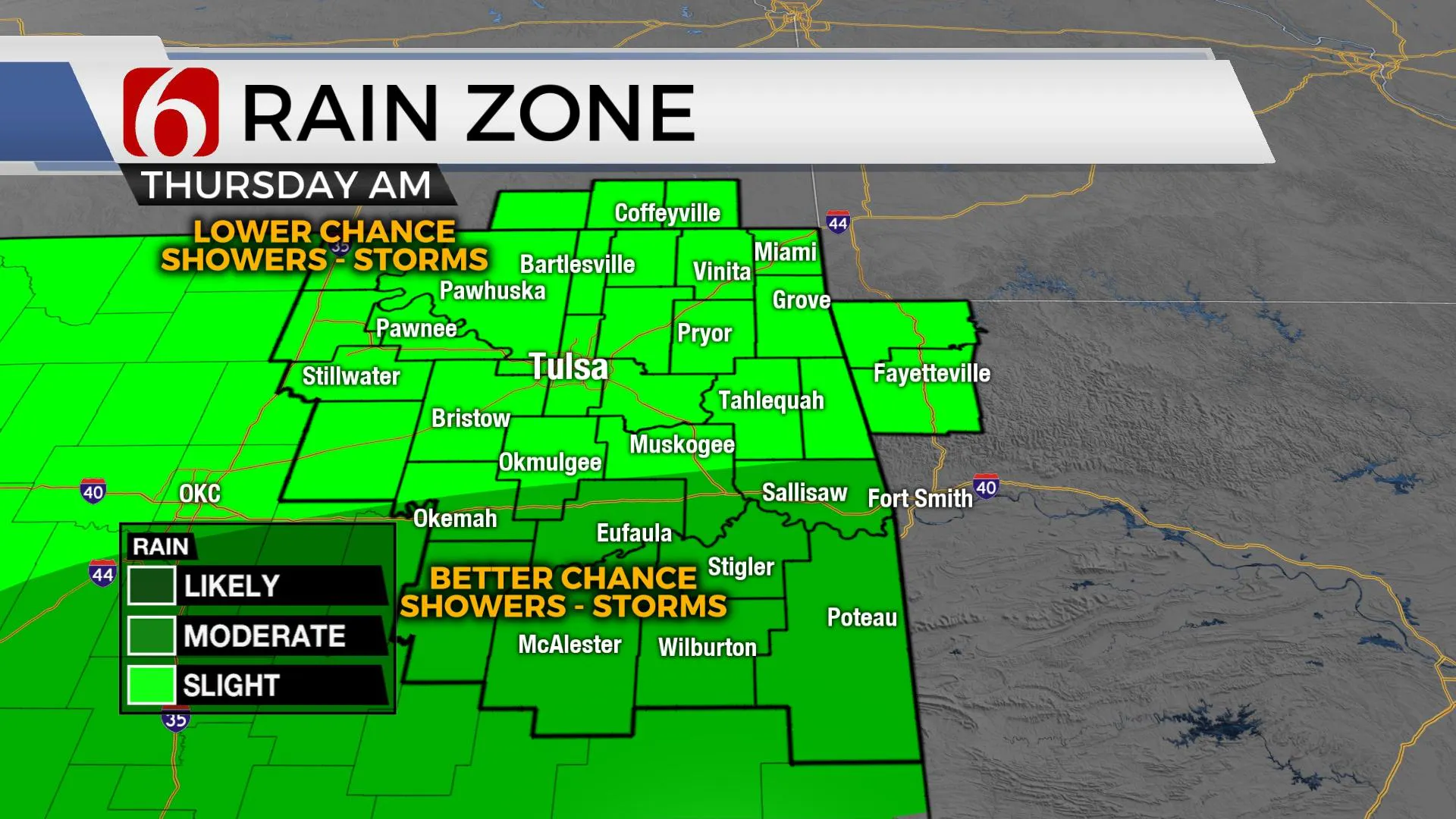
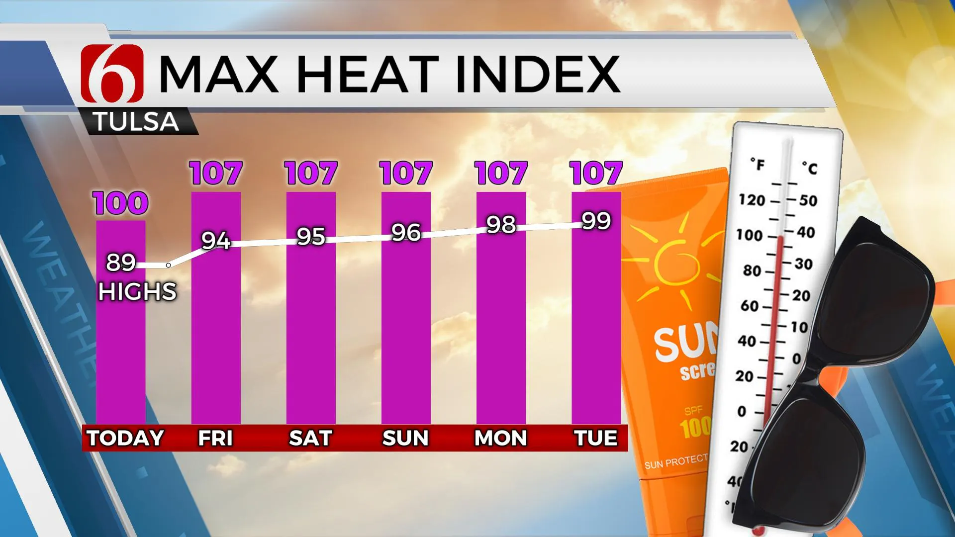
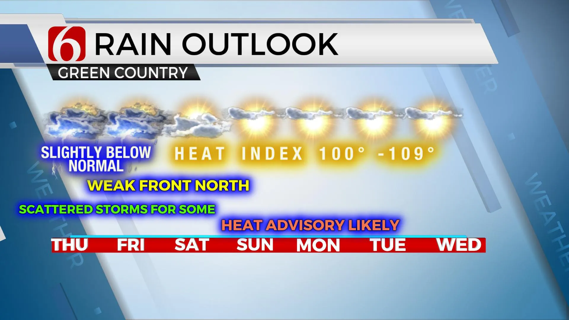
A weak disturbance in the southwest flow aloft will bring a few more scattered showers and storms into the region today and this evening. As with the previous few days, these will be highly scattered in nature but also likely to produce locally heavy rainfall for those locations that do receive precipitation. Better chances will remain across the southern sections of the state, but we’ll see a few across northern OK. A few cells may produce gusty winds but organized severe weather threats are unlikely due to the lack of stronger flow aloft and weak steering currents. Temps are expected to stay in the mid to upper 80s with partly to occasionally cloudy conditions, yet humidity values will support heat index values nearing 100 in some locations. Heat index values Friday into the weekend are expected to rise very near or slightly above heat criteria with locations from 105 to 109, more so Sunday into early next week. A mid-level ridge of high pressure will begin expanding northward into most of the state this weekend, but locations on the northern edge of the ridge (northern OK and southern Kansas) will remain in a favorable position for a few storms. A few of these storms may become strong to severe with damaging winds the main threat.

A strong upper-level system will eject into the central plains this weekend with a surface front moving southward Friday into Saturday with some data bringing this boundary across southeastern Kansas before stalling and lifting northeast Sunday midday. A few storms are likely to develop in the vicinity of this front Friday and could impact part of far northern OK by evening into early Saturday, and again late Saturday night into early Sunday morning. Locations along and south of highway 412 appear to be too far southward to experience this activity but we’ll keep some low probabilities for far northern OK into southern Kansas into the weekend.

Early next week, the ridge of high pressure will bring hot and humid weather into the state with highs reaching the mid to upper 90s and heat index values from 105 to 109. The ridge is expected to break down by the middle to end of next week with another front sagging southward with additional storm chances and a modest cool-down for the latter half of the week.

Hurricane Grace makes landfall near the Mexican Peninsula this morning and Henri south of Bermuda takes a turn north and may draw closer to the far northeastern U.S. by the end of the week.
![]()
Thanks for reading the Thursday morning weather discussion and blog.
Have a super great day!
Alan Crone
KOTV
If you’re into podcasts, check out my daily weather update below. Search for NewsOn6 and ‘Weather Out The Door’ on most podcast providers, including Apple, Stitcher, Tune-In and down below on Spotify.

More Like This
August 19th, 2021
February 14th, 2022
January 26th, 2022
January 25th, 2022
Top Headlines
December 12th, 2024
December 12th, 2024
December 12th, 2024


