The Heat Backs Off This Weekend While Remaining Above Average
Mostly sunny, hot, and humid Friday with a south breeze.Friday, August 27th 2021, 4:22 am
TULSA, Oklahoma -
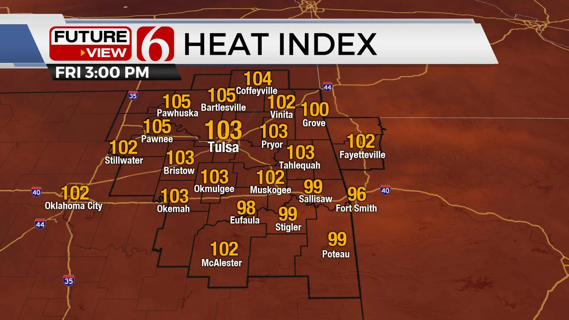
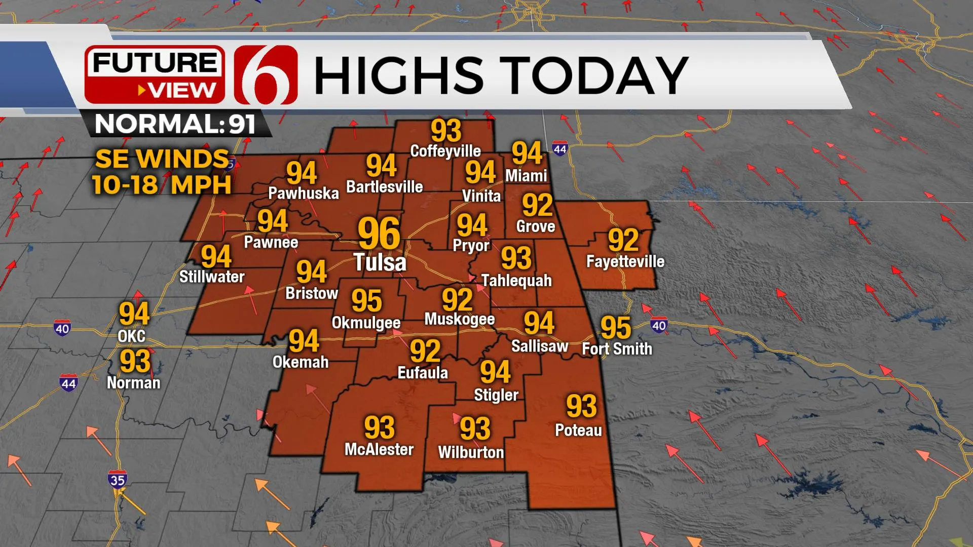
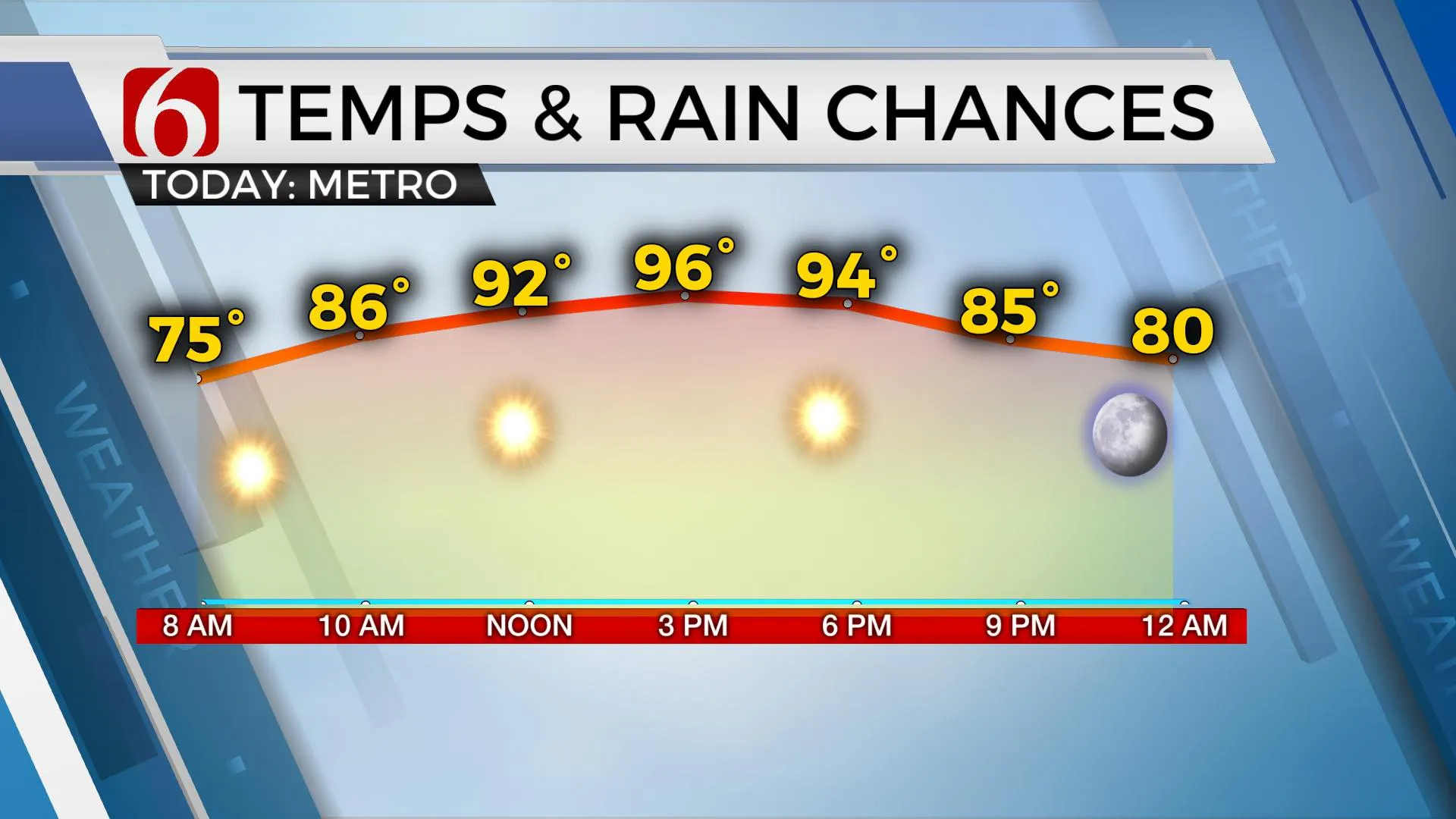
A minor reduction in heat and humidity is expected this weekend, but above-normal temperatures will remain with highs in the lower to mid-90s. Heat index values are still expected into the upper 90s to near 101 in some locations. While these values are not expected to trigger heat advisories, including today, heat stress remains possible through the weekend. A few isolated showers or storms will remain possible across extreme eastern OK and western Arkansas today and Saturday, with slightly better chances Sunday into Monday as a weak front approaches from the north and stalls while Hurricane Ida approaches southern Louisiana Sunday. The current track and intensity forecast for this tropical system appears too far east to have a direct impact on our weather regarding precipitation chances.

The mid-level ridge that has been parked over the state the past few days has flattened and is moving eastward. This allows a weak easterly wave component across the southeastern U.S. to move westward which may trigger a few isolated showers or storms across southeastern OK today and Saturday. Higher chances remain well south.
Northward, a stout upper-level wave will move across the central and northern high plains while a surface front slowly progresses across Nebraska and eventually into Kansas this weekend before stalling near or slightly north of the OK-KS state line early Monday. This front is not expected to enter our immediate area but may be close enough to support a few showers Monday. These probabilities will remain very low.

Monday and Tuesday the tropical system is moving northeast away from the southern plains with a return of hot and humid weather a few days before our next front has a chance to enter the state by the end of next week into the weekend.

Ida is expected to become a hurricane soon and will move northwest into the southern Gulf of Mexico while gaining intensity. The current intensity forecast points toward a Cat 2 storm approaching southern Louisiana Sunday, but additional strengthening is possible. The current official track forecast from NHC places major impacts across extremely low-lying areas of Louisiana with New Orleans in the right quadrant of the landfalling storm. This could create extremely high storm surge and inland flooding across coastal regions of Louisiana, Mississippi, and part of Alabama. Hurricane-force winds will be more closely packed to the deepening low-pressure area near and west of New Orleans. Additional tropical disturbances are strengthening in the Atlantic basin with additional named storms likely in the next few days.
![]()
Thanks for reading the Friday morning weather discussion and blog.
Have a super great day!
Alan Crone
KOTV
If you’re into podcasts, check out my daily weather update below. Search for NewsOn6 and ‘Weather Out The Door’ on most podcast providers, including Apple, Stitcher, Tune-In and down below on Spotify.

More Like This
August 27th, 2021
February 14th, 2022
January 26th, 2022
January 25th, 2022
Top Headlines
December 14th, 2024
December 14th, 2024
December 14th, 2024
December 14th, 2024


