A Few Scattered Storms Possible On Monday
Partly sunny skies with a few widely scattered showers or storms.Monday, August 30th 2021, 6:17 am
TULSA, Oklahoma -
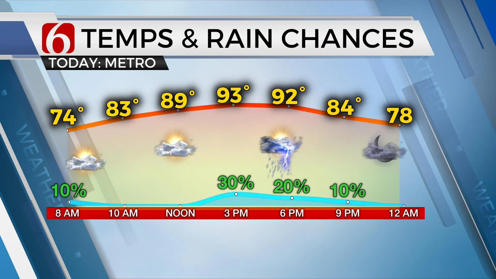
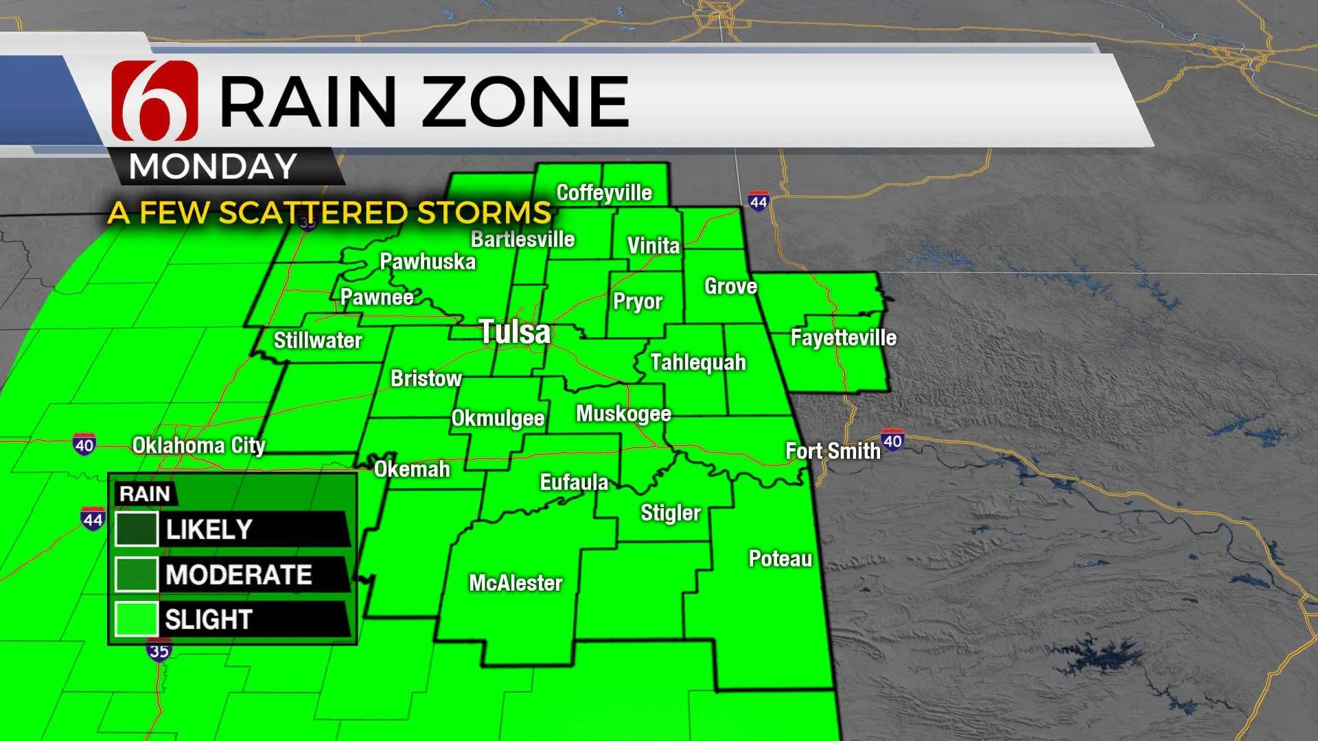
We're in store for some not-as-hot weather again today along with a few showers and storms for some locations. The trend of limited shower chances and above normal temps returns to Oklahoma for most of the week.

Wind flow backing around the Ida circulation combined with abundant low-level moisture and daytime heating will yield a few scattered showers and storms this afternoon and early evening. A few of these will produce locally heavy rainfall and some gusty winds, but the majority of Eastern OK will remain dry.

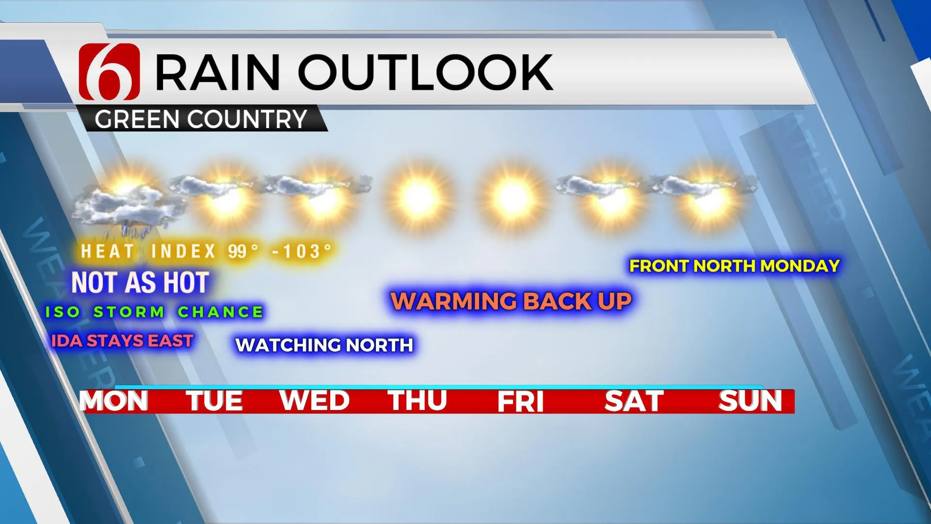
We’ve also noticed a few scattered showers early this morning, and one or two will remain possible, even for the early morning hours. Later today a complex of storms may develop to our north and move southward, with an outflow boundary reaching far southeastern Kansas or northeastern OK before dissipating. This could bring a few showers or storms Tuesday evening or early Wednesday morning. This remains a low, but not zero chance in the forecast. Unfortunately, the mid-level ridge of high pressure that has been present all of last week develops by midweek bringing more hot and humid weather to the state through the weekend. This ridge will not be as strong as last week. A weakness should allow for a few showers or storms Thursday or Friday across extreme southeastern OK but with limited coverage. The elusive front we've been seeing in the late runs of the model data for the past few weeks continues to be inconsistent. It appears in some model runs and doesn't in others. Our forecast will keep very little chance of any significant cool-down for the foreseeable future. There's an outside chance of heat index values reaching near 105 or slightly higher for the 2nd half of the week and this would trigger additional heat advisories. But for now, these data seem to be limited in time and space and it doesn't appear any heat headlines appear imminent for the week. Heat stress is possible but widespread advisories seem unlikely.

Sunday into the middle of next week, we’ll be watching northward as the front attempts to move southward. This could reach northern OK anytime from Sunday through the middle of next week. But the inconsistency in the data will keep this boundary off the map until about Tuesday or Wednesday of next week.
Thanks for reading the Monday morning weather discussion and blog.
Have a super great day!
Alan Crone
KOTV
If you’re into podcasts, check out my daily weather update below. Search for NewsOn6 and ‘Weather Out The Door’ on most podcast providers, including Apple, Stitcher, Tune-In and down below on Spotify.

More Like This
August 30th, 2021
February 14th, 2022
January 26th, 2022
January 25th, 2022
Top Headlines
December 10th, 2024
December 10th, 2024
December 10th, 2024
December 10th, 2024


