Cooler Mornings Return, But Summer Afternoons Continue
Happy Labor Day, Green Country! Drier air has filtered back into the area, and that’ll make a difference for both our morning lows and afternoon highs over the next several days.Monday, September 6th 2021, 10:24 am
TULSA, Oklahoma -
Happy Labor Day, Green Country! Drier air has filtered back into the area, and that’ll make a difference for both our morning lows and afternoon highs over the next several days.
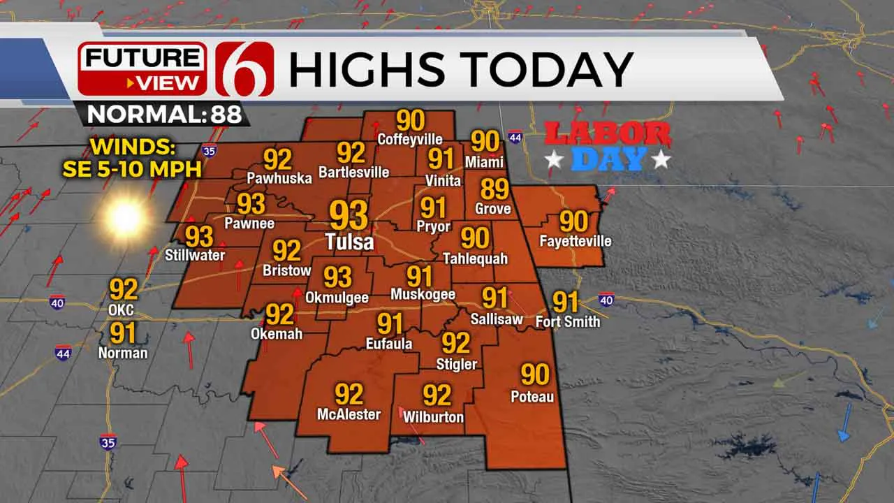
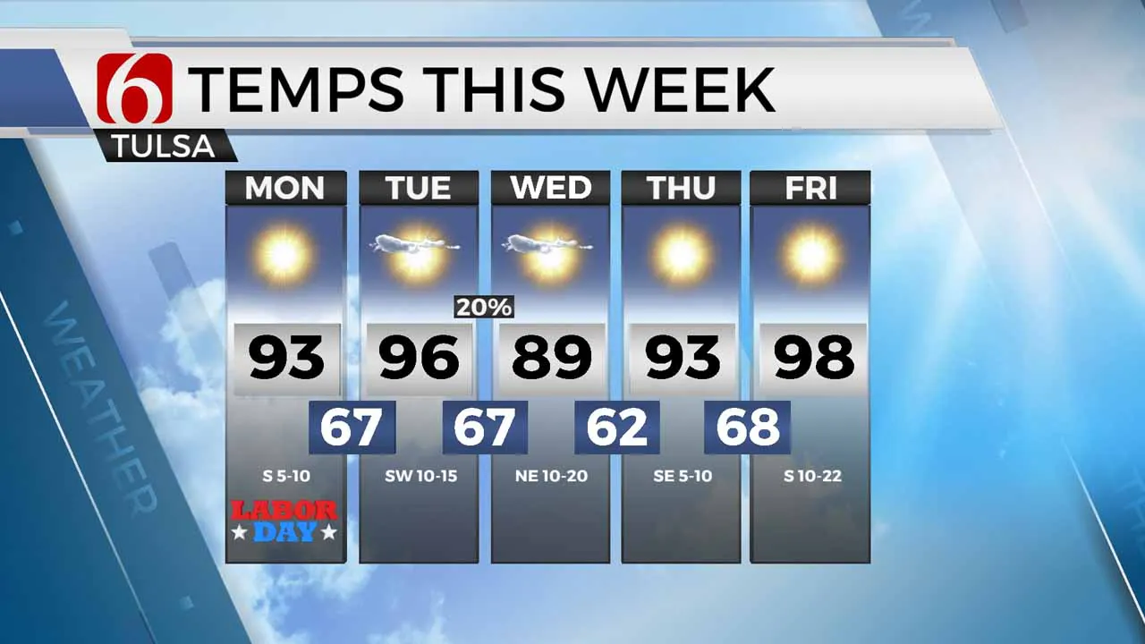
If you’ve got outdoor plans to celebrate Labor Day, the weather won’t slow you down! It’ll still be toasty with afternoon highs in the lower 90s. Expect lots of sunshine and light winds throughout the day.

We’ll get Tuesday morning off to a pleasant start with lows back in the 60s across eastern Oklahoma. The heat will crank up quickly Tuesday afternoon though, with highs back in the mid to upper 90s around the Tulsa metro. Humidity will be on the increase late in the day Tuesday out ahead of our next cool front.
That next front won’t have as much moisture to work with, but it looks strong enough to spark at least a few isolated showers and storms across southeast Kansas and northeast Oklahoma from Tuesday night into very early Wednesday morning. Behind that front, humidity values will once again drop off nicely on Wednesday with highs dropping back to the upper 80s!

Drier air looks to stick around through late in the week, which will help keep most of our mornings nice and cool over the next several days. Unfortunately, we don’t see any sort of fall-like afternoon temperatures any time soon. The heat will only build at the end of the week, with highs likely in the upper 90s to near 100 next weekend and rain chances remaining very minimal.
I hope you have a great Labor Day, Green Country! Stay safe! You can also follow me on Twitter @StephenNehrenz as well as my Facebook page Meteorologist Stephen Nehrenz to stay up to date with the very latest.
More Like This
September 6th, 2021
February 14th, 2022
January 26th, 2022
January 25th, 2022
Top Headlines
December 12th, 2024
December 12th, 2024
December 12th, 2024


