Summer Weather Today Before Cooler Weather Tuesday
The much-advertised cold front is located to our northwest this morning and is expected to move southeast into the area by late afternoon and evening.Monday, September 20th 2021, 7:30 am
TULSA, Oklahoma -
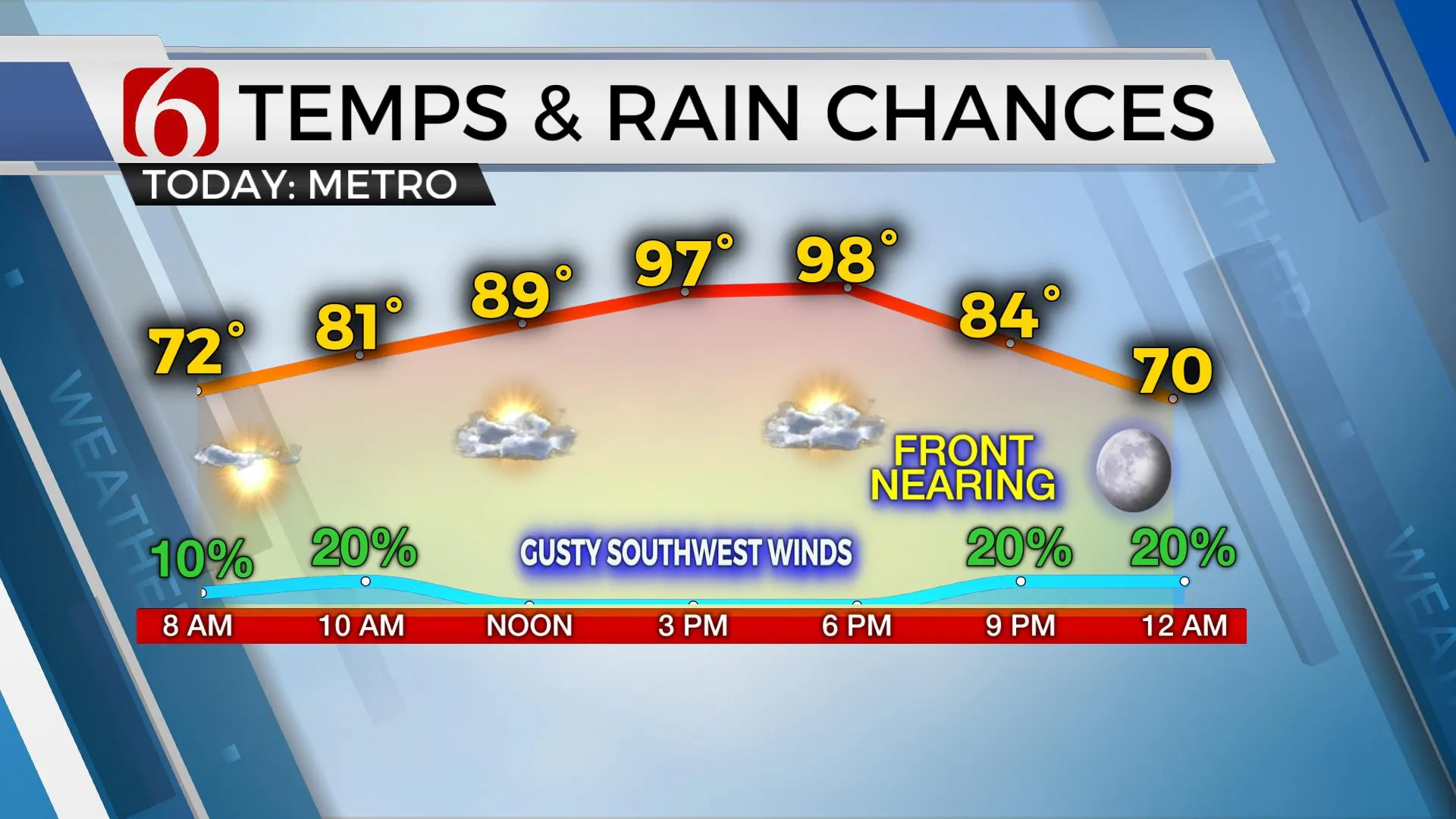
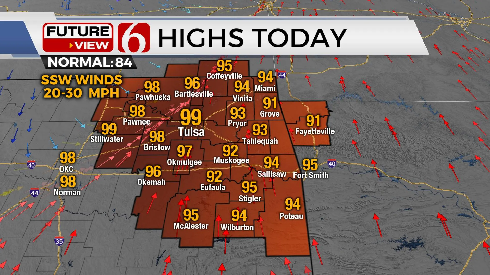
The much-advertised cold front is located to our northwest this morning and is expected to move southeast into the area by late afternoon and evening. We’re seeing a few spotty showers that could be developing this morning ahead of the main system. These will be very light if they happen at all and will scoot across northeastern OK around mid-morning with a high-based broken cloud deck. Gusty southwest winds are likely to kick in across the state by midday and will bring highs reaching the mid to upper 90s before the front arrives with a few storms near or east tonight. This will be followed by the chance for some spotty showers developing behind the front for a few hours early Tuesday morning. The window for a few strong to severe storms will remain, mostly from 6 p.m. to 10 p.m. tonight along the southeastward surging front. The higher severe parameters will be across far southeastern Kansas and extreme northeastern OK during this period with damaging winds and hail the main threat. As it looks right now, this threat will remain to the east of the Tulsa metro, but it may be close. The main upper-level trough is not expected to clear the central plains until Tuesday morning. Before this occurs, there will remain a chance for some post-frontal showers Tuesday morning.

Temps will be dropping from the 90s into the 80s by the early evening hours and then starting Tuesday morning with many locations in the lower to mid-60s. After a few early morning shower chances, clouds will clear from the west to east Tuesday afternoon with gusty northwest winds bringing a nice preview of fall weather. Daytime highs tomorrow are expected in the mid to upper 70s. As clouds clear and winds diminish, temperatures will drop into the lower and mid-50s by Wednesday morning with some valley locations briefly dipping into the upper 40s. Wednesday afternoon highs are expected to remain in the upper 70s to lower 80s. The pleasant mornings in the mid to upper 50s will continue through the end of the week but afternoon highs are expected to move back into the mid and upper 80s by Friday and possibly the lower 90s for the weekend.

The weekend pattern is a little unclear regarding another front crossing the area. This may occur either Friday night or Saturday but with little sensible weather change other than a minor wind shift for the northern third of the state as the front stalls and lifts northward.
Thanks for reading the Monday morning weather discussion and blog.
Have a super great day!
Alan Crone
KOTV
If you’re into podcasts, check out my daily weather update below. Search for NewsOn6 and ‘Weather Out The Door’ on most podcast providers, including Apple, Stitcher, Tune-In and down below on Spotify.

More Like This
September 20th, 2021
February 14th, 2022
January 26th, 2022
January 25th, 2022
Top Headlines
December 13th, 2024
December 13th, 2024
December 13th, 2024
December 13th, 2024


