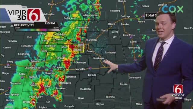
Thunderstorms Move Into Northeast Oklahoma
A weak front enters northwestern OK this morning and should progress to the southeast later today as some mid to upper-level forcing arrives from the southwest.Thursday, September 30th 2021, 5:17 am
TULSA, Oklahoma -
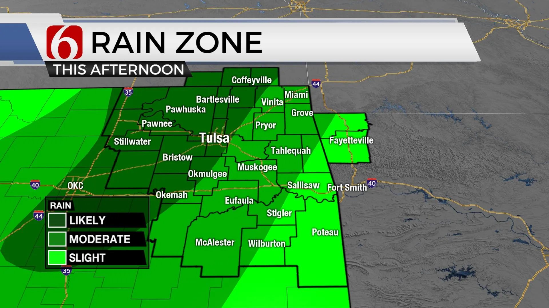
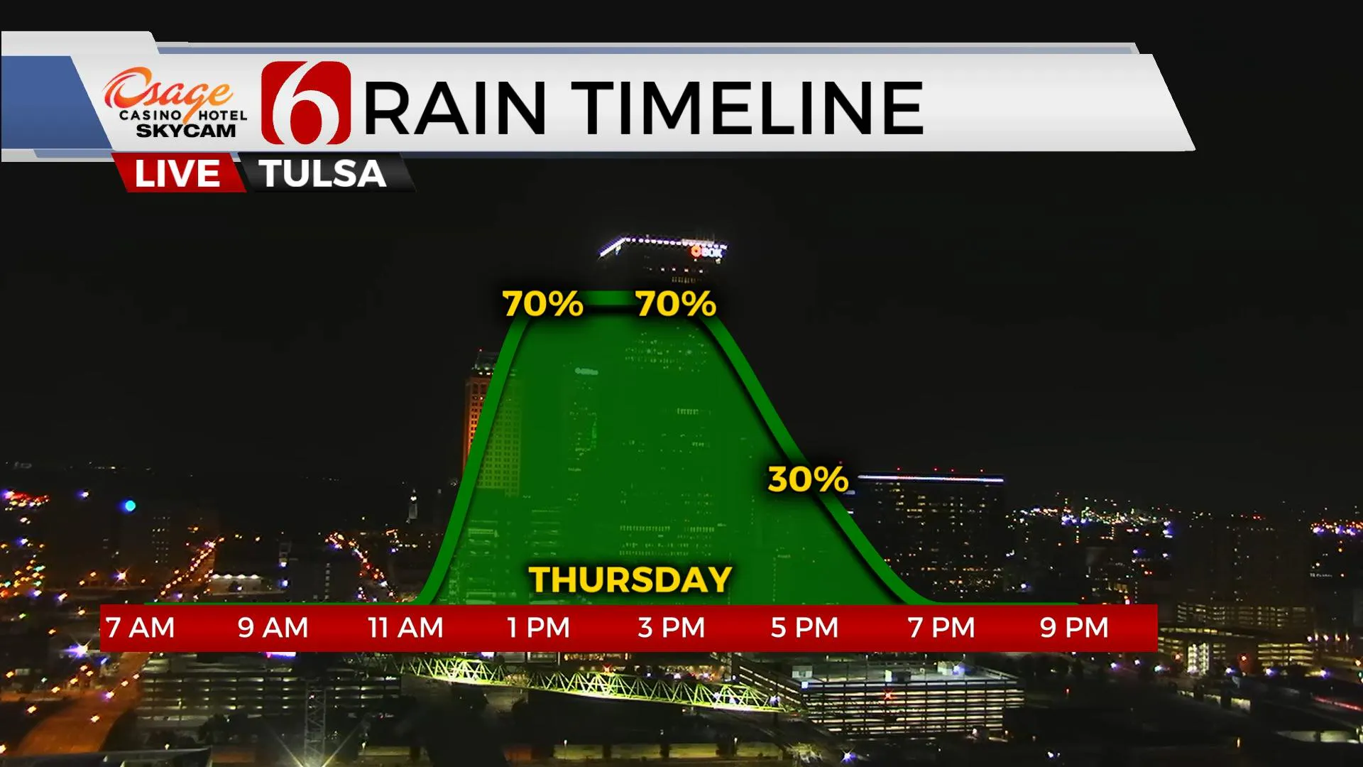
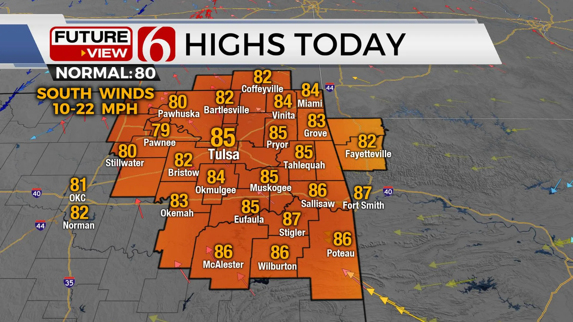
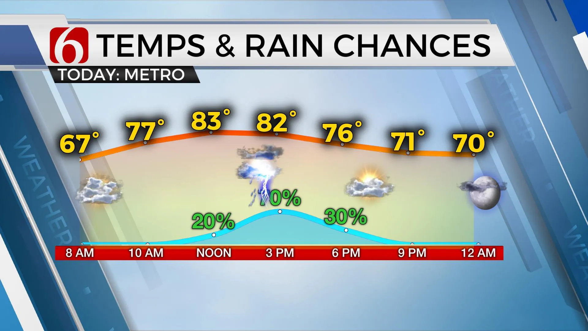
A weak front enters northwestern OK this morning and should progress to the southeast later today as some mid to upper-level forcing arrives from the southwest. The result should be increasing thunderstorms along this boundary this morning that will approach northeastern and eastern OK this afternoon. A quick return of significant low-level moisture is already in place and supports locally heavy rainfall, but just like yesterday, not all locations will experience precipitation today. The activity that's expected later today should be progressive, moving east to southeast around 25 to 35 mph which will help to mitigate the flooding potential. But heavy cells may result in a quick uptick of localized drainage issues. Temps will reach the lower 80s this afternoon before the storm activity arrives and this will keep the streak of 80 or higher in place for at least another day, possibly more. It's entirely possible we'll hit 80 Friday and Saturday, but most data support highs in the upper 70s for these periods. I need to stress that there remains some uncertainty to the exact coverage of storm activity for today.
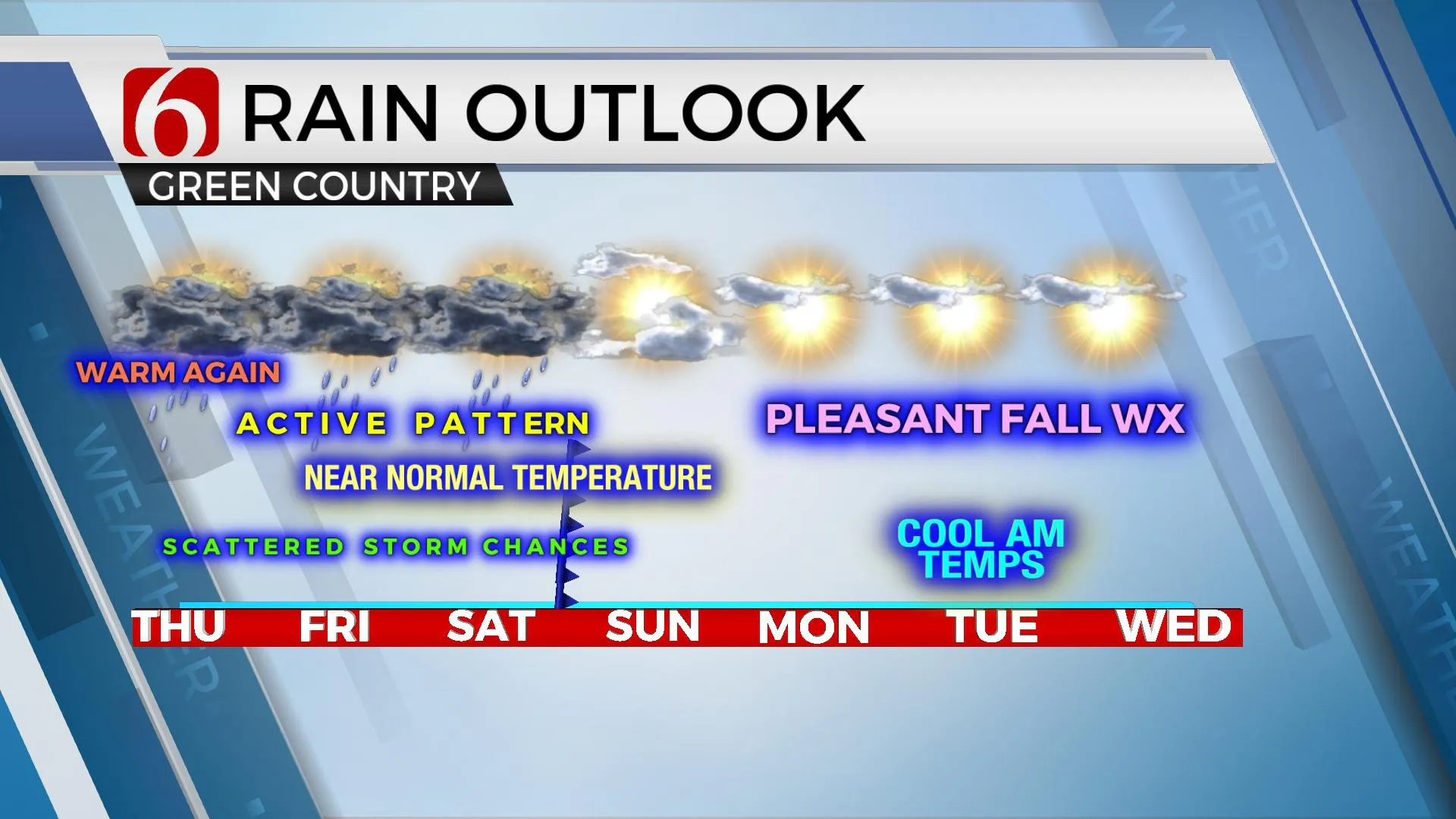
After this afternoon's activity, we should be in a relatively quiet period until early to midday Friday when a few additional storms are likely to develop from southwestern to central OK moving northeast. I’ve lowered the chances Friday for the midday to early afternoon before increasing chances arrive late Friday into early Saturday morning as the main upper trough nears the state. The above-mentioned front should be stalling and nearly stationary along or northwest of the I-44 corridor. Strong winds around the base of the trough nearing 50 to 70 knots will support a mention for a few strong storms by for part of late Friday evening into Saturday if surface instability increases. At this point in the forecast, severe threats will remain low but will be monitored closely for any changes. There will remain a few different scenarios for Saturday.
Saturday midday to afternoon will depend exactly upon what happens late Friday night into early Saturday morning. If the front remains stationary, additional storms are likely to develop Saturday midday to afternoon near this boundary before the front moves southeast Saturday evening taking storms out of the area. This scenario will require a rather healthy chance for storms and as mentioned above, possibly even a few strong to severe storms. Another scenario supports the front moving southeast Saturday morning with any additional storm activity developing across east-central to southeastern OK by the afternoon and evening. North winds would be faster to arrive for our region with decreasing chances for storms by afternoon across the northern sections. Regardless, we think the impact of this system will exit the area by at least Saturday afternoon. Therefore, as it stands now, we will not carry any pops for Sunday.
Temps should drop a few a degrees early next week with morning lows in the mid to upper 50s and afternoon highs near 79 to 81 as some pleasant fall weather arrives for a few days.
A very interesting and unusual upper air pattern is expected to persist across the nation early next week with a strong, Midwest cut-off low retrograding some by midweek with the main belt of westerlies well north into southern Canada. But by the following week, Oct 11th and beyond, the westerlies should migrate southward with numerous cyclones expected to develop across the intermountain region to plains states. This will bring very active weather into the nation and possibly into the state during this period.
Thanks for reading the Thursday morning weather discussion and blog.
Have a super great day!
Alan Crone
KOTV
If you’re into podcasts, check out my daily weather update below. Search for NewsOn6 and ‘Weather Out The Door’ on most podcast providers, including Apple, Stitcher, Tune-In and down below on Spotify.

More Like This
September 30th, 2021
June 21st, 2023
June 19th, 2023
June 13th, 2023
Top Headlines
December 11th, 2024
December 11th, 2024
December 11th, 2024
December 11th, 2024

