Rain Chances Return Early Wednesday Morning
Mostly sunny and more seasonable fall weather with a northeast breeze.Monday, October 25th 2021, 5:35 am
TULSA, Oklahoma -
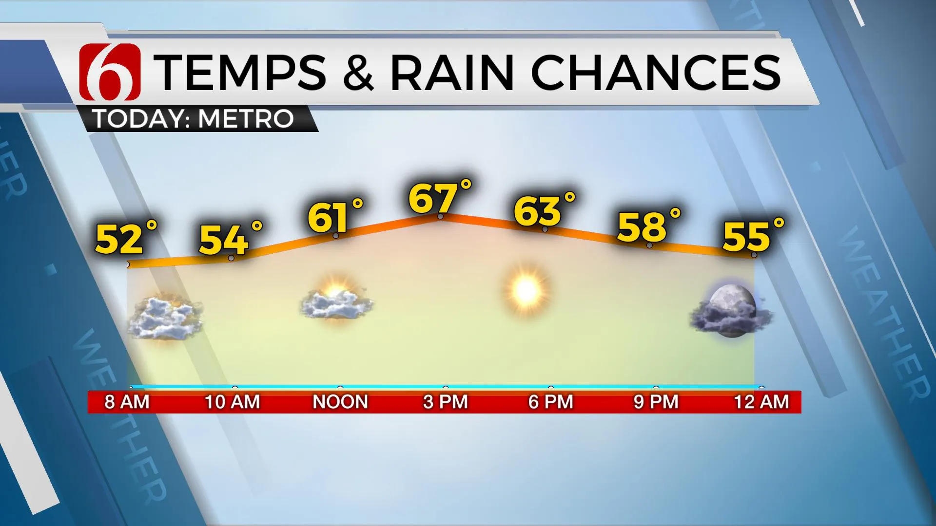
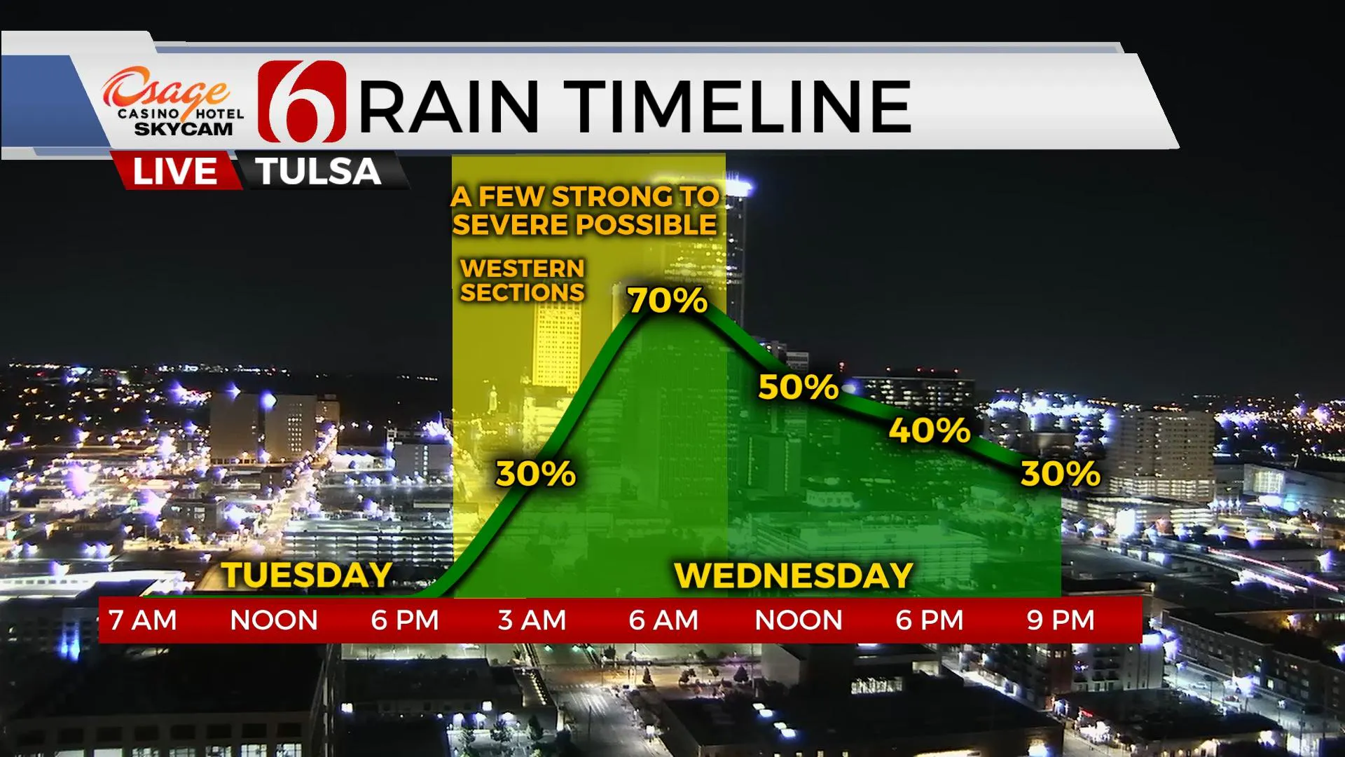
We get a good break from the active weather today with pleasant conditions before our next strong system moves into the area Tuesday night and Wednesday with rain and storm chances. Highs this afternoon will reach the mid and upper-60s north to lower-70s south with north winds this morning and south winds returning overnight at 10 to 15 mph. Windy and warm weather is likely Tuesday with highs nearing 80 along with south winds from 15 to 30 mph before storm chances return early Wednesday morning.

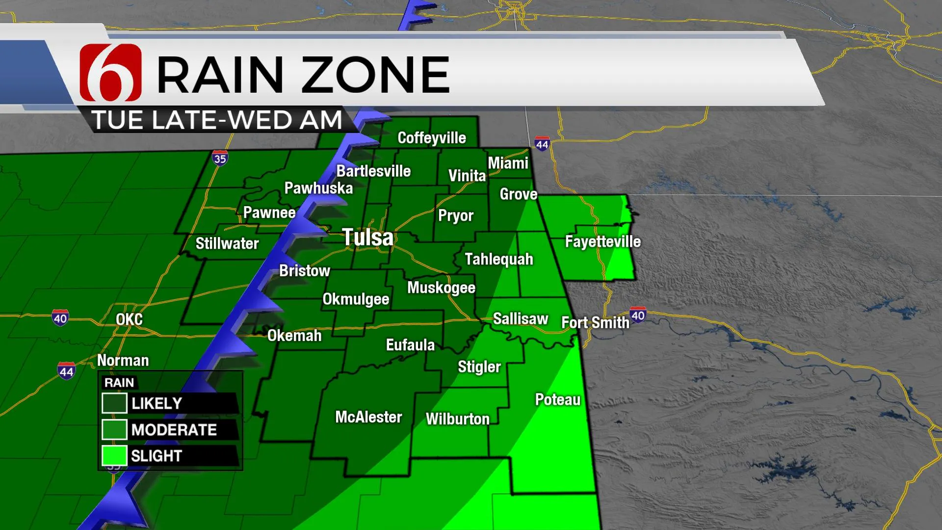
The cold front that moved across the area yesterday with severe weather threats across far eastern OK is south of the region this morning but will either lift northward as a warm front later tonight or reform to our north. Regardless, a fast return of low-level moisture appears Tuesday ahead of the next strong upper-level trough that will advance from the western U.S. into the plains Tuesday night and Wednesday morning. This brings another chance of showers and storms into the area, but with the focus starting to our west, higher chances for rain and storms will arrive for the metro compared to the Sunday system. This system also brings some threats for strong and severe storms, but the higher likelihood will be positioned slightly west, along the I-35 corridor into western OK. Our threats will include a chance for a few strong to severe storms along with some locally heavy rainfall in some locations pre-dawn Wednesday. Severe threats should be confined to areas near and west of Osage, Pawnee and Creek Counties and ending early Wednesday morning. Some data suggest the arriving upper trough may develop into a quasi-closed low and remain nearby or slightly east of the area Wednesday into early Thursday. This will require us to keep a chance for some rain until the feature exits the area Thursday midday.

Cooler temps are likely Wednesday with afternoon highs staying in the 60s along with gusty northwest to north winds. But stronger northwest wind arrives Thursday at 20 to near 40 mph. Wind advisories may be required. Fall-like conditions remain through the end of the week with morning lows in the 40s and highs in the 60s. Another front should near the state Sunday with highs reaching the upper 60s before north winds arrive Sunday afternoon and evening. Halloween evening temps should start in the upper 50s by 6 p.m. and reach the lower 50s by Sunday evening at 9 p.m.

Thanks for reading the Monday morning weather discussion and blog.
Have a super great day!
Alan Crone
KOTV
If you’re into podcasts, check out my daily weather update below. Search for NewsOn6 and ‘Weather Out The Door’ on most podcast providers, including Apple, Stitcher, Tune-In and down below on Spotify.

More Like This
October 25th, 2021
February 14th, 2022
January 26th, 2022
January 25th, 2022
Top Headlines
December 13th, 2024
December 13th, 2024
December 13th, 2024
December 13th, 2024


