Weekend System Nearing
Above normal temps, including nearing record highs Thursday will remain in the forecast before our next chance of showers and storms arrives this weekend followed by more seasonal weather early next week.Wednesday, December 1st 2021, 8:39 am
TULSA, Oklahoma -
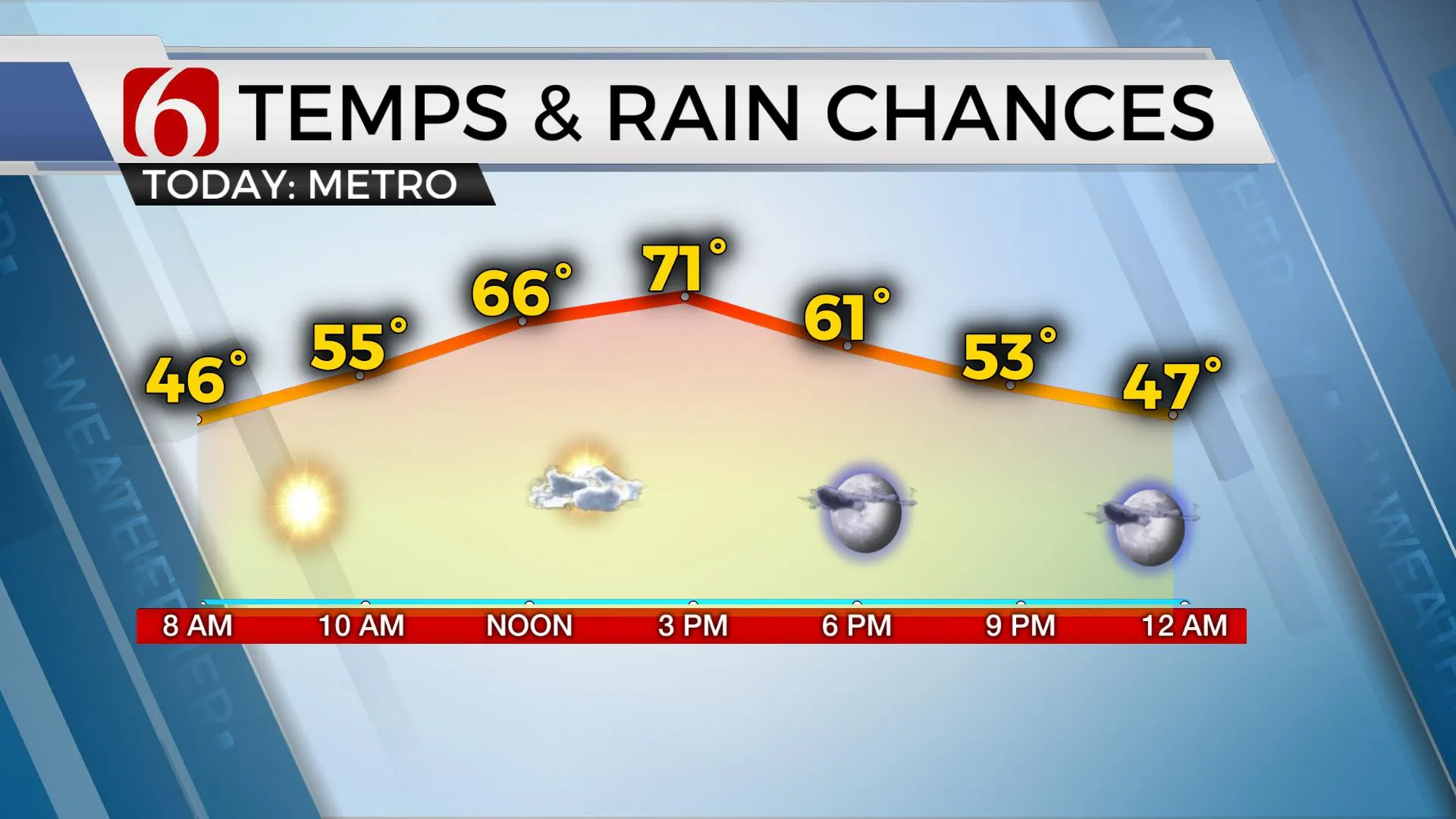
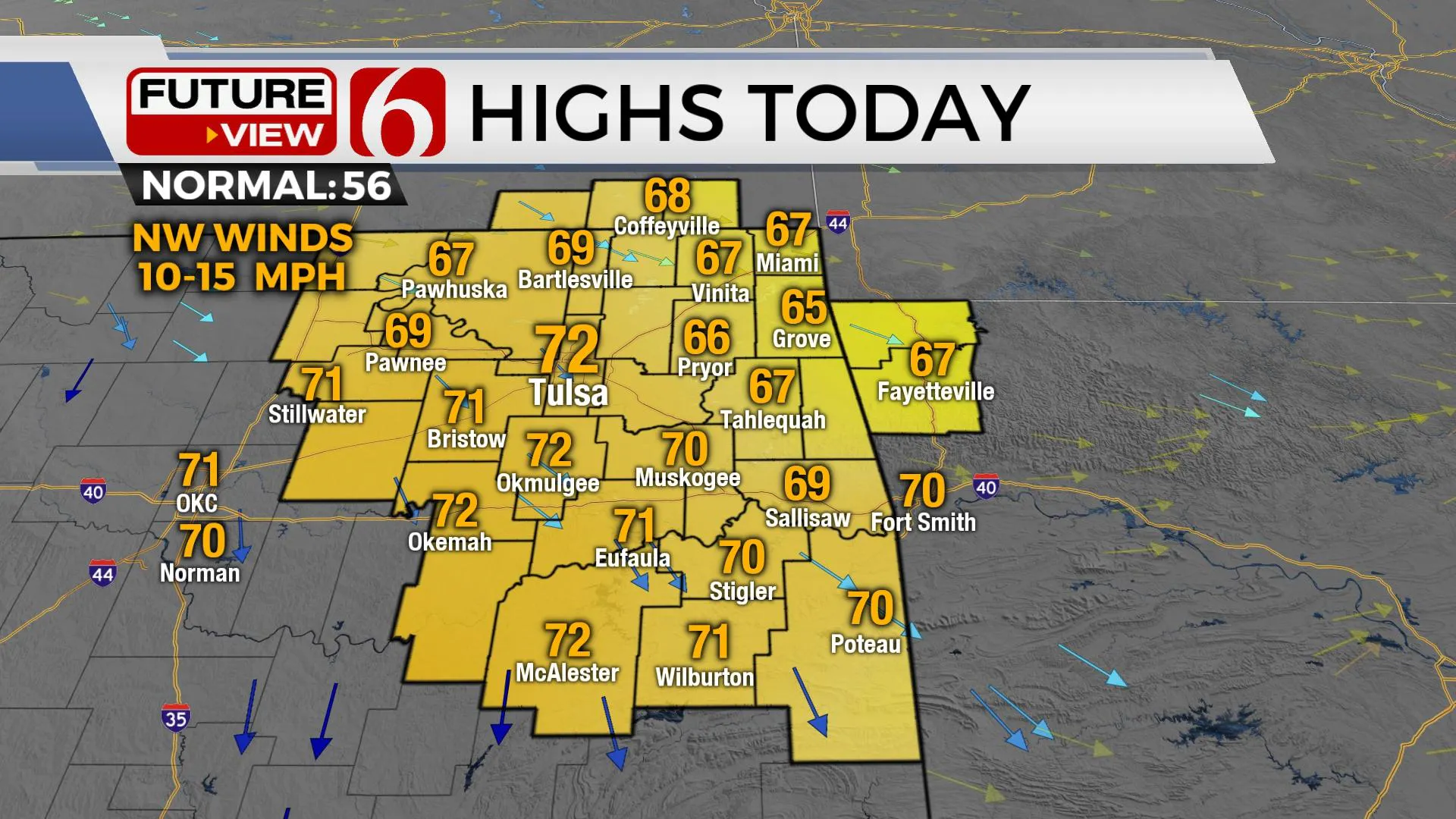
Above normal temps, including nearing record highs Thursday will remain in the forecast before our next chance of showers and storms arrives this weekend followed by more seasonal weather early next week. Temps this morning remain cool with locations near and north of the metro in the upper 30s while locations south of I-40 will start in the mid-40s. Northwest winds are expected today in the range of 10 to 15 mph with sunshine and afternoon highs in the upper 60s and lower 70s. Southwest winds return Thursday with morning lows in the lower 40s and afternoon highs reaching the mid to upper 70s with mostly sunny sky before clouds arrive early evening. Friday features highs in the mid-70s with no weather issues before the next series of storm systems near the state.
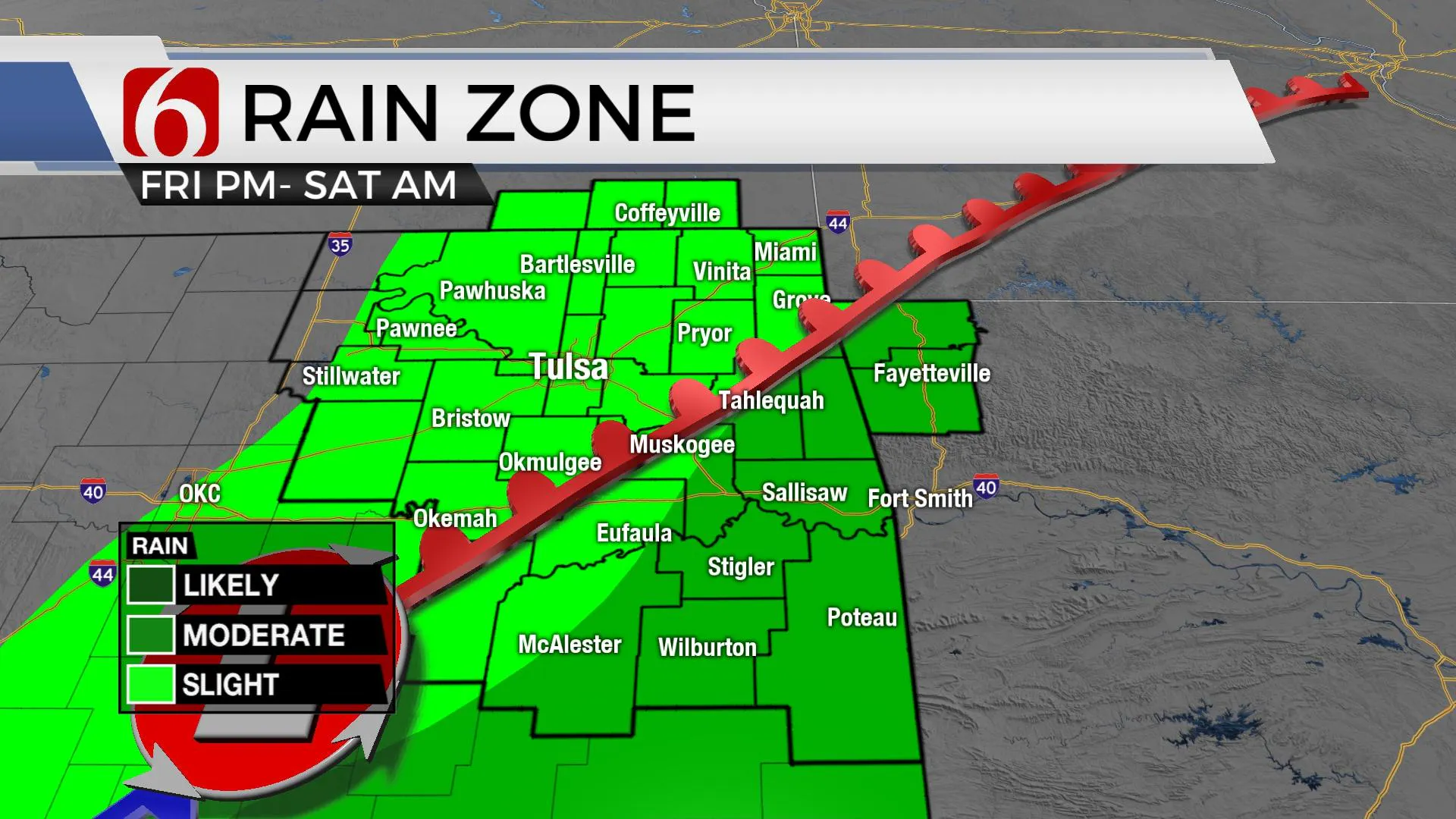
A broad area of low pressure will develop across the western third of Oklahoma Friday evening and slowly move eastward this weekend. South winds will continue to pull low-level moisture across East Texas into part of Eastern OK Friday night through Saturday morning and will eventually support a few showers or storms developing in these general areas. While higher chances for activity will remain east and southeast of Tulsa, our forecast will hold some probabilities for the metro region early Saturday morning. Data this morning has changed some regarding Sunday compared to previous and this will require some changes to part of the forecast.
The Friday night and Saturday morning system now has morphed into a possible multi-day window for a few scattered showers and thunderstorms as the overall system is slowing in the data. The chances for Saturday will remain near 20% near the metro and slightly higher for locations across east-central to southeastern OK as a weak upper impulse in the southern stream nears this region. Data has now turned slower with the Sunday surface front, and the next upper wave Sunday midday to afternoon now appears stronger in the data. The delay in timing will allow deeper moisture to pool across southeastern OK and north TX Sunday that should support a better coverage of storms across southeastern OK and northeast Texas. The Sunday temps could now reach the lower to mid-70s by midday before falling into the 50s by afternoon as the cold front sweeps across the area taking showers and storm chances out the state by early afternoon. Chilly weather would arrive Monday with morning lows in the upper 30s and lower 40s followed by afternoon highs in the upper 40s and lower 50s. A quick warm-up is likely Tuesday as strong southerly flow emerges across the plains in advance of the next system for the middle of next week that will also bring another robust shot of chilly weather.
Thanks for reading the Wednesday morning weather discussion and blog.
Have a super great day!
Alan Crone
KOTV
If you’re into podcasts, check out my daily weather update below. Search for NewsOn6 and ‘Weather Out The Door’ on most podcast providers, including Apple, Stitcher, Tune-In and down below on Spotify.

More Like This
December 1st, 2021
February 14th, 2022
January 26th, 2022
January 25th, 2022
Top Headlines
April 23rd, 2024
April 22nd, 2024
April 22nd, 2024


