Windy Weather Friday
A powerful storm system is ejecting into the central plains today and will bring strong southwest winds across the state. Critically high fire danger issues are possible near I-35 westward with moderately high conditions near the metro.Friday, December 10th 2021, 6:52 am
TULSA, Oklahoma -
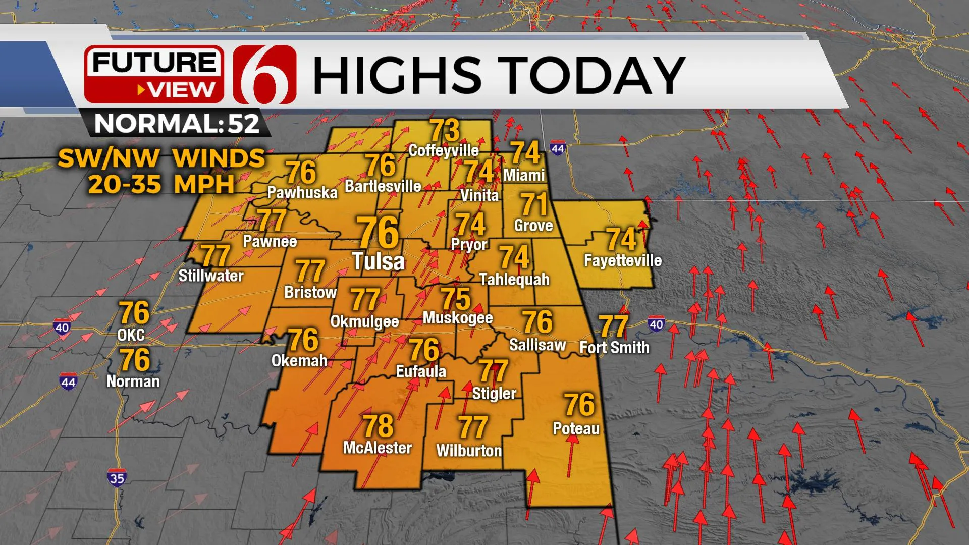
A powerful storm system is ejecting into the central plains today and will bring strong southwest winds across the state. Critically high fire danger issues are possible near I-35 westward with moderately high conditions near the metro. Locations near and east of the Tulsa metro may experience a few showers this morning through midday as a lead wave moves across the area. Any precipitation will be very light. Most locations will remain dry. Highs this afternoon will reach the mid-70s, nearing record highs in some locations before a strong cold front moves across the region tonight with northwest winds and blustery weather for most of Saturday. Sunday through early next week features increasing temps with a return of gusty south winds. The next system nears the state Thursday with rain and thunder chances for the eastern third of the state. A stronger system is possible next weekend.

A dry line is established this morning west of the metro with deeper moisture across eastern to southeastern OK. As the lead wave enters the state this morning through midday, numerous clouds are likely, and a few showers may survive to the surface. Southwest surface winds will quickly veer moisture eastward with drier air reaching the metro by early afternoon as strong southwest winds from 20 to 40 mph will be likely. High temps will quickly reach into the 70s. Humidity values will drop to near 20-30% in these locations and a rapid-fire spread is possible near and west of the metro. Areas across extreme eastern OK into far western Arkansas will have a low chance of showers or storms by evening as the cold front sweeps across the remainder of the state. Higher chances will remain well east of the state where severe weather will become likely overnight in a large area of the Mississippi to Tennessee Valleys northward to the Ohio River valley.

Saturday morning starts with gusty northwest winds at 15 to 30 mph and temps into the 30s. Wind chills will be in the lower to mid-20s. By Saturday afternoon, the pressure gradient will relax with lighter winds and highs reaching the lower 50s north and mid-50s south. Sunday starts near freezing but will finish with afternoon highs in the lower 60s as south winds return at 15 to 25 mph by late afternoon.

Early next week a strong upper-level system will again develop across the western U.S. with gusty south winds remaining across most of the southern plains and increasing temps through midweek. Afternoon highs will reach the upper 60s Monday and the lower 70s Tuesday and Wednesday. The next cold front is likely to arrive Thursday with increasing thunderstorm chances. Extended data suggest another strong system nearing by the weekend with increasing precipitation chances followed by a return of colder conditions.

Thanks for reading the Friday morning weather discussion and blog.
Have a super great day!
Alan Crone
KOTV
If you’re into podcasts, check out my daily weather update below. Search for NewsOn6 and ‘Weather Out The Door’ on most podcast providers, including Apple, Stitcher, Tune-In and down below on Spotify.

More Like This
December 10th, 2021
February 14th, 2022
January 26th, 2022
January 25th, 2022
Top Headlines
December 13th, 2024
December 13th, 2024
December 13th, 2024
December 13th, 2024


