Strong Winds, Record Warmth, Storms All In The Cards For Green Country
Our wild weather ride continues with wind, temperature, and storm impacts for our Wednesday.Wednesday, December 15th 2021, 9:15 am
TULSA, Oklahoma -
Our wild weather ride continues with wind, temperature, and storm impacts for our Wednesday.
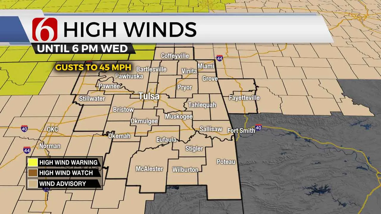
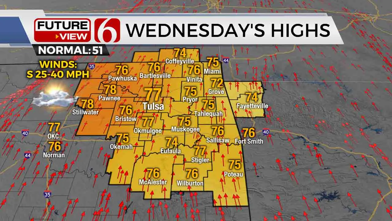
We’re in for record temperatures today as it feels more like the end of spring than December! We’ll have highs well into the 70s this afternoon with some sun breaks. A Wind Advisory is in effect across all of Green Country as well. South winds will continue to increase with some gusts at or above 40 miles per hour this afternoon.

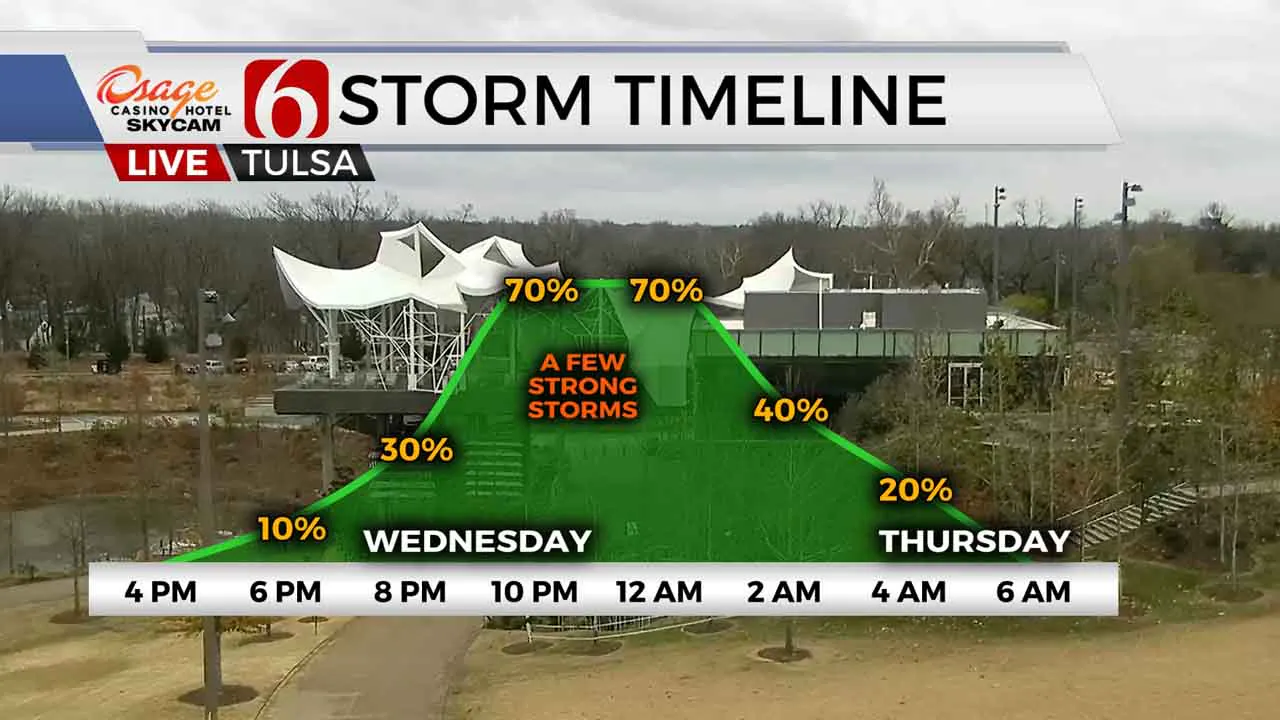
After sunset, a narrow line of showers and storms will begin to develop north/northwest of Tulsa and gradually spread south. With enough instability hanging around, we could end up with a few strong to severe storms across eastern and southeastern Oklahoma later tonight with wind and hail as the main threats. Rain and storms will push into far southeastern Oklahoma early Thursday morning, with cooler afternoon temperatures in the 50s and lower 60s Thursday afternoon.

By early Friday that cold front will temporarily lift back north as a warm front. As that happens, another round of scattered storms will develop, primarily focused along and southeast of the I-44 corridor. Some storms on Friday could be quite heavy across southeastern Oklahoma with multiple inches of rain possible. By early Saturday morning, the cold front gets a bigger push to the south and takes the rain chances with it, but also brings us much chillier conditions on Saturday with blustery north winds and highs only in the 40s.

I hope you have a great Wednesday, Green Country! You can follow me on Twitter @StephenNehrenz as well as my Facebook page Meteorologist Stephen Nehrenz to stay up to date with the very latest.
More Like This
December 15th, 2021
February 14th, 2022
January 26th, 2022
January 25th, 2022
Top Headlines
December 13th, 2024
December 13th, 2024
December 13th, 2024
December 13th, 2024


