More Arctic Air Moving Into Green Country
We’re tracking three fronts over the next 7 days, including a strong front Wednesday night into Thursday morning that brings more arctic air into the state.Monday, January 3rd 2022, 7:19 am
TULSA, Oklahoma -
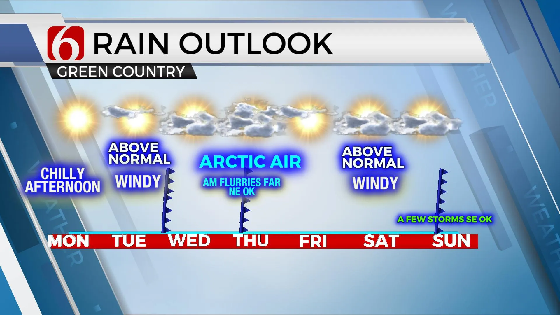
We’re tracking three fronts over the next 7 days, including a strong front Wednesday night into Thursday morning that brings more arctic air into the state. This system may also provide some light snow showers or flurries across extreme northeastern OK and southeastern Kansas with higher chances for accumulation across northern to east-central Kansas.

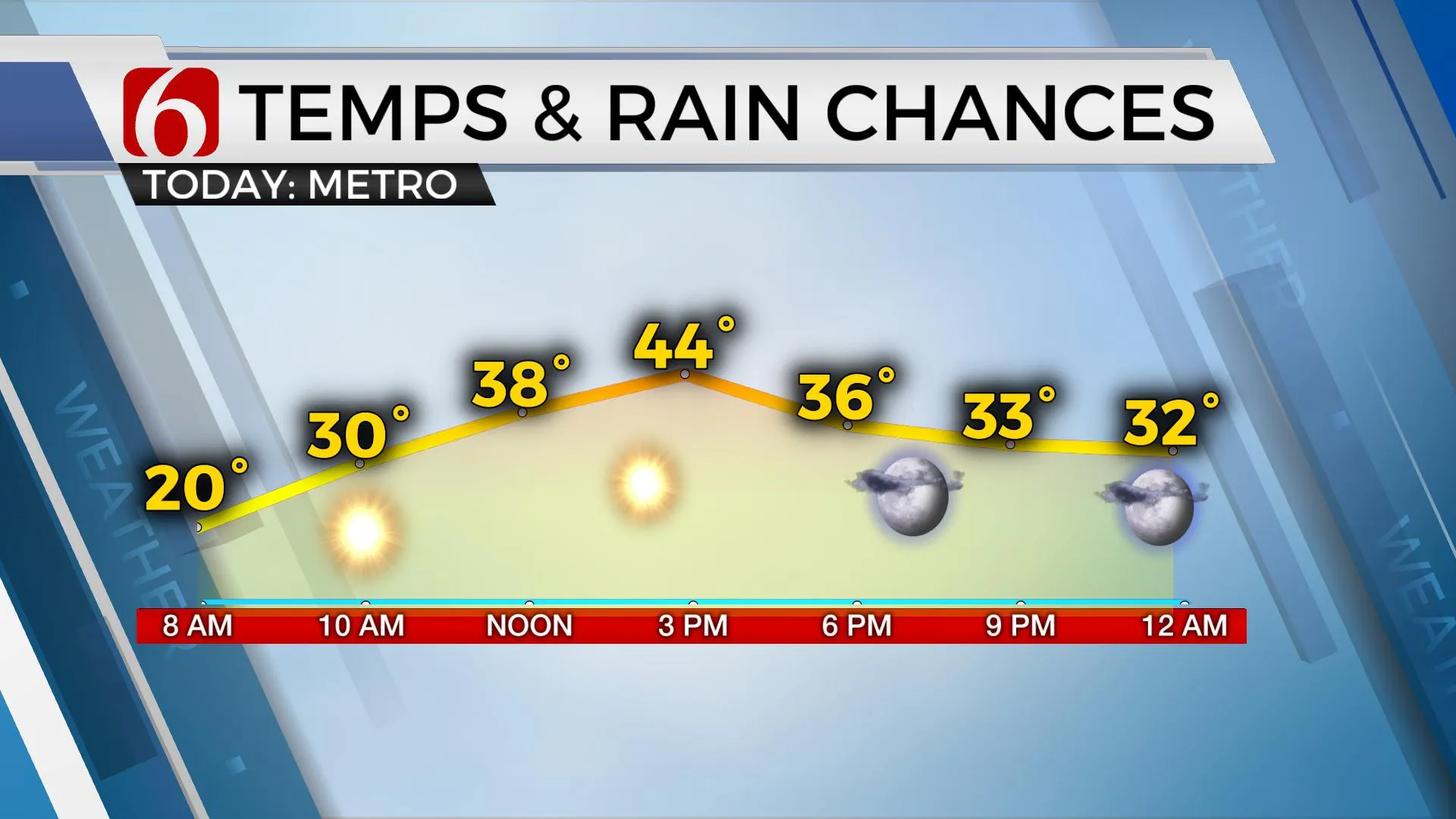
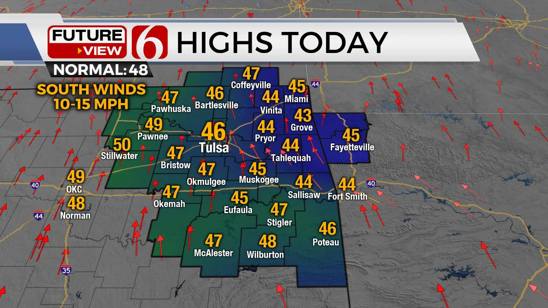
Temps will start this morning in the teens and lower 20s with clear sky and light south winds. A surface ridge of high pressure will move eastward today with south winds returning at 10 to 15 mph behind the exiting ridge. Afternoon temps should reach the mid-40s, near normal for this time of year. A strong short-wave will move across the central and northern plains tomorrow with a surface low developing across northern Nebraska. The pressure gradient will become tight with south winds increasing speeds from 20 to near 40 mph Tuesday as morning lows in the 30s respond with daytime highs in the mid-50s. The expected strong south winds combined with low humidity during the afternoon supports an increasing fire danger spread rate for tomorrow afternoon across most of the area. Higher spread rates and fire danger issues will remain to our west.

The first front moves across the area late Tuesday night into Wednesday morning. This will bring north winds and a minor reduction in temps with daytime highs still reaching the lower 40s with north winds near 10 to 15 mph. The 2nd and stronger surge of arctic air arrives late Wednesday evening into Thursday morning with a more notable drop in temps. Morning lows in the teens are likely with highs only in the mid-20s. A narrow band of accumulating snow is likely across central to east-central Kansas. There will be a chance for some light snow, mostly flurries across far northeastern OK as this band clips the area. Strong north winds from 15 to 30 mph combined with highs only in the 20s will support a very frigid Thursday afternoon. A surface ridge moves across the area late Thursday evening with clear sky and light winds with Friday morning lows in the single digits in the valleys and lower to mid-teens elsewhere. Friday afternoon highs will return to the 40s with south winds and sunny sky.

This weekend brings strong south winds Saturday from 15 to 30 mph with afternoon highs reaching the upper 50s to lower 60s before the next strong front brings a glancing blow of colder air into the area Sunday with highs dropping into the lower to mid-40s. Low-level moisture will be pooling across southeastern OK where a few showers or storms may occur with this Sunday front.
Thanks for reading the Monday morning weather discussion and blog.
Have a super great day!
Alan Crone
KOTV
If you’re into podcasts, check out my daily weather update below. Search for NewsOn6 and ‘Weather Out The Door’ on most podcast providers, including Apple, Stitcher, Tune-In and down below on Spotify.

More Like This
January 3rd, 2022
February 14th, 2022
January 26th, 2022
January 25th, 2022
Top Headlines
December 11th, 2024
December 11th, 2024
December 11th, 2024
December 11th, 2024


