Windy Weather Returns Tuesday
Strong southerly flow will quickly arrive today as another storm system ejects into the central and northern plains during the next 24 to 36 hours.Tuesday, January 4th 2022, 7:24 am
TULSA, Oklahoma -
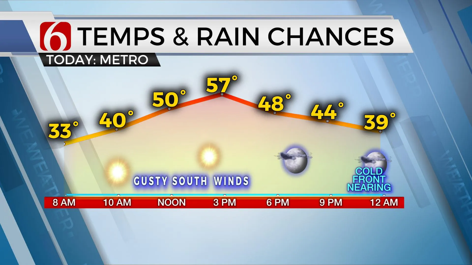
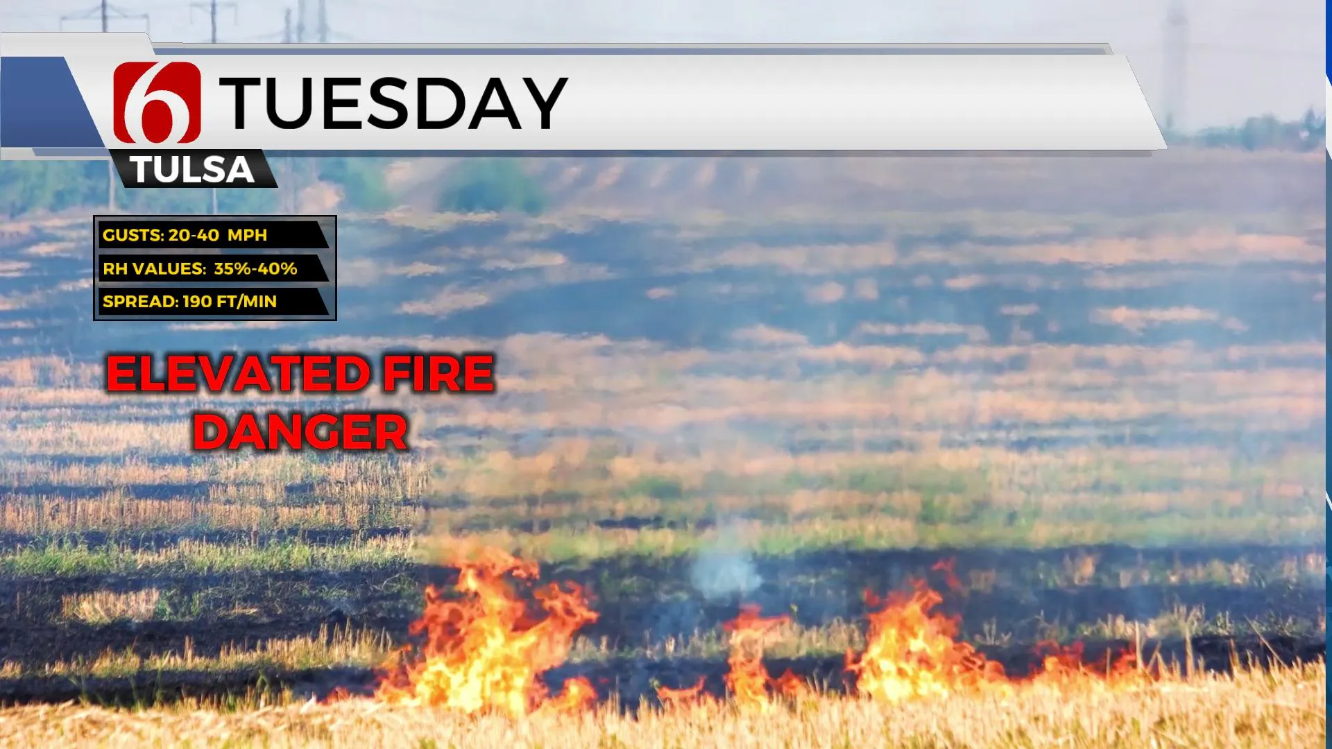
Strong southerly flow will quickly arrive today as another storm system ejects into the central and northern plains during the next 24 to 36 hours. As this surface low forms and moves into the Midwest, strong south winds will respond across Oklahoma with winds gusting from 20 to near 40 mph for the midday periods. These strong winds combined with low humidity during the afternoon supports another elevated to high fire danger later this afternoon near and west of Highway 75. Refrain from outdoor burning or any activity that may start fires as environmental weather conditions will spread fires rapidly today.

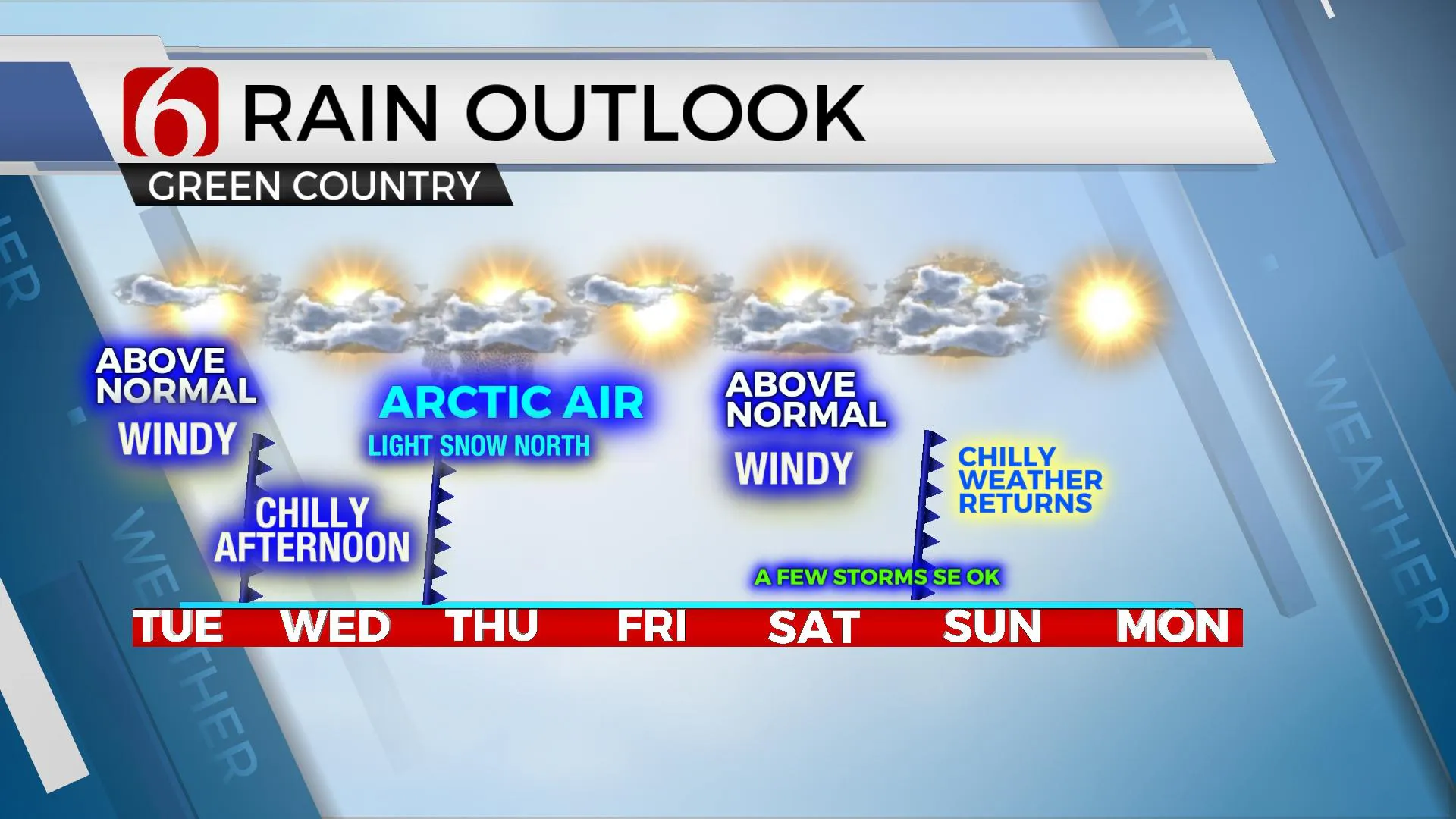
Temps start this morning in the upper 20s and lower 30s and will reach the mid to upper 50s this afternoon across most of the eastern third of the state. Gusty south winds will create a rather blustery day. The first of three fronts for the foreseeable future will arrive later tonight bringing north winds Wednesday and temps dropping into the lower 40s for afternoon highs. As the boundary moves across the area later tonight through Wednesday morning a few clouds will be likely but dry air in the lower atmosphere should keep any precipitation falling from the cloud bases from reaching the surface.

The second and stronger front arrives Wednesday evening into Thursday morning with another surge of shallow arctic air. Temps will take another tumble. Thursday morning lows will drop into the mid-teens with afternoon highs staying in the mid to upper 20s. Data has trended slightly more southward with the possibility of some light wintry precip. A few snow flurries or light snow showers will be possible along the OK-KS and Arkansas state line regions with no significant impacts. As the shallow air arrives pre-dawn Thursday, a very small window for freezing drizzle will be possible across far northeastern OK. This arctic air mass will quickly modify by the weekend. Friday morning starts in the teens and reaches the upper 40s near 50 for the afternoon highs as south winds quickly return. Saturday strong southerly flow with winds from 20 to 30 mph will be likely as temps climb to near 60 across northeastern OK and the lower 70s across the western third of state before the next strong front arrives late Saturday evening into Sunday morning with another surge of cold air that impacts the area Sunday and Monday. Low-level moisture will be pooling across southeastern OK during this period where a few showers or storms will be possible.

Thanks for reading the Tuesday morning weather discussion and blog.
Have a super great day!
Alan Crone
KOTV
If you’re into podcasts, check out my daily weather update below. Search for NewsOn6 and ‘Weather Out The Door’ on most podcast providers, including Apple, Stitcher, Tune-In and down below on Spotify.

More Like This
January 4th, 2022
February 14th, 2022
January 26th, 2022
January 25th, 2022
Top Headlines
December 14th, 2024
December 14th, 2024
December 14th, 2024


