Breezy, Warm Conditions Bring Elevated Fire Danger
Sunny skies and a nice warm-up are expected, but Tuesday's dry and breezy conditions bring an elevated fire danger.Tuesday, January 11th 2022, 6:39 am
TULSA, Oklahoma -
Sunny skies and a nice warm-up are expected, but Tuesday's dry and breezy conditions bring an elevated fire danger.
Here are the details from News On 6 Meteorologist Alan Crone:
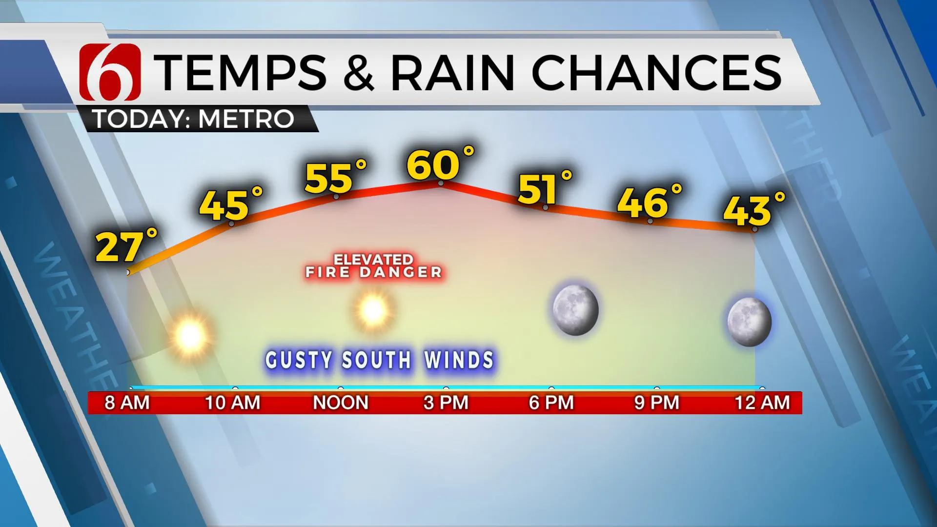
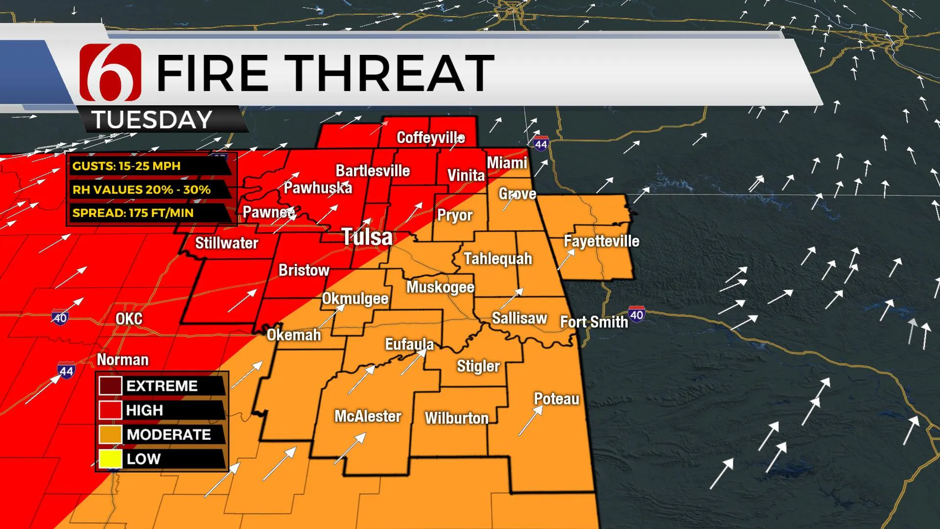
As the surface high moves away from the region and the next pair of upper-level waves, one in the southern stream and one in the northern stream begin moving east, pressure falls to the north will bring gusty southwest winds to our area on Tuesday afternoon. Low humidity in the afternoon combined with gusty winds and dry vegetation will bring increasing fire spread rates. Please refrain from outdoor burning and remain aware of any activity that may spark off a grass fire. Other than gusty winds, more sunshine and warmer weather are likely on Tuesday with afternoon highs nearing the mid to upper 50s east and lower 60s near or west of the metro. Wind speeds will relax some Wednesday, yet another weak surface boundary moves across the state by the afternoon bringing a weak wind shift from the northwest for a few hours tomorrow afternoon. Highs will continue in the upper 50s and lower 60s Wednesday through Friday.

The next stronger front and upper-level system will move across the area late Friday night. Moisture remains quite limited ahead of this system, but the data has trended a little more west and south with the upper-level low. This could bring some light precip into far NE OK late Friday night into early Saturday morning. Once again, the race will be between precipitation and colder air and any possible column cooling under the low. This system may be like the last, bringing a very small swath of rain to snow mix across far NE OK. It is still early and any changes in the trajectory will change the forecast. Regardless of any low precip potential, colder and breezy conditions follow the frontal passage Saturday with strong north winds and highs near 40. This chilly air mass will remain Sunday before moderating some Monday as another warming trend begins early next week.

Thanks for reading the Tuesday morning weather discussion and blog.
Have a super great day!
Alan Crone
KOTV

More Like This
January 11th, 2022
June 21st, 2023
June 19th, 2023
June 13th, 2023
Top Headlines
April 19th, 2024
April 19th, 2024


