Mild Wednesday Weather Before Winter Returns For The Weekend
Another chilly start brings a pleasant afternoon.Wednesday, January 12th 2022, 7:33 am
TULSA, Oklahoma -
Another chilly start brings a pleasant afternoon.
Here are the details from News On 6 Meteorologist Alan Crone:
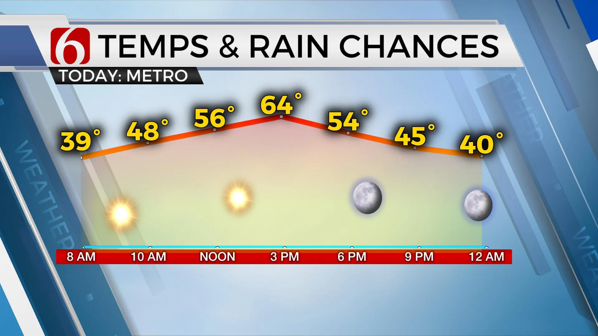
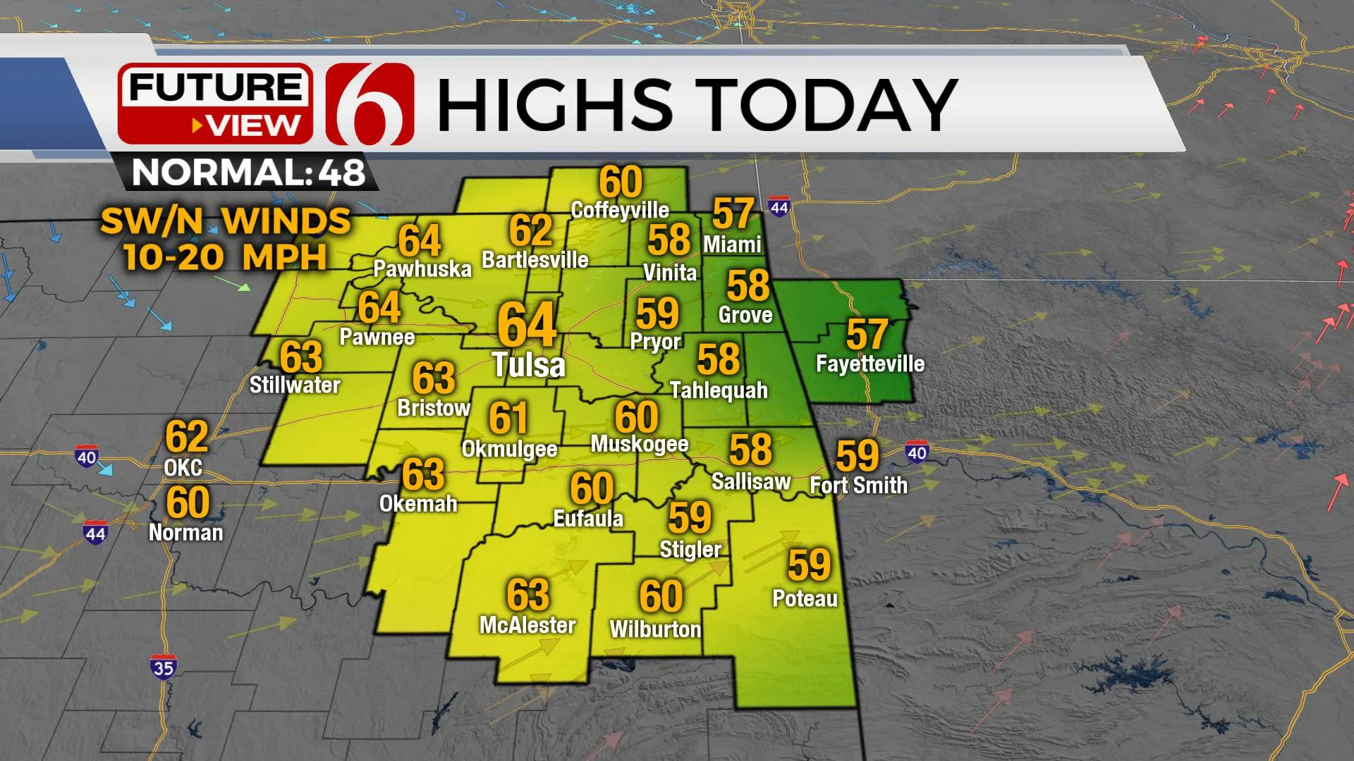
The warm weather pattern will remain through the end of the week before the next stronger system brings a blustery Saturday, including a mention for some showers to snow across part of the area. Highs on Wednesday afternoon will reach the upper 50s east and lower to mid-60s near and west of the Tulsa metro. A weak wind shift will cross the area later Wednesday evening with no major impacts.

The upper air pattern remains progressive. A weak wave is passing to the south in the southern stream and another wave remains well north. Midlevel ridging arrives Wednesday and continues through Friday with the upper flow transitioning to a northwest flow. This initially brings warmer than average weather for the next few days, including light winds both Wednesday and Thursday before gusty south winds return Friday ahead of the next system.

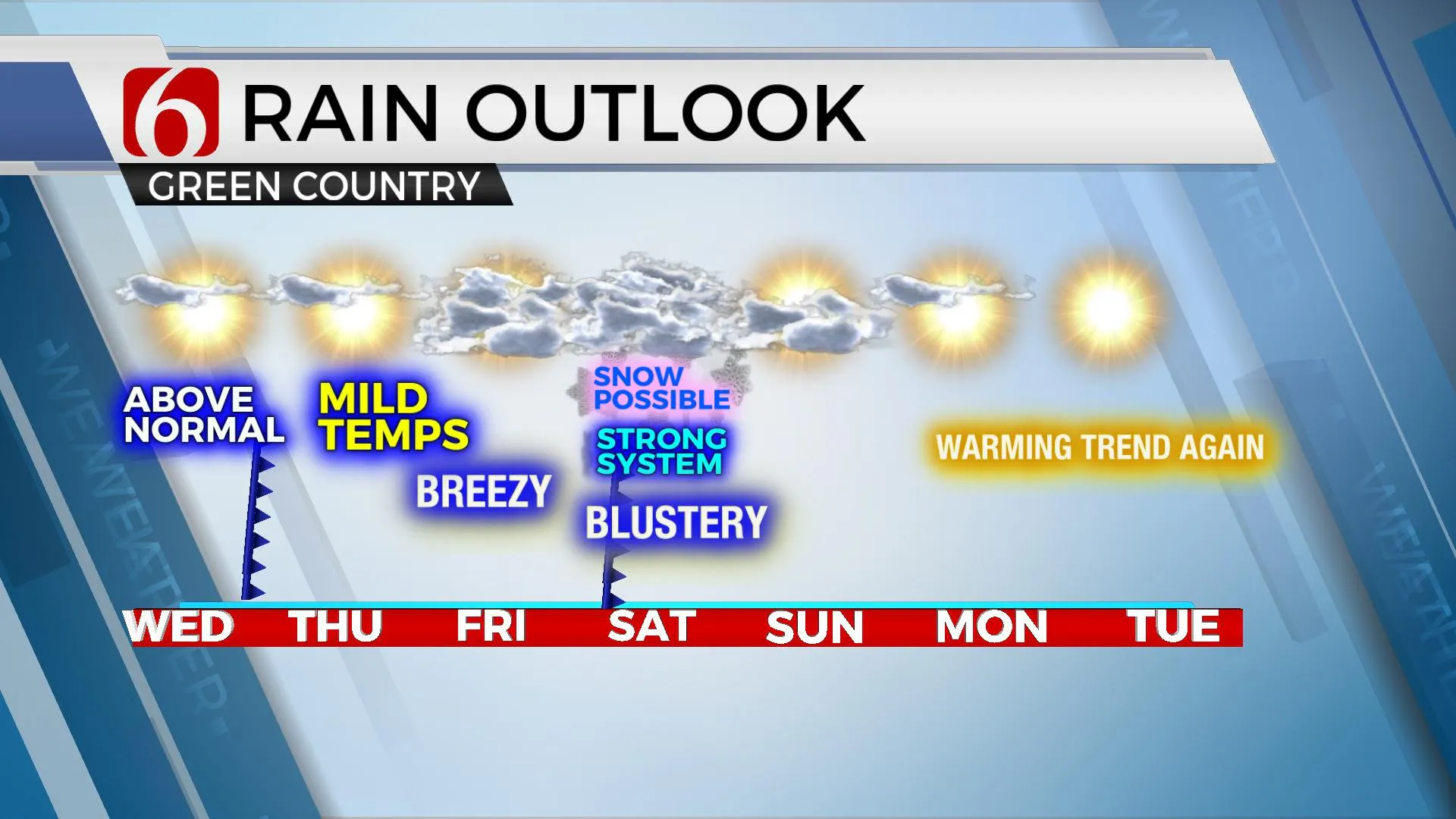
The data continues supporting a strong upper-level low dropping across the northern plains Friday and moving across OK Saturday before turning east. The data continue to move the system more westward, and this brings the chance for more impactful weather across part of the area this weekend, including the possibility of some rain to snow. As with nearly all winter systems, there will continue to be differences in the data that could support significantly different outcomes regarding the exact location of precip, the amounts and even precip type. A small window will exist early Saturday morning for some mix, but the higher chance will arrive later in the afternoon and evening as the upper-level system drops southward. Column cooling will bring colder air to the surface and any precip will have the chance to change over to light snow. Higher elevations of northwestern Arkansas will be in a good spot for accumulation, and we’ll also see some chances for minor accumulations across part of the region with this system. This system is likely to occur, but the exact track may still change. This means additional changes to the forecast are likely before the system nears Saturday.

Regardless of any precip potential, blustery conditions are likely to return Saturday with afternoon temps in the upper 30s with strong north winds from 15 to 30 mph. Colder weather will be likely Sunday before the airmass quickly modifies as the upper trough moves east and another warming trend will begin early next week.
Thanks for reading the Wednesday morning weather discussion and blog.
Have a super great day!
Alan Crone
KOTV
If you’re into podcasts, check out my daily weather update below. Search for NewsOn6 and ‘Weather Out The Door’ on most podcast providers, including Apple, Stitcher, Tune-In and down below on Spotify.

More Like This
January 12th, 2022
June 21st, 2023
June 19th, 2023
June 13th, 2023
Top Headlines
December 11th, 2024
December 11th, 2024
December 11th, 2024
December 11th, 2024


