Cold Temperatures, Snow Chances Return For The Weekend
The warming trend is coming to an end as winter moves back in.Thursday, January 13th 2022, 7:58 am
TULSA, Oklahoma -
The warming trend is coming to an end as winter moves back in.
Here are the details from News On 6 Meteorologist Alan Crone:
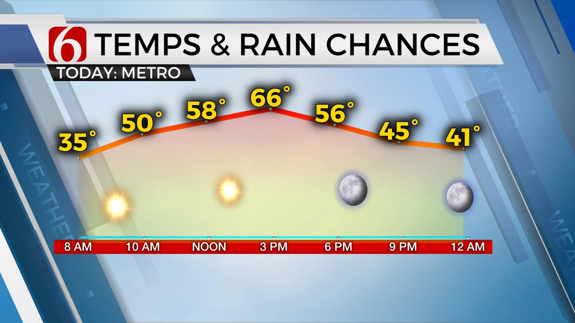
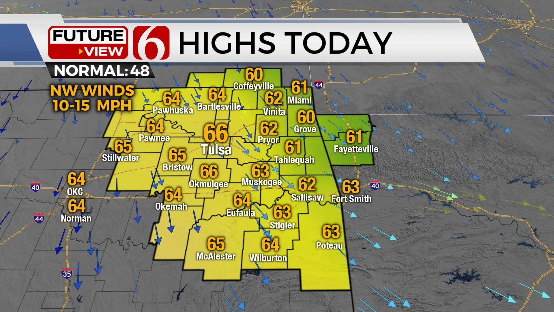
Another mild afternoon is likely on Thursday with sunshine and highs in the lower to mid-60s. But the warming trend ends Friday night as a winter system impacts the state, including the possibility of some light snow Saturday.

The main upper-level wave we're watching that eventually develops into a potent winter storm is still forming on Thursday morning off the Pacific coastal areas of western Canada. This wave will top the mean western ridge and drop through the plains Friday night arriving across Oklahoma Saturday. As this system develops, snow is likely to develop along and east of the upper feature as it moves southward through the plains and midwestern U.S. Saturday. The exact trajectory of the upper feature will have a big impact on the possibility of wintry precipitation across Eastern OK.

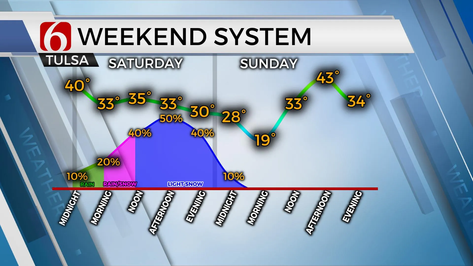
As pressure falls begin, a surface low will form across southeastern Colorado Friday and drop along the Red River Valley by Friday evening into Saturday morning. This will quickly bring north winds across the state overnight into Saturday with the initial surge of colder air. But the main cold air push needed for wintry weather will be connected to column cooling under the upper level low as it moves across the region during the day Saturday. The exact track of this low will hold the key to snowfall accumulations. A track more westward (current EURO data) would provide more snowfall, around 1 to 2 inches. A track more east ( GFS) would bring mostly light snow ( a dusting to near 1 inch). As the initial front moves into the area late Friday evening, a period of light showers will be possible pre-dawn Saturday across far NE OK and SE Kansas. Regardless of the different scenarios, moisture remains limited with this system with higher moisture and thermal overlays positioned east of our immediate area. The system should be able to produce some snowfall for most of NE OK with higher amounts along the OK-Arkansas state line region eastward. Higher elevations of NW Arkansas (the Boston Mountains) will be near winter storm warning criteria that may extend into part of the Ozarks of southern Missouri. As it appears now, we’ll be in the running for an advisory-level event.

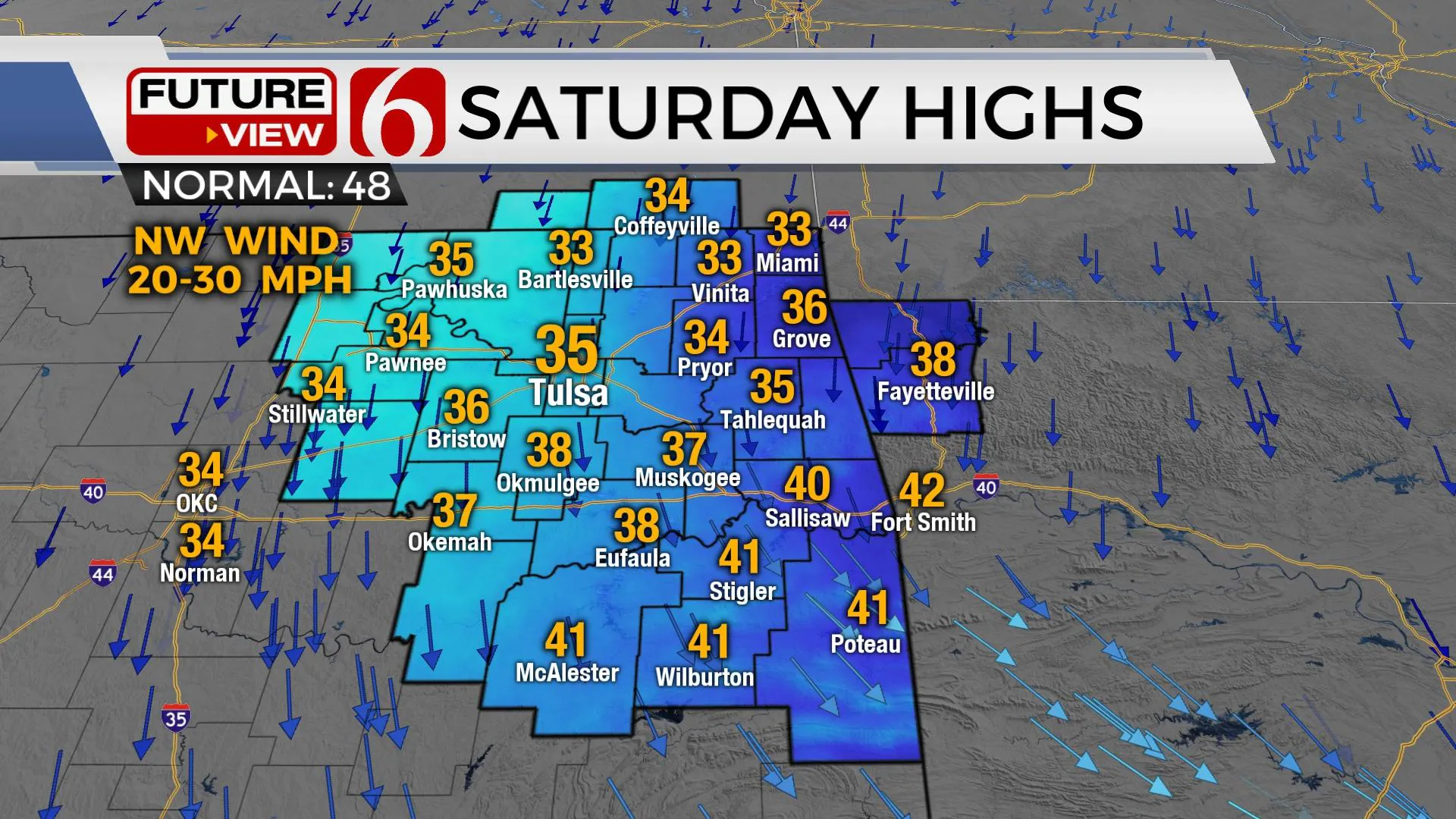
Strong north winds are likely Saturday with blustery weather. Temps will remain in the mid to upper 30s with bitterly cold wind chill values for most of the day. This system will exit the area late Saturday evening into pre-dawn Sunday with a slowly moderating air mass Sunday afternoon. Another mini-warming trend is likely early next week before additional cold air arrives by Wednesday.
As with all winter systems, small changes in track and temperature can lead to major changes quickly in the forecast. Please check back often for updates.

Thanks for reading the Thursday morning weather update.
Have a super great day!
Alan Crone
KOTV
If you’re into podcasts, check out my daily weather update below. Search for NewsOn6 and ‘Weather Out The Door’ on most podcast providers, including Apple, Stitcher, Tune-In and down below on Spotify.

More Like This
January 13th, 2022
June 21st, 2023
June 19th, 2023
June 13th, 2023
Top Headlines
December 13th, 2024
December 13th, 2024
December 13th, 2024
December 13th, 2024


